6441 x 5823 px | 54,5 x 49,3 cm | 21,5 x 19,4 inches | 300dpi
Aufnahmedatum:
1817
Ort:
Asia
Weitere Informationen:
Dieses Bild kann kleinere Mängel aufweisen, da es sich um ein historisches Bild oder ein Reportagebild handel
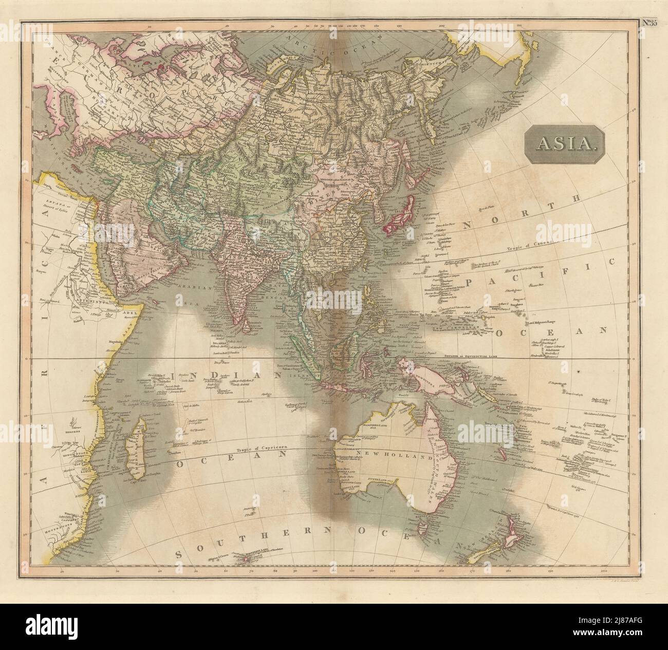
Asia. Artist/engraver/cartographer: Drawn & engraved by John & George Menzies for John Thomson's "New General Atlas". Provenance: "A new general atlas", consisting of a series of geographical designs, on various projections, exhibiting the form and component parts of the globe; and a collection of maps and charts, delineating the natural and political divisions of the Empires, Kingdoms, and States in the World", Edinburgh: Printed by George Ramsay and Company, for John Thomson and Company, Edinburgh; Baldwin, Cradock, and Joy, London; and John Cumming, Dublin [Thomson's New General Atlas]. Type: Antique early 19th century atlas map with original hand colouring. This large detailed map of Asia is presented on the equatorial Gnomonic projection. includes at least one group of phantom islands. "Los Jardines or the 12 islands" are marked in two separate places on the map - once "according to the Spanish charts", and in a different location "according to Captain Marshall" (discoverer of the Marshall islands), both north and east of the Mariana Islands, even though they do not exist. The coastline of "New Holland" (Australia) is approximate at best, particularly the south coast in the Great Australian Bight, although this part of the coastline had been more accurately mapped by 1811. The eastern part of New Guinea is shown detached from the main body of the island, according to the observations of Torres