5098 x 8130 px | 43,2 x 68,8 cm | 17 x 27,1 inches | 300dpi
Aufnahmedatum:
1720
Ort:
London
Weitere Informationen:
Dieses Bild kann kleinere Mängel aufweisen, da es sich um ein historisches Bild oder ein Reportagebild handel
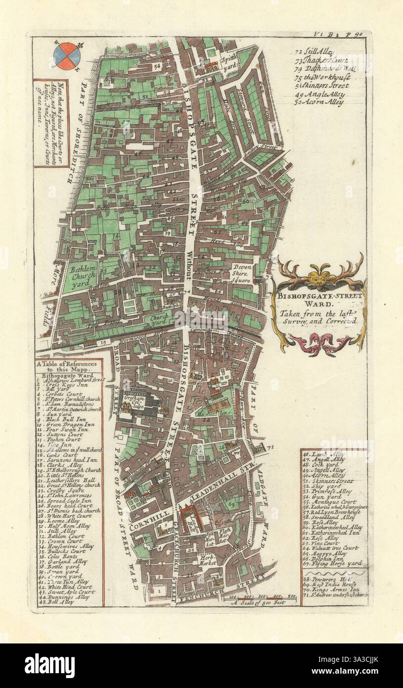
Bishopsgate Street Ward. Artist/engraver/cartographer: Published by John Strype from a plate originally published by John Stow. Provenance: "A survey of the cities of London and Westminster, containing the original, antiquity, increase, modern estate and government of those cities. Written at first in the year 1598, by John Stow, citizen and native of London .. Corrected, improved, and very much enlarged .. by John Strype, MA, a native also of the said city", London, printed for A. Churchill, J. Knapton, R. Knaplock, J. Walthoe, E. Horne, B. Tooke, D. Midwinter, B. Cowse, R. Robinson, and T.Ward, MDCCXX [Stow's survey of London]. Type: Hand coloured copperplate engraved map. The map shows Bishopsgate Street within and without the old London Wall (now a street of the same name), and the adjacent area. Other prominent thoroughfares include Gracechurch Street, Leadenhall Street, Broad Street, Cornhill, St Mary Axe. The maps covers the area from Fenchurch Street to Spitalfields. Leadenhall market, including the fish, flesh and herb markets, are indicated.