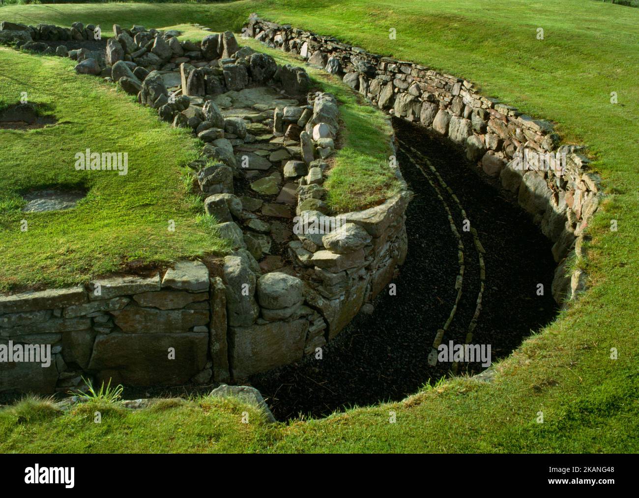
Blick nordöstlich von Ardestie Iron Age Earth House (Souterrain), Angus, Schottland, Großbritannien, zeigt den gebogenen unterirdischen Durchgang (R) mit angrenzenden Oberflächenmerkmalen.
3780 x 2682 px | 32 x 22,7 cm | 12,6 x 8,9 inches | 300dpi
Aufnahmedatum:
19. Mai 1988
Ort:
Ardestie Earth House (Souterrain), Monifieth, Dundee, Angus, Scotland, UK
Weitere Informationen:
View NE of Ardestie Late Iron Age (C1st-C2ndAD) earth house (souterrain), Angus, Scotland, UK, showing the curved underground passage (R) with adjacent surface features (L). A narrow passage slopes down from the W to an entrance with door jambs (front L). A narrow structure links the souterrain to three other above ground areas used for a variety of domestic & industrial purposes either within or just outside a timber round house. The banana-shaped passage is some 25m long, a trench lined with corbelled drystone side walls. It was roofed, & the floor paved with a central drain. Despite the drain the surrounding boulder clay held water & flooding caused the souterrain to be partly dismantled - the roof & upper wall courses removed - & the passage filled with earth. Discovered during field clearance in 1949, it was excavated 1949-50 by F.T. Wainwright.