4112 x 3100 px | 34,8 x 26,2 cm | 13,7 x 10,3 inches | 300dpi
Aufnahmedatum:
1851
Ort:
South Asia
Weitere Informationen:
Dieses Bild kann kleinere Mängel aufweisen, da es sich um ein historisches Bild oder ein Reportagebild handel
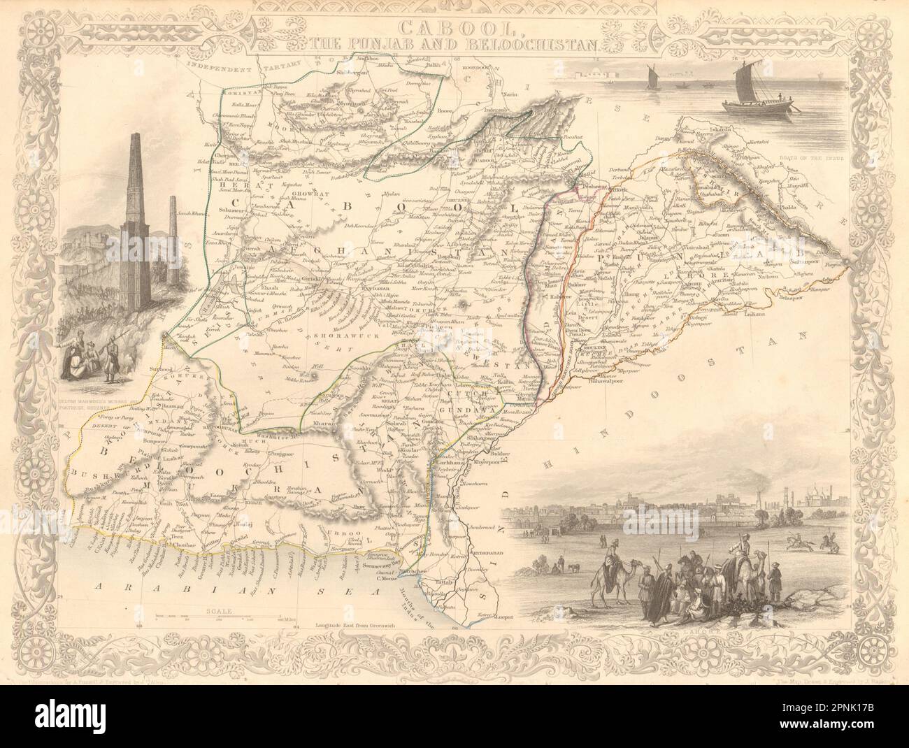
Cabool, The Punjab and Beloochistan. Artist/engraver/cartographer: Map drawn and engraved by J. Rapkin; vignette illustrations drawn by A Fussell & engraved by JB Allen. Published by John Tallis & Co. Provenance: "Tallis's Illustrated Atlas and Modern History of the World, Geographical, Political, Commercial and Statistical", edited by R Montgomery Martin Esq., published by John Tallis and Company, London & New York [Tallis's Illustrated Atlas]. Type: Antique engraved map by J Rapkin, published by John Tallis. Original outline hand colour, decorative border, and attractive inset vignette views. The map covers modern Pakistan, Afghanistan, and part of India. Vignettes: Boats on the Indus; Sultan Mahmoud's Minars and Fortress - Ghuznef. Afghanistan. Lahore & Amritsar are marked.