North tower Stockfotos & Bilder
 Sternwarte NORTH Tower, Blickrichtung Nordost - Lick Observatorium, Mount Hamilton, San Jose, Santa Clara County, CA Stockfotohttps://www.alamy.de/image-license-details/?v=1https://www.alamy.de/sternwarte-north-tower-blickrichtung-nordost-lick-observatorium-mount-hamilton-san-jose-santa-clara-county-ca-image249354263.html
RMTDK1WB–Sternwarte NORTH Tower, Blickrichtung Nordost - Lick Observatorium, Mount Hamilton, San Jose, Santa Clara County, CA
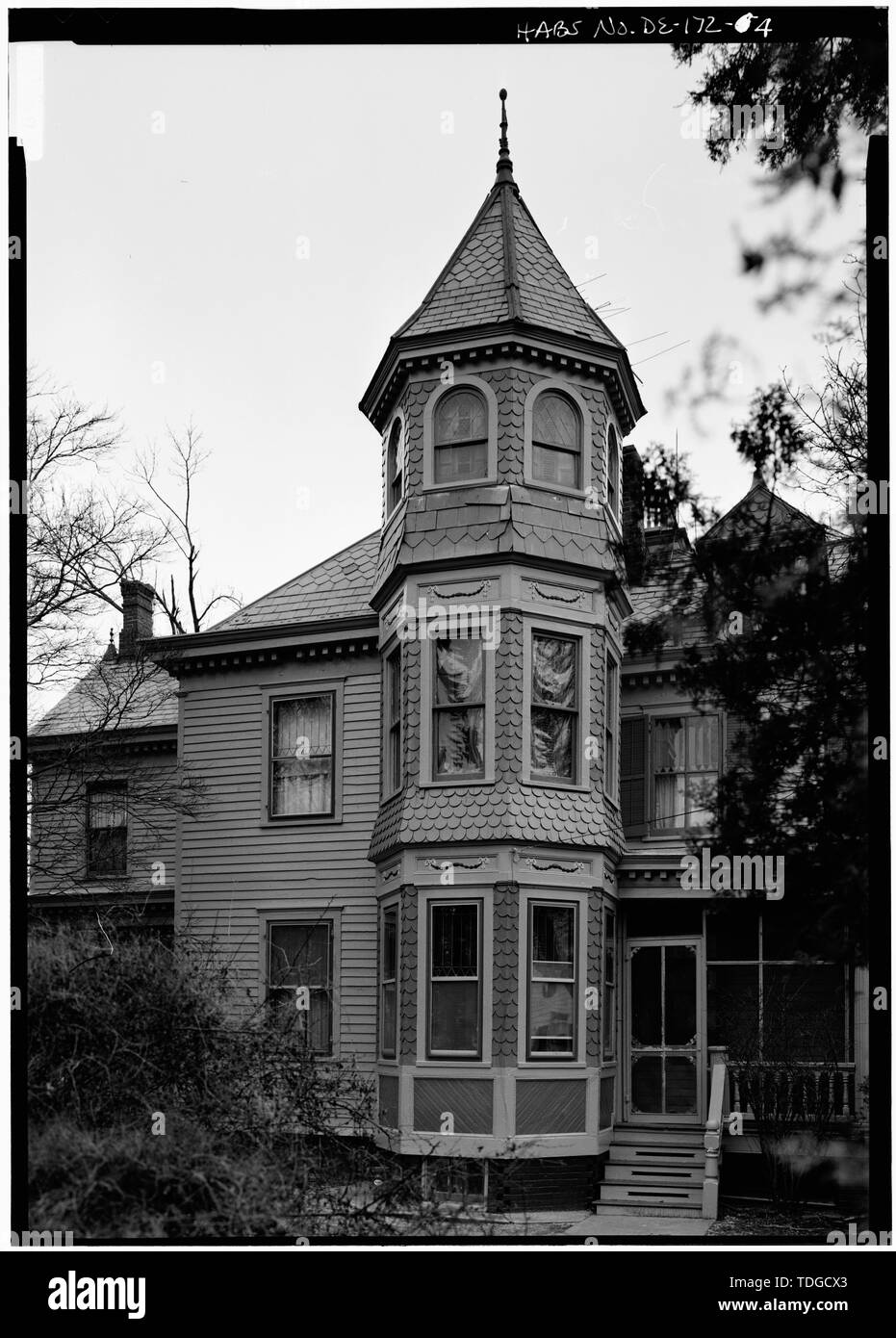 NORTH Tower - John B. Lindale Haus und Hof, 24 South Main Street, Magnolia, Kent County, DE Stockfotohttps://www.alamy.de/image-license-details/?v=1https://www.alamy.de/north-tower-john-b-lindale-haus-und-hof-24-south-main-street-magnolia-kent-county-de-image249297051.html
RMTDGCX3–NORTH Tower - John B. Lindale Haus und Hof, 24 South Main Street, Magnolia, Kent County, DE
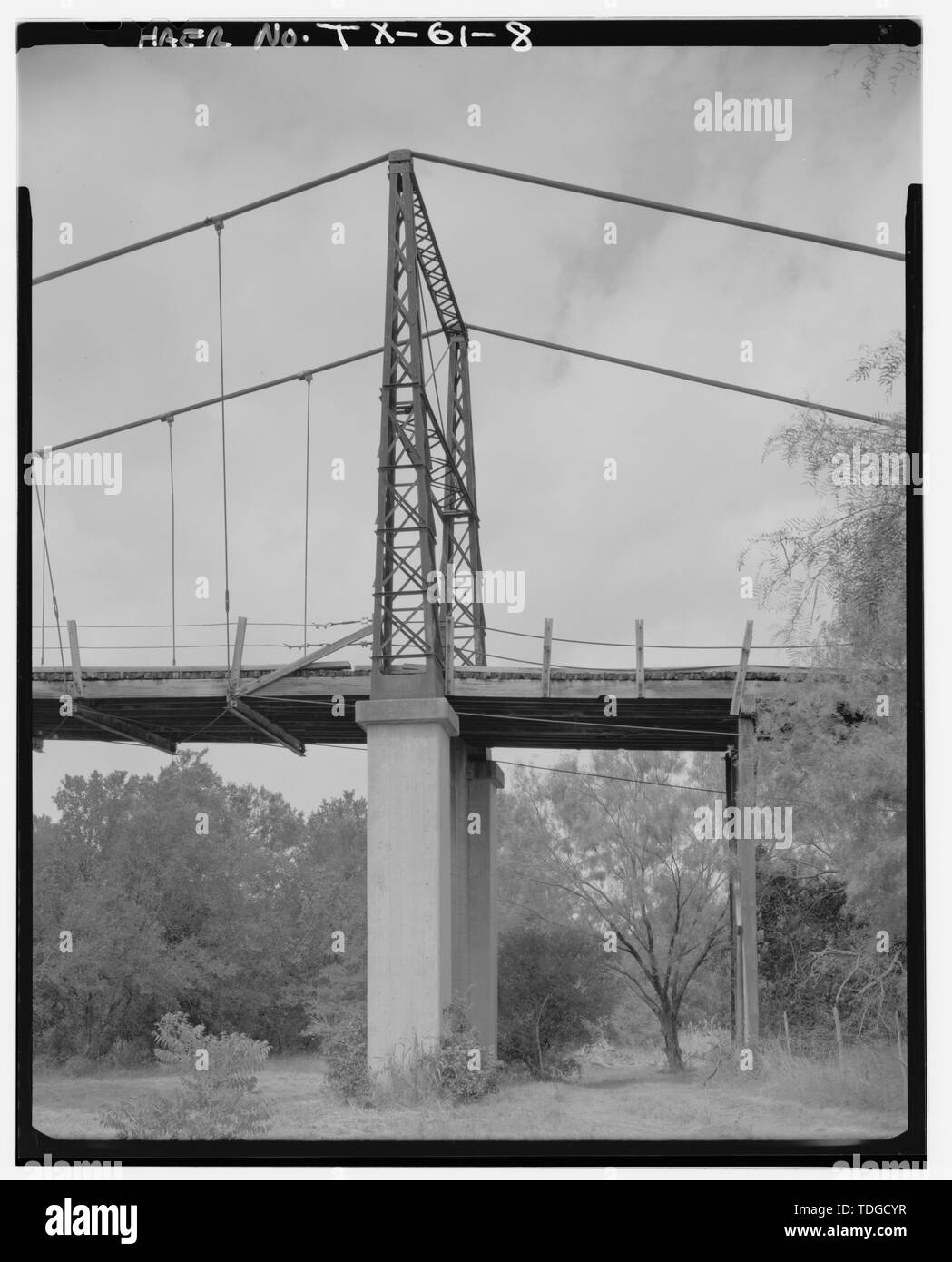 NORTH Tower, von E.-Regency Suspension Bridge Spanning Colorado River an der Grafschaft Route 126, Goldthwaite, Mills County, TX Stockfotohttps://www.alamy.de/image-license-details/?v=1https://www.alamy.de/north-tower-von-e-regency-suspension-bridge-spanning-colorado-river-an-der-grafschaft-route-126-goldthwaite-mills-county-tx-image249297099.html
RMTDGCYR–NORTH Tower, von E.-Regency Suspension Bridge Spanning Colorado River an der Grafschaft Route 126, Goldthwaite, Mills County, TX
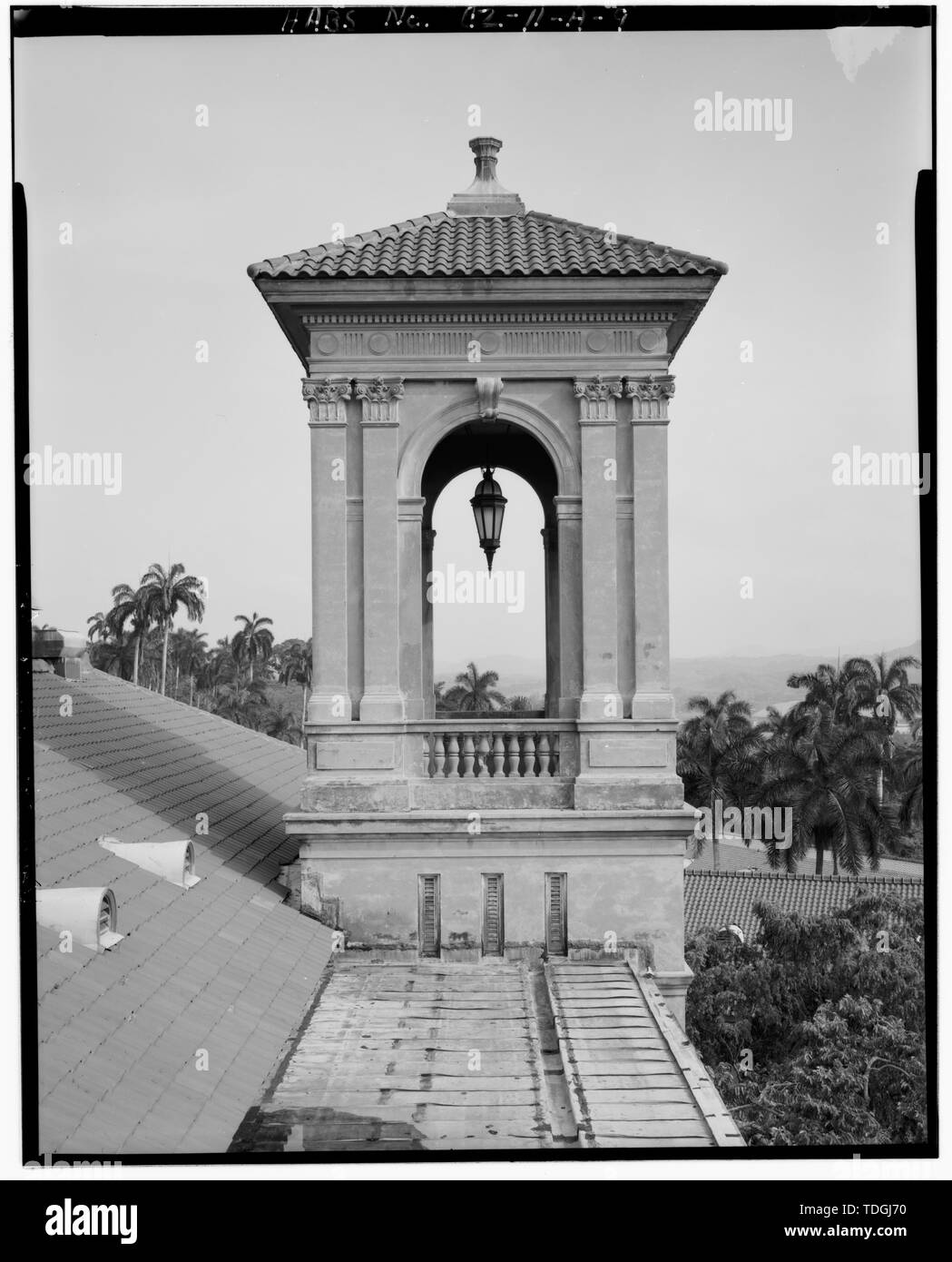 North Tower, nach Norden. - Gorgas Krankenhaus, Verwaltung und Kliniken Gebäude, Culebra Road, Balboa Park, ehemaliger Panama Canal Zone, CZ Stockfotohttps://www.alamy.de/image-license-details/?v=1https://www.alamy.de/north-tower-nach-norden-gorgas-krankenhaus-verwaltung-und-kliniken-gebaude-culebra-road-balboa-park-ehemaliger-panama-canal-zone-cz-image249301220.html
RMTDGJ70–North Tower, nach Norden. - Gorgas Krankenhaus, Verwaltung und Kliniken Gebäude, Culebra Road, Balboa Park, ehemaliger Panama Canal Zone, CZ
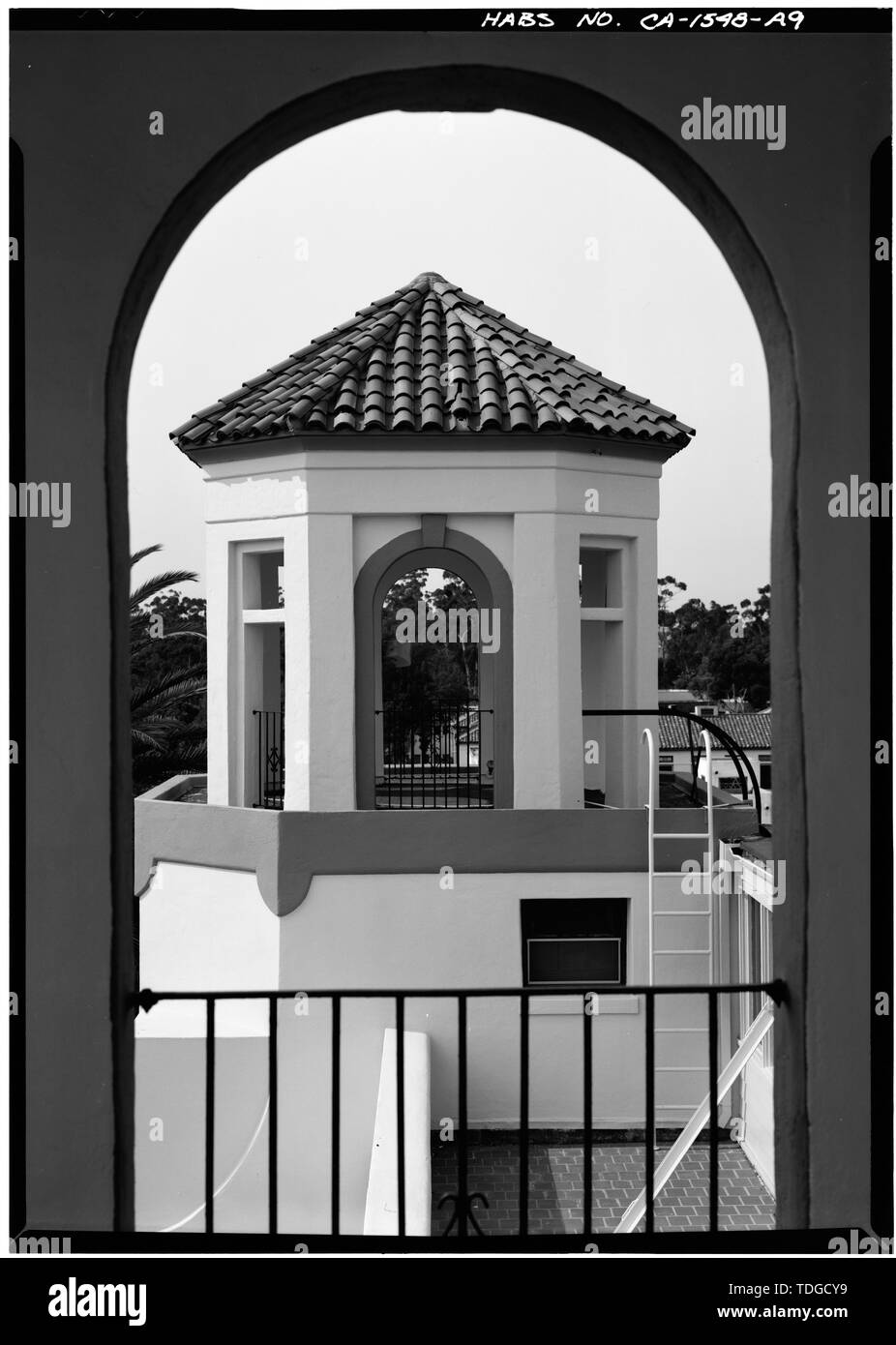 NORTH TOWER GERAHMT VON ARCH - U.S. Naval Hospital, Verwaltungsgebäude, Park Boulevard, Balboa Park, San Diego, San Diego County, CA Stockfotohttps://www.alamy.de/image-license-details/?v=1https://www.alamy.de/north-tower-gerahmt-von-arch-us-naval-hospital-verwaltungsgebaude-park-boulevard-balboa-park-san-diego-san-diego-county-ca-image249297085.html
RMTDGCY9–NORTH TOWER GERAHMT VON ARCH - U.S. Naval Hospital, Verwaltungsgebäude, Park Boulevard, Balboa Park, San Diego, San Diego County, CA
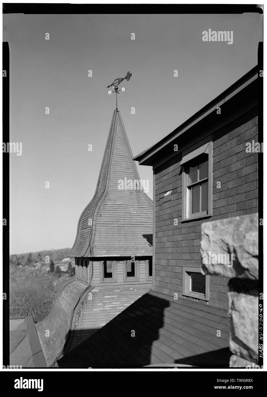 Dach DETAIL DER NORDTURM VON SÜDEN, ZEIGT WINDFAHNE - Mohonk Mountain House, Mountain Rest Road, New Paltz, Ulster County, NY Stockfotohttps://www.alamy.de/image-license-details/?v=1https://www.alamy.de/dach-detail-der-nordturm-von-suden-zeigt-windfahne-mohonk-mountain-house-mountain-rest-road-new-paltz-ulster-county-ny-image256681066.html
RMTWGR8X–Dach DETAIL DER NORDTURM VON SÜDEN, ZEIGT WINDFAHNE - Mohonk Mountain House, Mountain Rest Road, New Paltz, Ulster County, NY
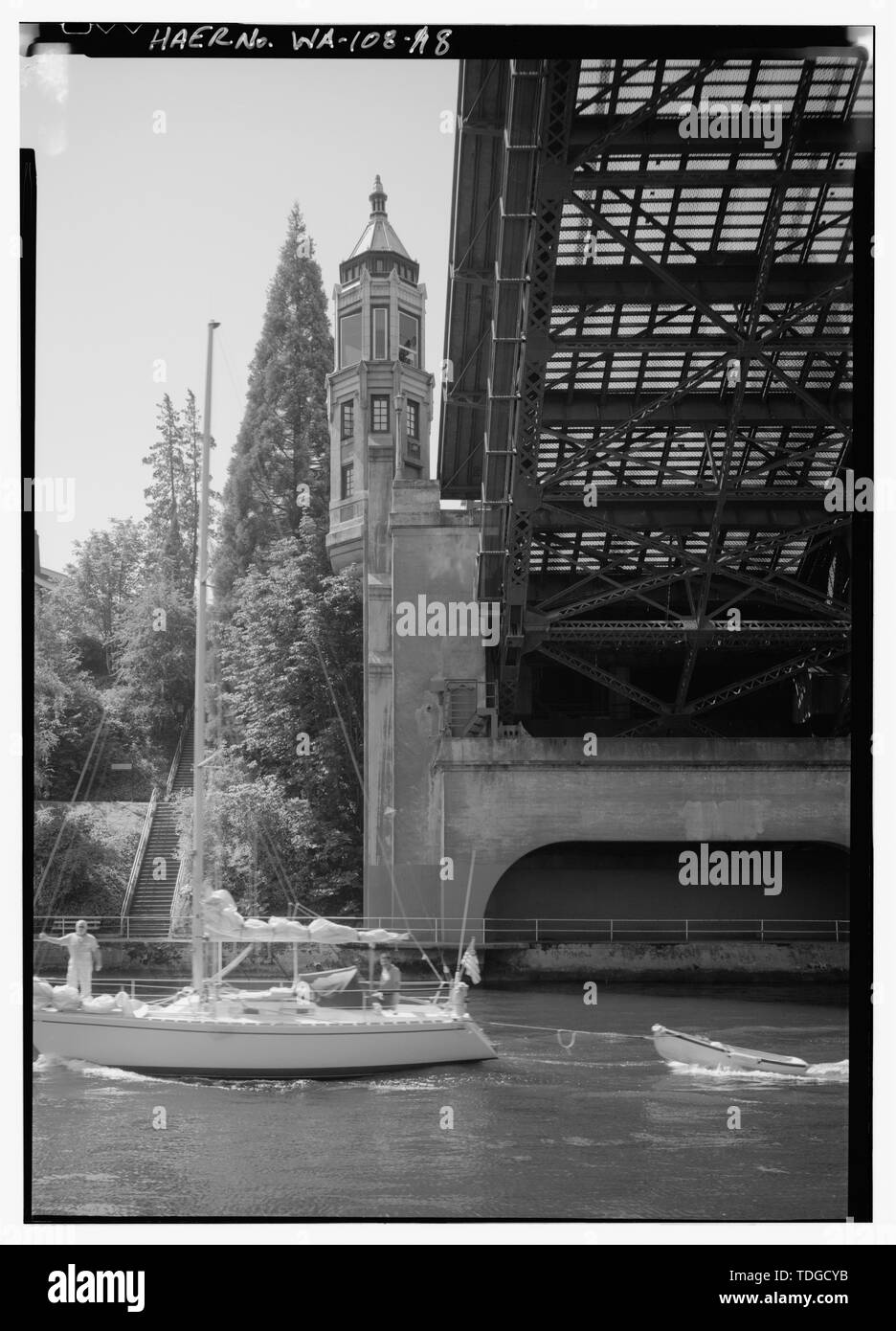 NORTH TOWER IN HÖHE AN POSITION ÖFFNEN - montlake Brücke, Spanning Montlake Schnitt an der State Route 513, Seattle, King County, WA; Stumpf, Karl W, Sender Stockfotohttps://www.alamy.de/image-license-details/?v=1https://www.alamy.de/north-tower-in-hohe-an-position-offnen-montlake-brucke-spanning-montlake-schnitt-an-der-state-route-513-seattle-king-county-wa-stumpf-karl-w-sender-image249297087.html
RMTDGCYB–NORTH TOWER IN HÖHE AN POSITION ÖFFNEN - montlake Brücke, Spanning Montlake Schnitt an der State Route 513, Seattle, King County, WA; Stumpf, Karl W, Sender
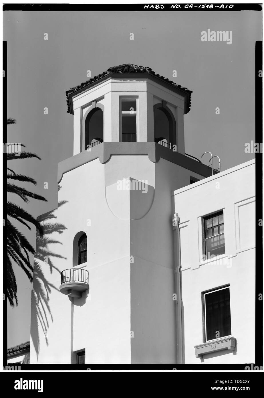 Nordturm UND BALKON, WEST SIDE DETAIL - U.S. Naval Hospital, Verwaltungsgebäude, Park Boulevard, Balboa Park, San Diego, San Diego County, CA Stockfotohttps://www.alamy.de/image-license-details/?v=1https://www.alamy.de/nordturm-und-balkon-west-side-detail-us-naval-hospital-verwaltungsgebaude-park-boulevard-balboa-park-san-diego-san-diego-county-ca-image249297075.html
RMTDGCXY–Nordturm UND BALKON, WEST SIDE DETAIL - U.S. Naval Hospital, Verwaltungsgebäude, Park Boulevard, Balboa Park, San Diego, San Diego County, CA
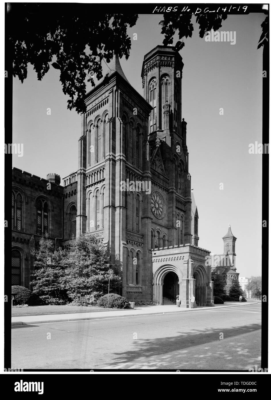 NORTH Tower, Porte Cochere und FLAG TOWER, nach Südwesten - Smithsonian Institution Building, 1000 Jefferson Drive, zwischen dem neunten und zwölften Straßen, Südwesten, Washington, District of Columbia, DC Stockfotohttps://www.alamy.de/image-license-details/?v=1https://www.alamy.de/north-tower-porte-cochere-und-flag-tower-nach-sudwesten-smithsonian-institution-building-1000-jefferson-drive-zwischen-dem-neunten-und-zwolften-strassen-sudwesten-washington-district-of-columbia-dc-image249297116.html
RMTDGD0C–NORTH Tower, Porte Cochere und FLAG TOWER, nach Südwesten - Smithsonian Institution Building, 1000 Jefferson Drive, zwischen dem neunten und zwölften Straßen, Südwesten, Washington, District of Columbia, DC
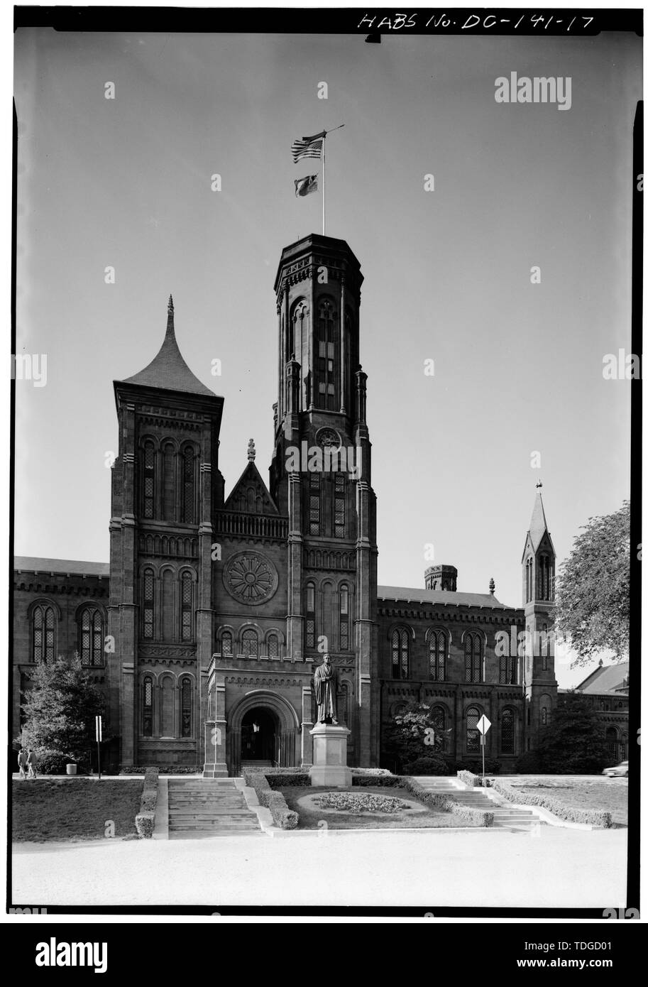 NORTH Tower, Porte Cochere und FLAG TOWER, Blick nach Süden - Smithsonian Institution Building, 1000 Jefferson Drive, zwischen dem neunten und zwölften Straßen, Südwesten, Washington, District of Columbia, DC Stockfotohttps://www.alamy.de/image-license-details/?v=1https://www.alamy.de/north-tower-porte-cochere-und-flag-tower-blick-nach-suden-smithsonian-institution-building-1000-jefferson-drive-zwischen-dem-neunten-und-zwolften-strassen-sudwesten-washington-district-of-columbia-dc-image249297105.html
RMTDGD01–NORTH Tower, Porte Cochere und FLAG TOWER, Blick nach Süden - Smithsonian Institution Building, 1000 Jefferson Drive, zwischen dem neunten und zwölften Straßen, Südwesten, Washington, District of Columbia, DC
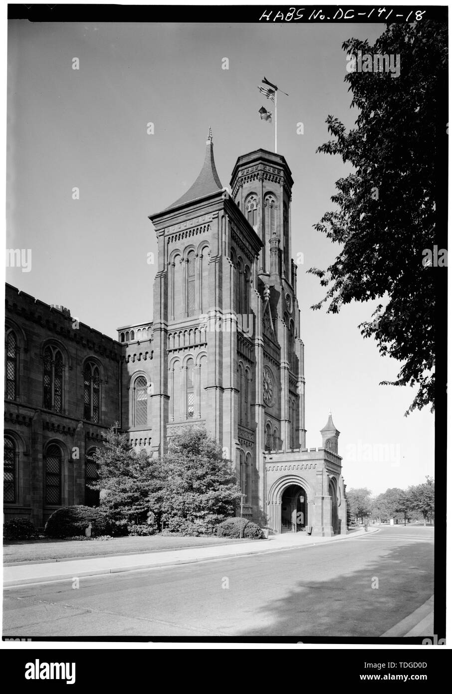 NORTH Tower, Porte Cochere und FLAG TOWER, südwestlich von WEST - Smithsonian Institution Building, 1000 Jefferson Drive, zwischen dem neunten und zwölften Straßen, Südwesten, Washington, District of Columbia, DC Stockfotohttps://www.alamy.de/image-license-details/?v=1https://www.alamy.de/north-tower-porte-cochere-und-flag-tower-sudwestlich-von-west-smithsonian-institution-building-1000-jefferson-drive-zwischen-dem-neunten-und-zwolften-strassen-sudwesten-washington-district-of-columbia-dc-image249297117.html
RMTDGD0D–NORTH Tower, Porte Cochere und FLAG TOWER, südwestlich von WEST - Smithsonian Institution Building, 1000 Jefferson Drive, zwischen dem neunten und zwölften Straßen, Südwesten, Washington, District of Columbia, DC
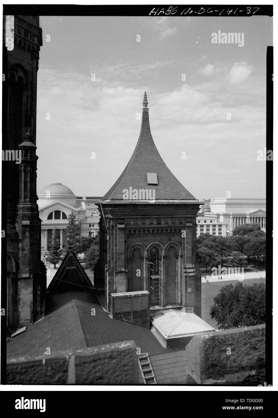 NORTH TOWER OBERE ZONE VON SOUTH TOWER DACH, Blick nach Norden - Smithsonian Institution Building, 1000 Jefferson Drive, zwischen dem neunten und zwölften Straßen, Südwesten, Washington, District of Columbia, DC Stockfotohttps://www.alamy.de/image-license-details/?v=1https://www.alamy.de/north-tower-obere-zone-von-south-tower-dach-blick-nach-norden-smithsonian-institution-building-1000-jefferson-drive-zwischen-dem-neunten-und-zwolften-strassen-sudwesten-washington-district-of-columbia-dc-image249297104.html
RMTDGD00–NORTH TOWER OBERE ZONE VON SOUTH TOWER DACH, Blick nach Norden - Smithsonian Institution Building, 1000 Jefferson Drive, zwischen dem neunten und zwölften Straßen, Südwesten, Washington, District of Columbia, DC
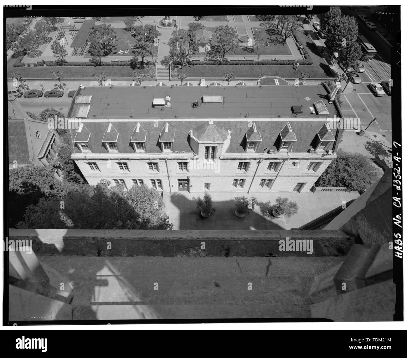 Ansicht von Westen Elevation und Dach (von Norden's cathedral tower) - Grace Cathedral, George Gibbs Memorial Hall, 1051 Taylor Street, San Francisco, San Francisco County, CA Stockfotohttps://www.alamy.de/image-license-details/?v=1https://www.alamy.de/ansicht-von-westen-elevation-und-dach-von-nordens-cathedral-tower-grace-cathedral-george-gibbs-memorial-hall-1051-taylor-street-san-francisco-san-francisco-county-ca-image249376336.html
RMTDM21M–Ansicht von Westen Elevation und Dach (von Norden's cathedral tower) - Grace Cathedral, George Gibbs Memorial Hall, 1051 Taylor Street, San Francisco, San Francisco County, CA
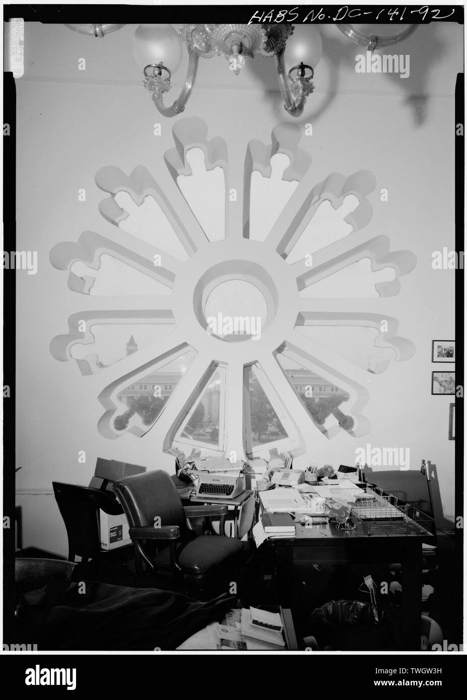 ROSE FENSTER IN ZIMMER T 472, NORTH Tower, 4. Stock, Blick nach Norden - Smithsonian Institution Building, 1000 Jefferson Drive, zwischen dem neunten und zwölften Straßen, Südwesten, Washington, District of Columbia, DC Stockfotohttps://www.alamy.de/image-license-details/?v=1https://www.alamy.de/rose-fenster-in-zimmer-t-472-north-tower-4-stock-blick-nach-norden-smithsonian-institution-building-1000-jefferson-drive-zwischen-dem-neunten-und-zwolften-strassen-sudwesten-washington-district-of-columbia-dc-image256682485.html
RMTWGW3H–ROSE FENSTER IN ZIMMER T 472, NORTH Tower, 4. Stock, Blick nach Norden - Smithsonian Institution Building, 1000 Jefferson Drive, zwischen dem neunten und zwölften Straßen, Südwesten, Washington, District of Columbia, DC
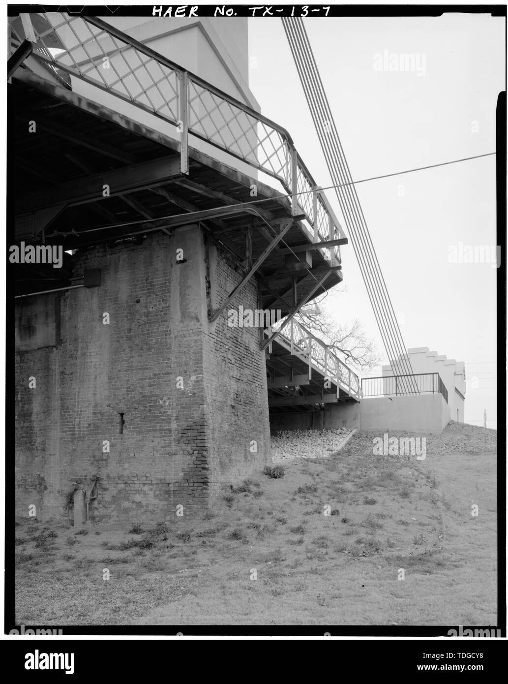 NORTH TOWER DETAIL. - Waco Suspension Bridge Spanning Brazos River Bridge Street, Waco, McLennan County, TX; Waco Brücke Unternehmen; Griffith, Thomas M; Missouri Valley Bridge und Iron Company Stockfotohttps://www.alamy.de/image-license-details/?v=1https://www.alamy.de/north-tower-detail-waco-suspension-bridge-spanning-brazos-river-bridge-street-waco-mclennan-county-tx-waco-brucke-unternehmen-griffith-thomas-m-missouri-valley-bridge-und-iron-company-image249297084.html
RMTDGCY8–NORTH TOWER DETAIL. - Waco Suspension Bridge Spanning Brazos River Bridge Street, Waco, McLennan County, TX; Waco Brücke Unternehmen; Griffith, Thomas M; Missouri Valley Bridge und Iron Company
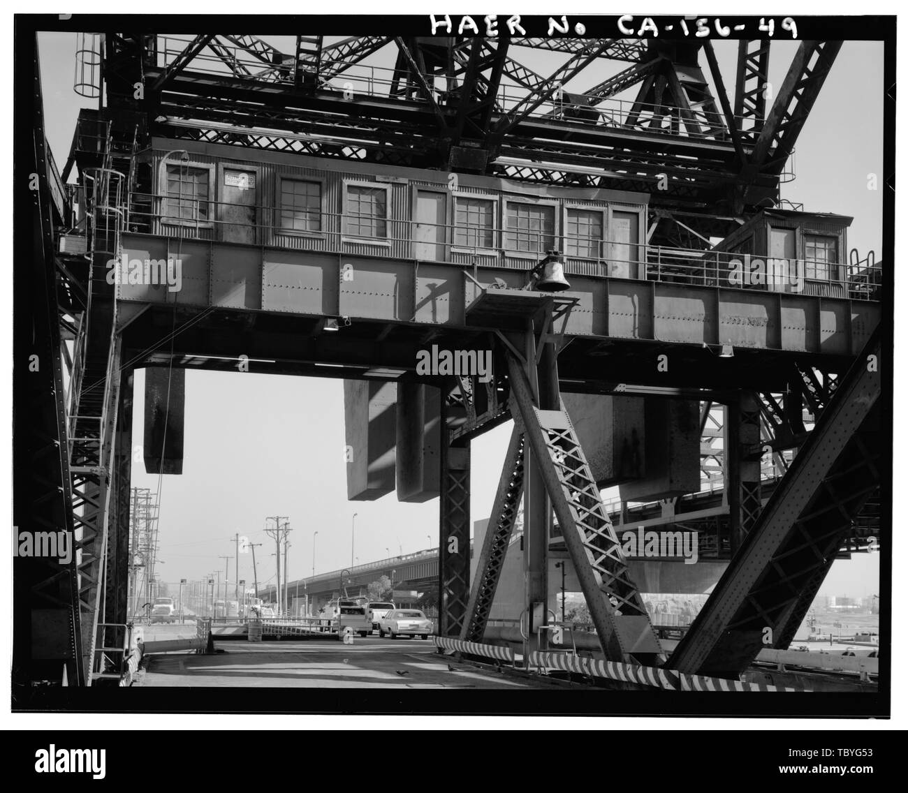 Maschinen Zimmer im North Tower. Nach Norden. Maschinen Zimmer enthalten alle Motoren, Regler, Motor und Getriebe für den Betrieb eine Spanne, in diesem Fall, den Norden erstrecken. Hinweis Glocke mit Klöppel für Dauerbetrieb, wie Nebel Signale. Henry Ford Brücke, Spanning Cerritos Kanal, Los AngelesLong Strand Hafen, Los Angeles, Los Angeles County, CA Stockfotohttps://www.alamy.de/image-license-details/?v=1https://www.alamy.de/maschinen-zimmer-im-north-tower-nach-norden-maschinen-zimmer-enthalten-alle-motoren-regler-motor-und-getriebe-fur-den-betrieb-eine-spanne-in-diesem-fall-den-norden-erstrecken-hinweis-glocke-mit-kloppel-fur-dauerbetrieb-wie-nebel-signale-henry-ford-brucke-spanning-cerritos-kanal-los-angeleslong-strand-hafen-los-angeles-los-angeles-county-ca-image248311759.html
RMTBYG53–Maschinen Zimmer im North Tower. Nach Norden. Maschinen Zimmer enthalten alle Motoren, Regler, Motor und Getriebe für den Betrieb eine Spanne, in diesem Fall, den Norden erstrecken. Hinweis Glocke mit Klöppel für Dauerbetrieb, wie Nebel Signale. Henry Ford Brücke, Spanning Cerritos Kanal, Los AngelesLong Strand Hafen, Los Angeles, Los Angeles County, CA
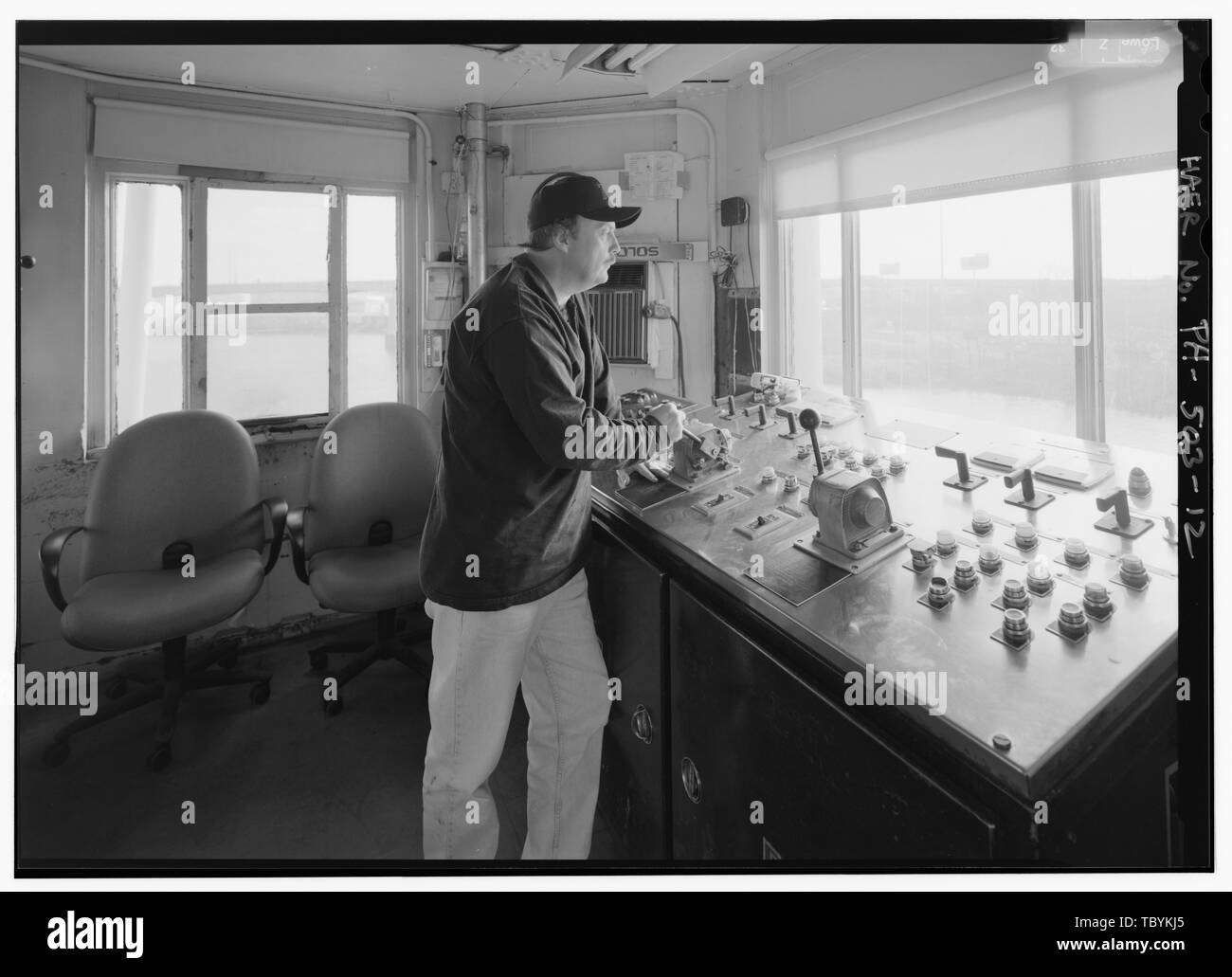 Mike Feeney, Operator, in North Tower. Die University Avenue Bridge, Spanning Schuylkill River an der University Avenue (State Route 3003), Philadelphia, Philadelphia County, PA Dravo Contracting-unternehmen Philadelphia Abteilung für Öffentliche Arbeiten DeLony, Eric N, Projektleiter Pennsylvania Verkehrsministerium, Sponsor historische Pennsylvania und Museum Kommission, sponsor Ross, Helen P, Historiker Spivey, Justin M, Historiker Lowe, Jet, Fotograf Stockfotohttps://www.alamy.de/image-license-details/?v=1https://www.alamy.de/mike-feeney-operator-in-north-tower-die-university-avenue-bridge-spanning-schuylkill-river-an-der-university-avenue-state-route-3003-philadelphia-philadelphia-county-pa-dravo-contracting-unternehmen-philadelphia-abteilung-fur-offentliche-arbeiten-delony-eric-n-projektleiter-pennsylvania-verkehrsministerium-sponsor-historische-pennsylvania-und-museum-kommission-sponsor-ross-helen-p-historiker-spivey-justin-m-historiker-lowe-jet-fotograf-image248314477.html
RMTBYKJ5–Mike Feeney, Operator, in North Tower. Die University Avenue Bridge, Spanning Schuylkill River an der University Avenue (State Route 3003), Philadelphia, Philadelphia County, PA Dravo Contracting-unternehmen Philadelphia Abteilung für Öffentliche Arbeiten DeLony, Eric N, Projektleiter Pennsylvania Verkehrsministerium, Sponsor historische Pennsylvania und Museum Kommission, sponsor Ross, Helen P, Historiker Spivey, Justin M, Historiker Lowe, Jet, Fotograf
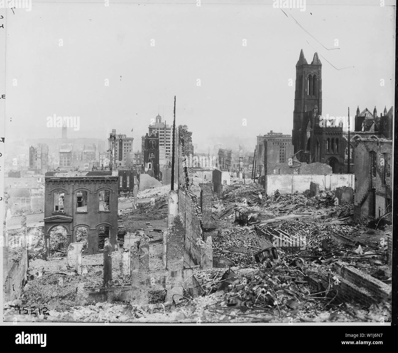 Erdbeben in San Francisco 1906: [Dies ist möglicherweise Fairmont Hill Gebiet westlich von der Taylor Street, südlich von Clay Street, nördlich von der Pine Street, und östlich von Embarcadero Street. Das Ferry Building, mit der Uhr im Turm, ist der Abstand auf der linken Seite angezeigt. Saint Mary's Church bei DuPont und California Street; Kaufleute" auszutauschen, und die Mühlen Gebäude werden auch angezeigt Stockfotohttps://www.alamy.de/image-license-details/?v=1https://www.alamy.de/erdbeben-in-san-francisco-1906-dies-ist-moglicherweise-fairmont-hill-gebiet-westlich-von-der-taylor-street-sudlich-von-clay-street-nordlich-von-der-pine-street-und-ostlich-von-embarcadero-street-das-ferry-building-mit-der-uhr-im-turm-ist-der-abstand-auf-der-linken-seite-angezeigt-saint-marys-church-bei-dupont-und-california-street-kaufleute-auszutauschen-und-die-muhlen-gebaude-werden-auch-angezeigt-image259170611.html
RMW1J6N7–Erdbeben in San Francisco 1906: [Dies ist möglicherweise Fairmont Hill Gebiet westlich von der Taylor Street, südlich von Clay Street, nördlich von der Pine Street, und östlich von Embarcadero Street. Das Ferry Building, mit der Uhr im Turm, ist der Abstand auf der linken Seite angezeigt. Saint Mary's Church bei DuPont und California Street; Kaufleute" auszutauschen, und die Mühlen Gebäude werden auch angezeigt
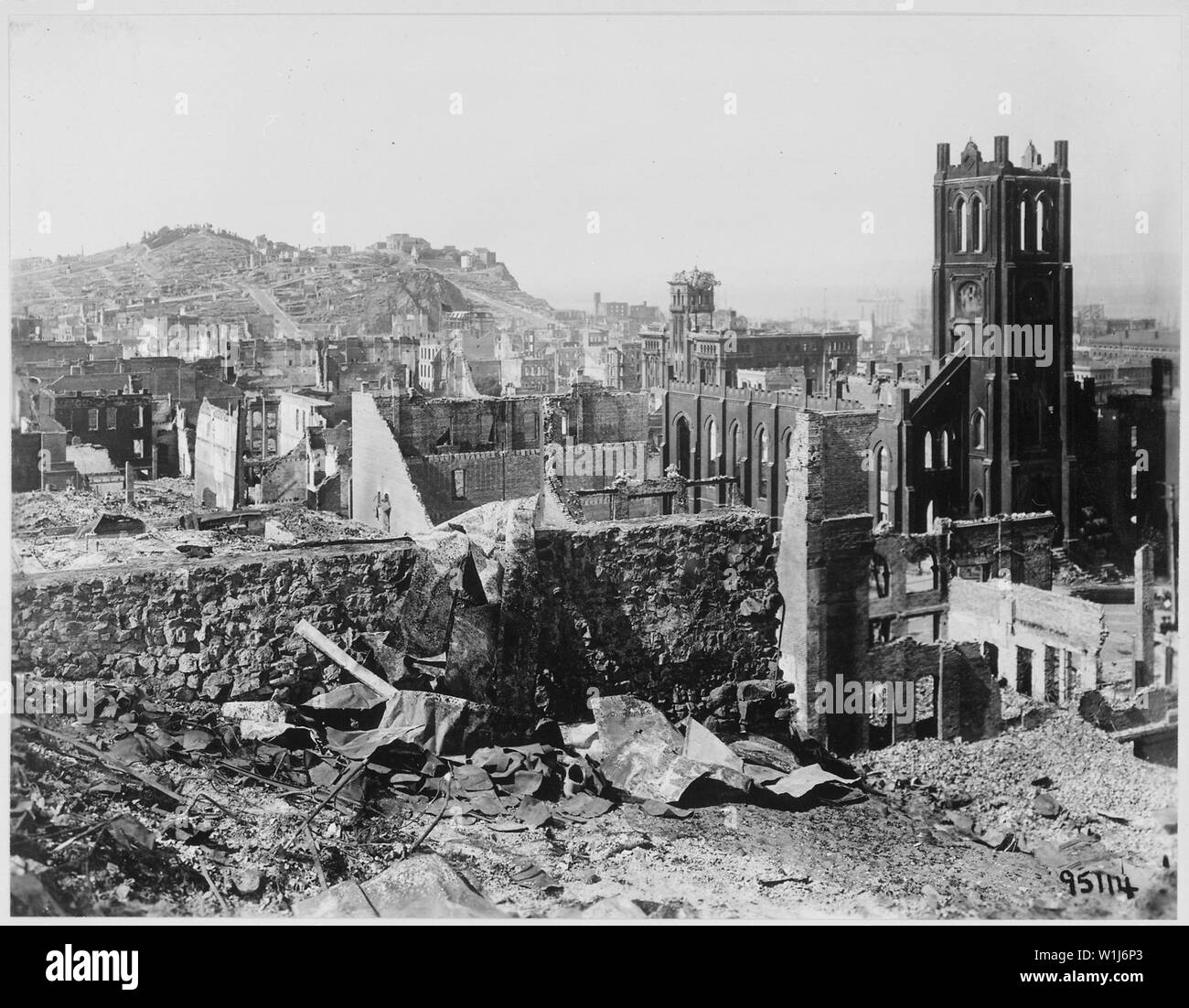 Erdbeben in San Francisco 1906: Gebiet nördlich von California Street in der Nähe der Grant Avenue übersicht Telegraph Hill in der Ferne. Die Kirche stand auf der rechten Seite ist die Saint Mary's Church, Eingang zu Chinatown. Der Bereich neben Saint Mary's Church, mit einem Zerknitterten der Tower oder die auf dem Turm ist die Halle der Gerechtigkeit auf der Kearny und Ton Straßen Stockfotohttps://www.alamy.de/image-license-details/?v=1https://www.alamy.de/erdbeben-in-san-francisco-1906-gebiet-nordlich-von-california-street-in-der-nahe-der-grant-avenue-ubersicht-telegraph-hill-in-der-ferne-die-kirche-stand-auf-der-rechten-seite-ist-die-saint-marys-church-eingang-zu-chinatown-der-bereich-neben-saint-marys-church-mit-einem-zerknitterten-der-tower-oder-die-auf-dem-turm-ist-die-halle-der-gerechtigkeit-auf-der-kearny-und-ton-strassen-image259170635.html
RMW1J6P3–Erdbeben in San Francisco 1906: Gebiet nördlich von California Street in der Nähe der Grant Avenue übersicht Telegraph Hill in der Ferne. Die Kirche stand auf der rechten Seite ist die Saint Mary's Church, Eingang zu Chinatown. Der Bereich neben Saint Mary's Church, mit einem Zerknitterten der Tower oder die auf dem Turm ist die Halle der Gerechtigkeit auf der Kearny und Ton Straßen
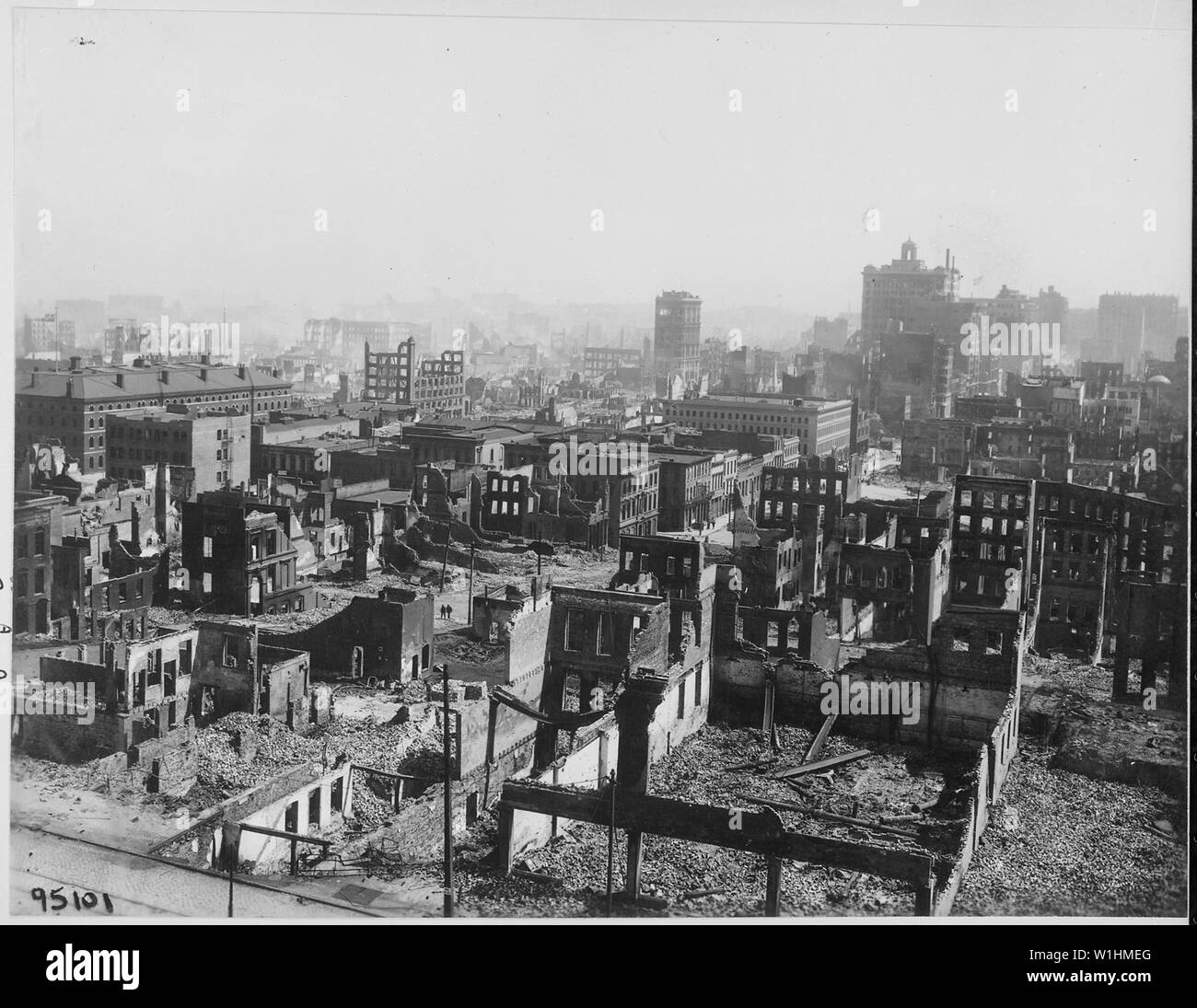 Foto von der Schaden von der San Francisco Erdbeben; Umfang und Inhalt: Original Bildunterschrift: Erdbeben in San Francisco 1906: California Street nach Norden von der Batterie Straße; der Großmarkt für Obst und Bezirk produzieren. Die niedrigen Gebäude auf der linken Seite mit allen die Schornsteine, weiße Steine und Windows ist Gebäude der Vereinigten Staaten Gutachter, und ein Teil der United States Customs House. Das große Gebäude mit dem Turm und Radio Station ist die Kaufleute" auszutauschen. Stockfotohttps://www.alamy.de/image-license-details/?v=1https://www.alamy.de/foto-von-der-schaden-von-der-san-francisco-erdbeben-umfang-und-inhalt-original-bildunterschrift-erdbeben-in-san-francisco-1906-california-street-nach-norden-von-der-batterie-strasse-der-grossmarkt-fur-obst-und-bezirk-produzieren-die-niedrigen-gebaude-auf-der-linken-seite-mit-allen-die-schornsteine-weisse-steine-und-windows-ist-gebaude-der-vereinigten-staaten-gutachter-und-ein-teil-der-united-states-customs-house-das-grosse-gebaude-mit-dem-turm-und-radio-station-ist-die-kaufleute-auszutauschen-image259159448.html
RMW1HMEG–Foto von der Schaden von der San Francisco Erdbeben; Umfang und Inhalt: Original Bildunterschrift: Erdbeben in San Francisco 1906: California Street nach Norden von der Batterie Straße; der Großmarkt für Obst und Bezirk produzieren. Die niedrigen Gebäude auf der linken Seite mit allen die Schornsteine, weiße Steine und Windows ist Gebäude der Vereinigten Staaten Gutachter, und ein Teil der United States Customs House. Das große Gebäude mit dem Turm und Radio Station ist die Kaufleute" auszutauschen.
 NORTHWEST TURM AUS SOUTH TOWER DACH, Blick nach Norden durch Northwest - Smithsonian Institution Building, 1000 Jefferson Drive, zwischen dem neunten und zwölften Straßen, Südwesten, Washington, District of Columbia, DC Stockfotohttps://www.alamy.de/image-license-details/?v=1https://www.alamy.de/northwest-turm-aus-south-tower-dach-blick-nach-norden-durch-northwest-smithsonian-institution-building-1000-jefferson-drive-zwischen-dem-neunten-und-zwolften-strassen-sudwesten-washington-district-of-columbia-dc-image249300830.html
RMTDGHN2–NORTHWEST TURM AUS SOUTH TOWER DACH, Blick nach Norden durch Northwest - Smithsonian Institution Building, 1000 Jefferson Drive, zwischen dem neunten und zwölften Straßen, Südwesten, Washington, District of Columbia, DC
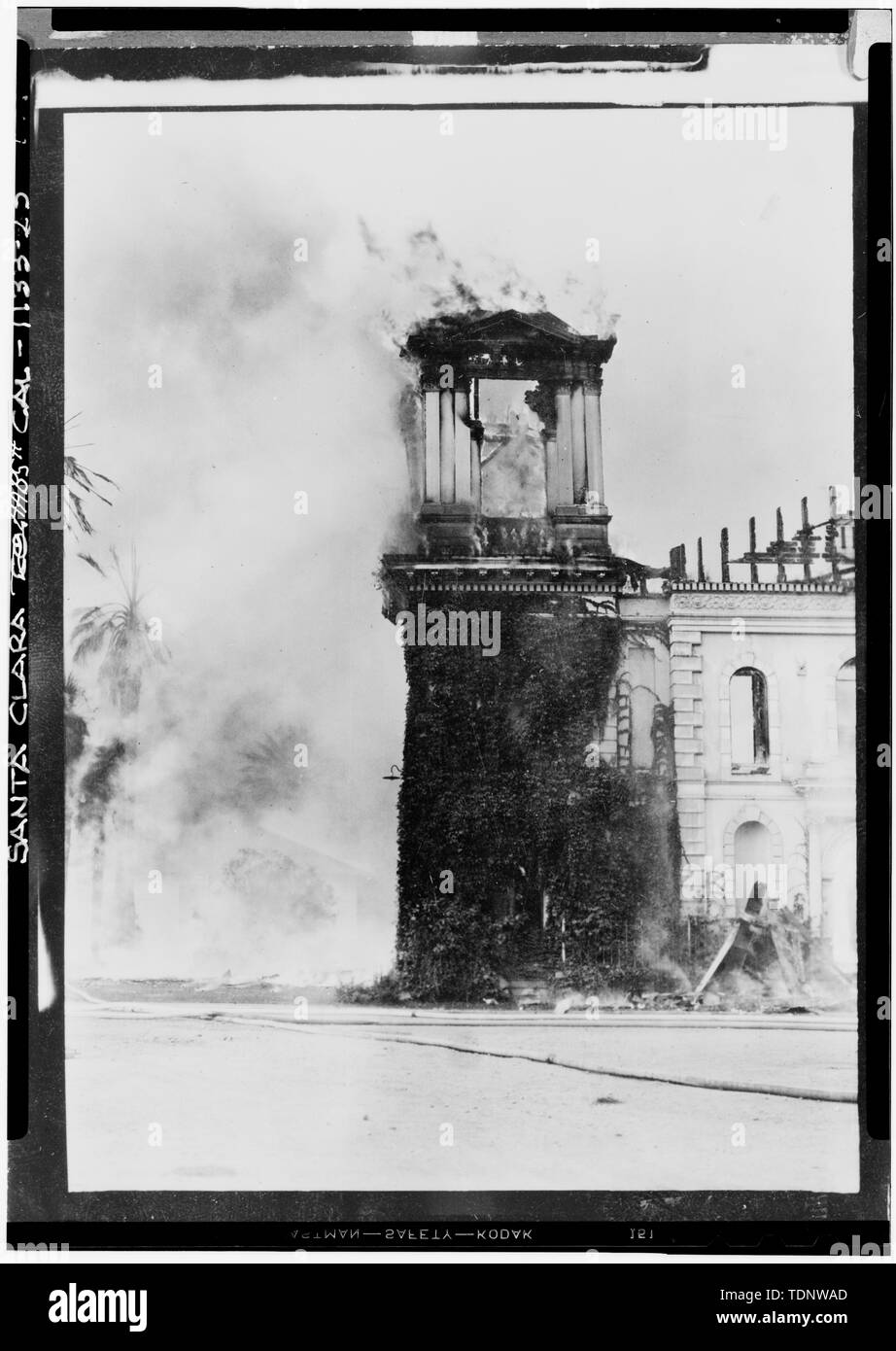 Fotokopie des Oktober 23, 1926, Foto in San Francisco Call-Bulletin Bibliothek. NORTH Tower bei Brand vom 23. Oktober 1926 - Die Mission Santa Clara de Asis, Franklin und Grant Straßen, Santa Clara, Santa Clara County, CA Stockfotohttps://www.alamy.de/image-license-details/?v=1https://www.alamy.de/fotokopie-des-oktober-23-1926-foto-in-san-francisco-call-bulletin-bibliothek-north-tower-bei-brand-vom-23-oktober-1926-die-mission-santa-clara-de-asis-franklin-und-grant-strassen-santa-clara-santa-clara-county-ca-image249416565.html
RMTDNWAD–Fotokopie des Oktober 23, 1926, Foto in San Francisco Call-Bulletin Bibliothek. NORTH Tower bei Brand vom 23. Oktober 1926 - Die Mission Santa Clara de Asis, Franklin und Grant Straßen, Santa Clara, Santa Clara County, CA
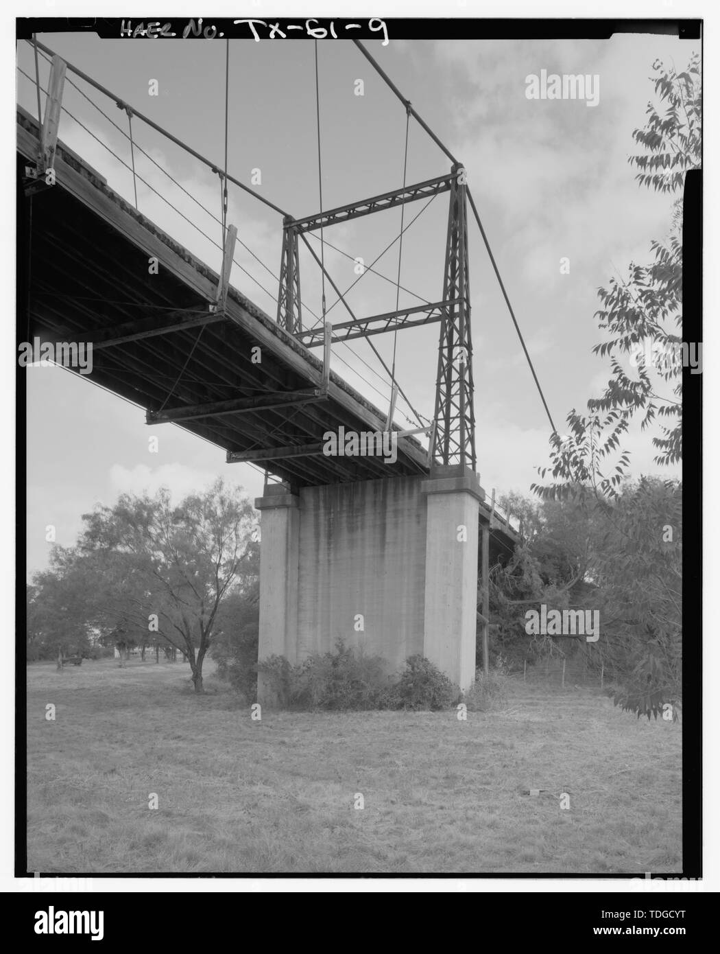 NORTH Tower, von SE. - Regency Suspension Bridge Spanning Colorado River an der Grafschaft Route 126, Goldthwaite, Mills County, TX Stockfotohttps://www.alamy.de/image-license-details/?v=1https://www.alamy.de/north-tower-von-se-regency-suspension-bridge-spanning-colorado-river-an-der-grafschaft-route-126-goldthwaite-mills-county-tx-image249297100.html
RMTDGCYT–NORTH Tower, von SE. - Regency Suspension Bridge Spanning Colorado River an der Grafschaft Route 126, Goldthwaite, Mills County, TX
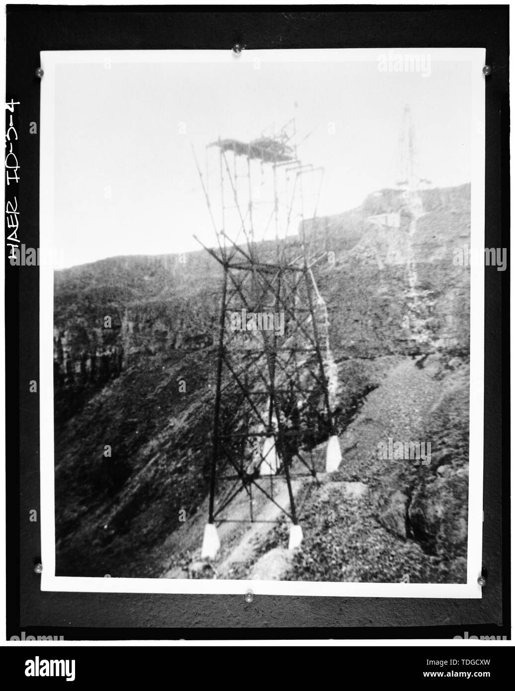 NORTH Tower. - Twin Falls-Jerome Brücke, US-Highway 93 Spanning Snake River, Twin Falls, Twin Falls County, ID Stockfotohttps://www.alamy.de/image-license-details/?v=1https://www.alamy.de/north-tower-twin-falls-jerome-brucke-us-highway-93-spanning-snake-river-twin-falls-twin-falls-county-id-image249297073.html
RMTDGCXW–NORTH Tower. - Twin Falls-Jerome Brücke, US-Highway 93 Spanning Snake River, Twin Falls, Twin Falls County, ID
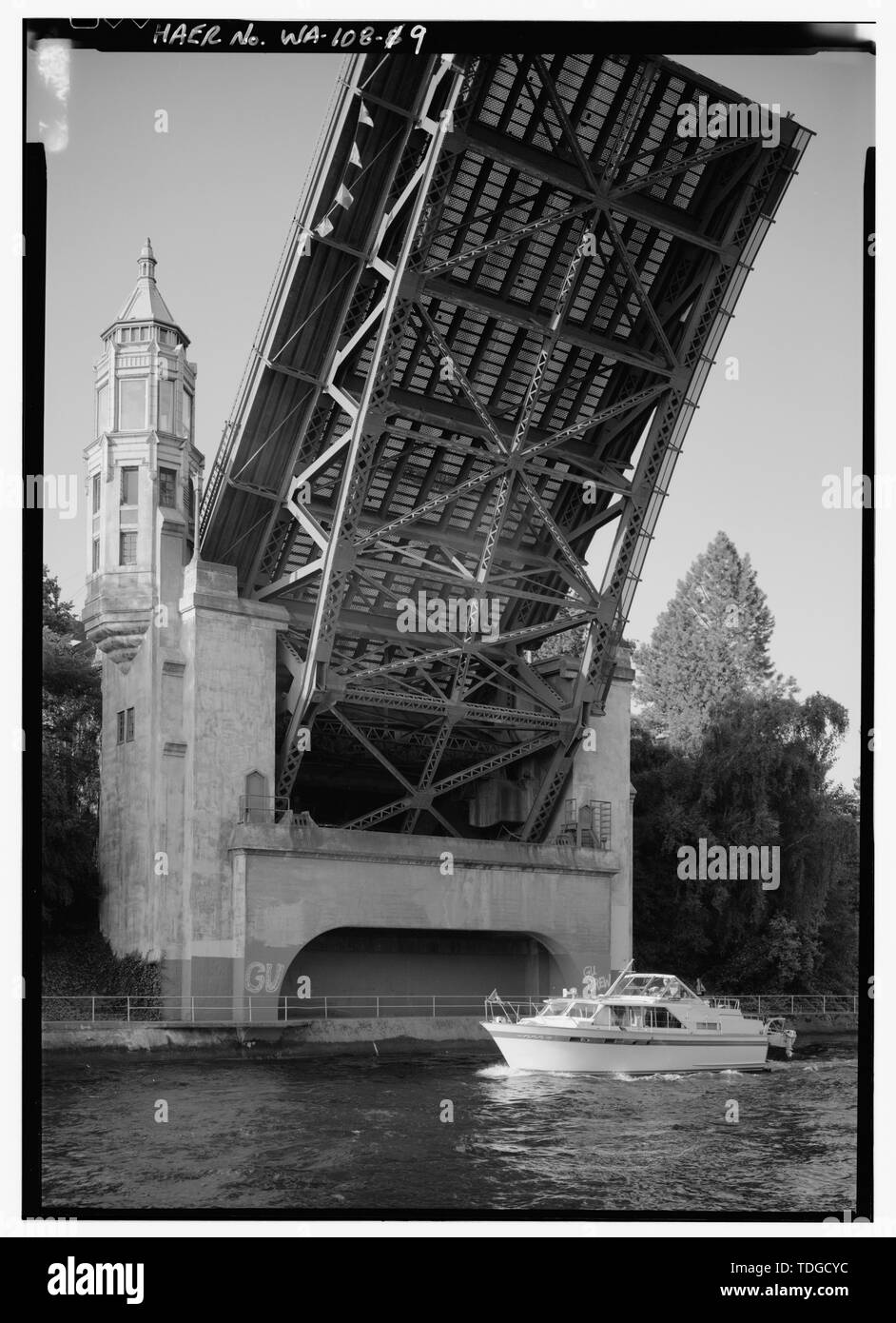 NORTH TOWER IN OFFENER STELLUNG - montlake Brücke, Spanning Montlake Schnitt an der State Route 513, Seattle, King County, WA; Stumpf, Karl W, Sender Stockfotohttps://www.alamy.de/image-license-details/?v=1https://www.alamy.de/north-tower-in-offener-stellung-montlake-brucke-spanning-montlake-schnitt-an-der-state-route-513-seattle-king-county-wa-stumpf-karl-w-sender-image249297088.html
RMTDGCYC–NORTH TOWER IN OFFENER STELLUNG - montlake Brücke, Spanning Montlake Schnitt an der State Route 513, Seattle, King County, WA; Stumpf, Karl W, Sender
 NORTH Tower, OSTSEITE VOM DACH - U.S. Naval Hospital, Verwaltungsgebäude, Park Boulevard, Balboa Park, San Diego, San Diego County, CA Stockfotohttps://www.alamy.de/image-license-details/?v=1https://www.alamy.de/north-tower-ostseite-vom-dach-us-naval-hospital-verwaltungsgebaude-park-boulevard-balboa-park-san-diego-san-diego-county-ca-image249297096.html
RMTDGCYM–NORTH Tower, OSTSEITE VOM DACH - U.S. Naval Hospital, Verwaltungsgebäude, Park Boulevard, Balboa Park, San Diego, San Diego County, CA
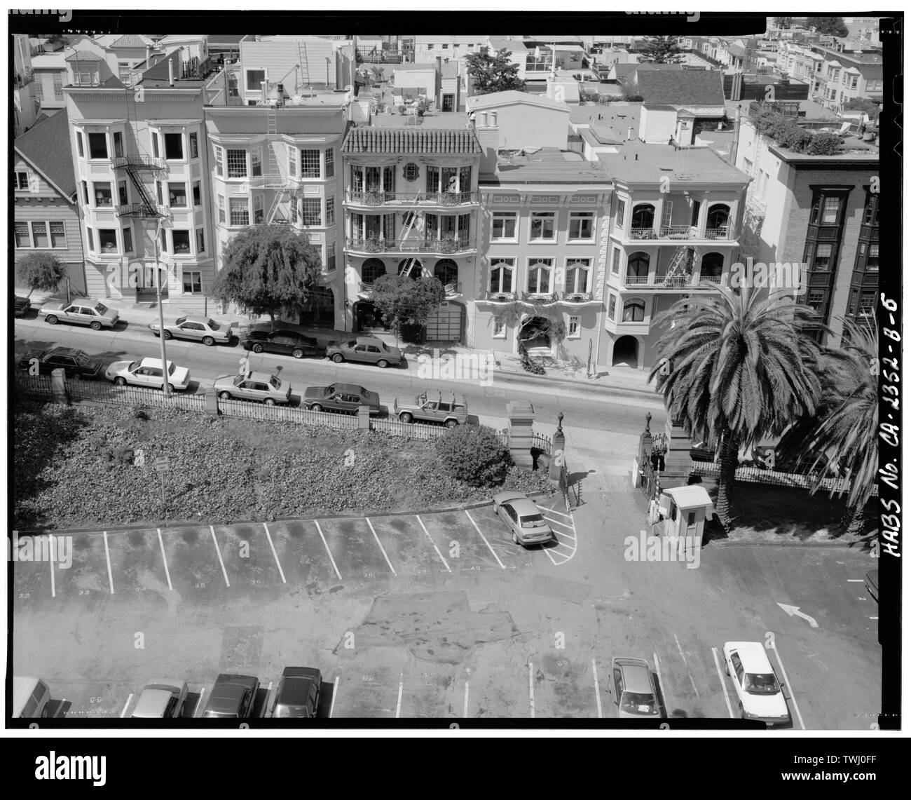 Sacramento Street Tor, Ansicht von Süden (von Norden's cathedral tower) - Grace Cathedral, Crocker Zaun, Taylor und Sacramento Street, San Francisco, San Francisco County, CA Stockfotohttps://www.alamy.de/image-license-details/?v=1https://www.alamy.de/sacramento-street-tor-ansicht-von-suden-von-nordens-cathedral-tower-grace-cathedral-crocker-zaun-taylor-und-sacramento-street-san-francisco-san-francisco-county-ca-image256707123.html
RMTWJ0FF–Sacramento Street Tor, Ansicht von Süden (von Norden's cathedral tower) - Grace Cathedral, Crocker Zaun, Taylor und Sacramento Street, San Francisco, San Francisco County, CA
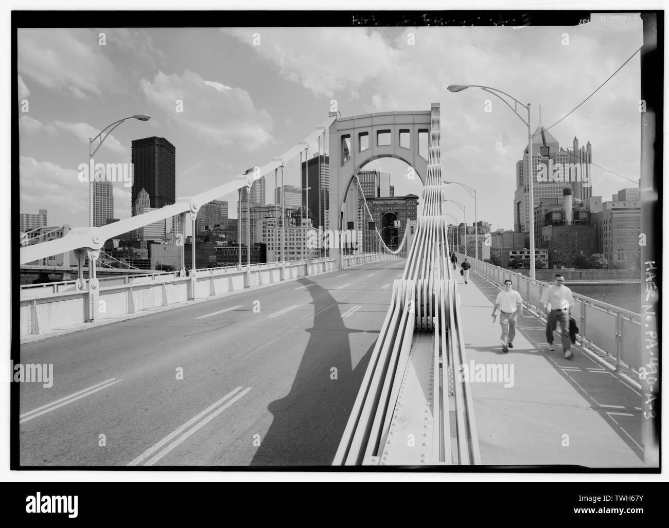 Fahrbahn, Auge - Bars und North Tower. - Drei Schwestern Brücken, Sixth Street Bridge, Spanning Allegheny River bei Sixth Street, Pittsburgh, Allegheny County, PA; Covell, Vernon R; Nutter, D; Roush, Stanley L; Wilkerson, T J; American Bridge Company; Stiftung; Allegheny County Abteilung für öffentliche Arbeiten; Braun, Norman F; Richardson, George S; Arnold, Bion J; Clemente, Roberto; DeLony, Eric N, Projektleiter; Pennsylvania Verkehrsministerium, Sponsor; historische Pennsylvania und Museum Kommission, Sponsor; Lowe, Jet, Fotograf; Berg, David C, Fotograf; Gordon, Susan H, d Stockfotohttps://www.alamy.de/image-license-details/?v=1https://www.alamy.de/fahrbahn-auge-bars-und-north-tower-drei-schwestern-brucken-sixth-street-bridge-spanning-allegheny-river-bei-sixth-street-pittsburgh-allegheny-county-pa-covell-vernon-r-nutter-d-roush-stanley-l-wilkerson-t-j-american-bridge-company-stiftung-allegheny-county-abteilung-fur-offentliche-arbeiten-braun-norman-f-richardson-george-s-arnold-bion-j-clemente-roberto-delony-eric-n-projektleiter-pennsylvania-verkehrsministerium-sponsor-historische-pennsylvania-und-museum-kommission-sponsor-lowe-jet-fotograf-berg-david-c-fotograf-gordon-susan-h-d-image256689663.html
RMTWH67Y–Fahrbahn, Auge - Bars und North Tower. - Drei Schwestern Brücken, Sixth Street Bridge, Spanning Allegheny River bei Sixth Street, Pittsburgh, Allegheny County, PA; Covell, Vernon R; Nutter, D; Roush, Stanley L; Wilkerson, T J; American Bridge Company; Stiftung; Allegheny County Abteilung für öffentliche Arbeiten; Braun, Norman F; Richardson, George S; Arnold, Bion J; Clemente, Roberto; DeLony, Eric N, Projektleiter; Pennsylvania Verkehrsministerium, Sponsor; historische Pennsylvania und Museum Kommission, Sponsor; Lowe, Jet, Fotograf; Berg, David C, Fotograf; Gordon, Susan H, d
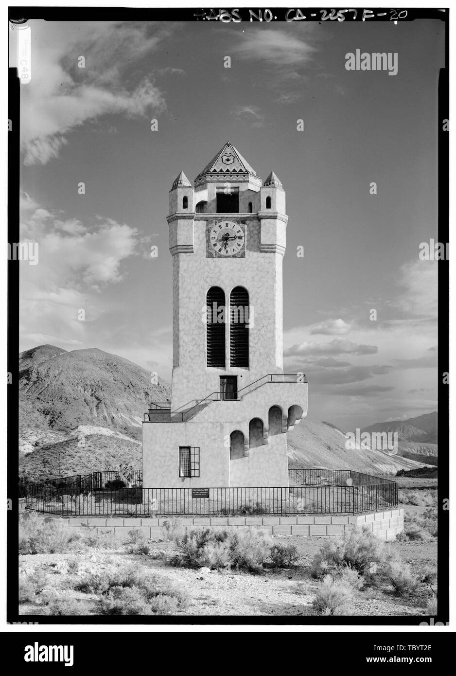 NORTH Erhöhung der Death Valley Ranch, Chimes Tower, Death Valley Junction, Inyo County, CA Stockfotohttps://www.alamy.de/image-license-details/?v=1https://www.alamy.de/north-erhohung-der-death-valley-ranch-chimes-tower-death-valley-junction-inyo-county-ca-image248317958.html
RMTBYT2E–NORTH Erhöhung der Death Valley Ranch, Chimes Tower, Death Valley Junction, Inyo County, CA
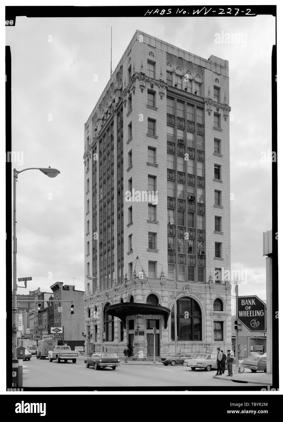 Norden und Osten Fronten medizinische Turm Gebäude, zwölften und wichtigsten Straßen, Wheeling, Ohio County, WV Stockfotohttps://www.alamy.de/image-license-details/?v=1https://www.alamy.de/norden-und-osten-fronten-medizinische-turm-gebaude-zwolften-und-wichtigsten-strassen-wheeling-ohio-county-wv-image248317180.html
RMTBYR2M–Norden und Osten Fronten medizinische Turm Gebäude, zwölften und wichtigsten Straßen, Wheeling, Ohio County, WV
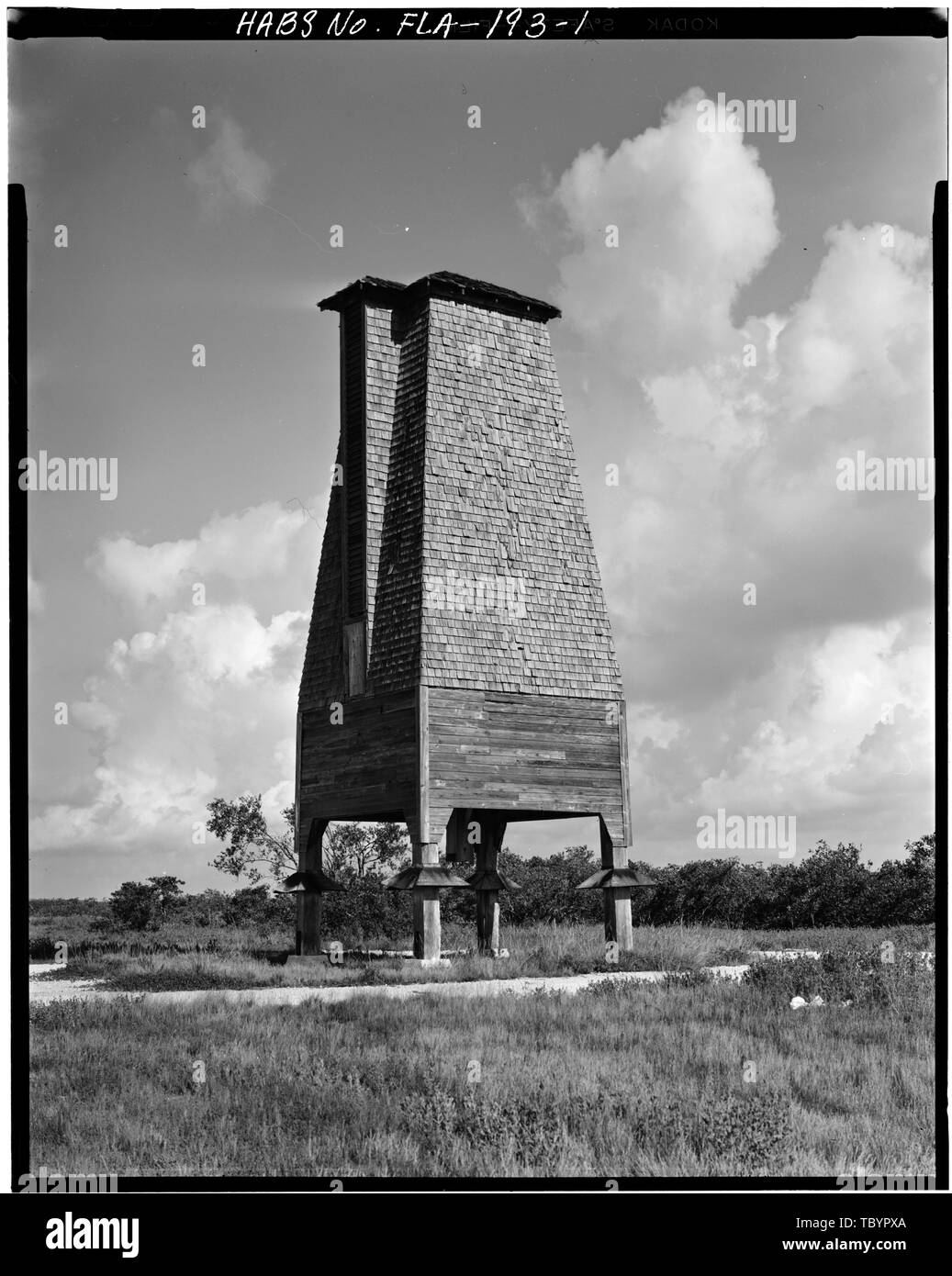 Norden und Osten ERHÖHUNGEN Perky Bat Tower, Airport Road, Key West, Monroe County, FL Stockfotohttps://www.alamy.de/image-license-details/?v=1https://www.alamy.de/norden-und-osten-erhohungen-perky-bat-tower-airport-road-key-west-monroe-county-fl-image248317058.html
RMTBYPXA–Norden und Osten ERHÖHUNGEN Perky Bat Tower, Airport Road, Key West, Monroe County, FL
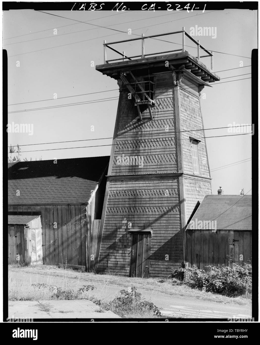 Im Norden und Westen seiten Connemara Haus, Wasserturm, Little Lake Road, Mendocino, Mendocino County, CA Stockfotohttps://www.alamy.de/image-license-details/?v=1https://www.alamy.de/im-norden-und-westen-seiten-connemara-haus-wasserturm-little-lake-road-mendocino-mendocino-county-ca-image248317607.html
RMTBYRHY–Im Norden und Westen seiten Connemara Haus, Wasserturm, Little Lake Road, Mendocino, Mendocino County, CA
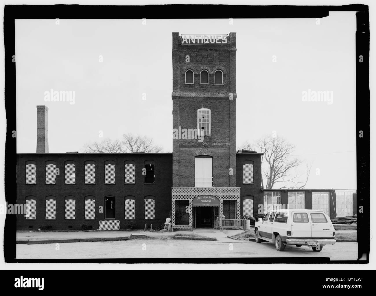 NORTH ERHÖHUNG DER WASSERTURM. Blaue Feder Cotton Mill, Route 20, Oxford, Calhoun County, AL Stockfotohttps://www.alamy.de/image-license-details/?v=1https://www.alamy.de/north-erhohung-der-wasserturm-blaue-feder-cotton-mill-route-20-oxford-calhoun-county-al-image248318305.html
RMTBYTEW–NORTH ERHÖHUNG DER WASSERTURM. Blaue Feder Cotton Mill, Route 20, Oxford, Calhoun County, AL
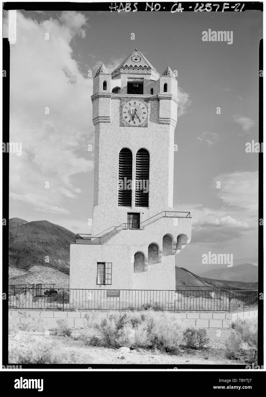 Norden ELEVATION, näher Death Valley Ranch, Chimes Tower, Death Valley Junction, Inyo County, CA Stockfotohttps://www.alamy.de/image-license-details/?v=1https://www.alamy.de/norden-elevation-naher-death-valley-ranch-chimes-tower-death-valley-junction-inyo-county-ca-image248318399.html
RMTBYTJ7–Norden ELEVATION, näher Death Valley Ranch, Chimes Tower, Death Valley Junction, Inyo County, CA
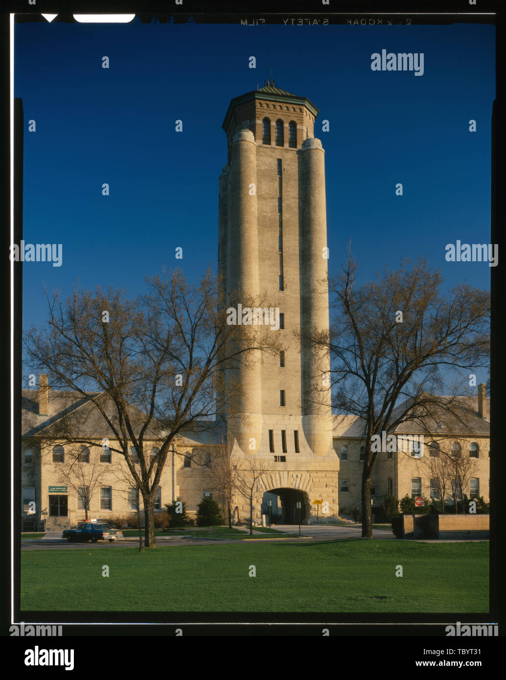 Nord HÖHE Fort Sheridan, Wasserturm, Leonard Wood Avenue, Lake Forest, Lake County, IL Stockfotohttps://www.alamy.de/image-license-details/?v=1https://www.alamy.de/nord-hohe-fort-sheridan-wasserturm-leonard-wood-avenue-lake-forest-lake-county-il-image248317973.html
RMTBYT31–Nord HÖHE Fort Sheridan, Wasserturm, Leonard Wood Avenue, Lake Forest, Lake County, IL
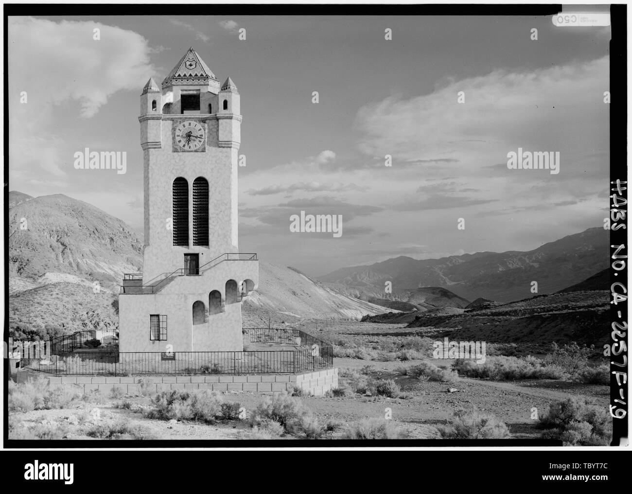 Nord HÖHE UND BLICK AUF DEN TAL der Death Valley Ranch, Chimes Tower, Death Valley Junction, Inyo County, CA Stockfotohttps://www.alamy.de/image-license-details/?v=1https://www.alamy.de/nord-hohe-und-blick-auf-den-tal-der-death-valley-ranch-chimes-tower-death-valley-junction-inyo-county-ca-image248318096.html
RMTBYT7C–Nord HÖHE UND BLICK AUF DEN TAL der Death Valley Ranch, Chimes Tower, Death Valley Junction, Inyo County, CA
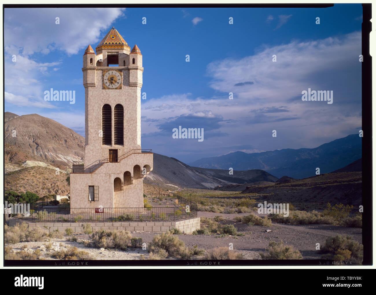 Norden Elevation und Aussicht Tal Death Valley Ranch, Chimes Tower, Death Valley Junction, Inyo County, CA Stockfotohttps://www.alamy.de/image-license-details/?v=1https://www.alamy.de/norden-elevation-und-aussicht-tal-death-valley-ranch-chimes-tower-death-valley-junction-inyo-county-ca-image248320483.html
RMTBYY8K–Norden Elevation und Aussicht Tal Death Valley Ranch, Chimes Tower, Death Valley Junction, Inyo County, CA
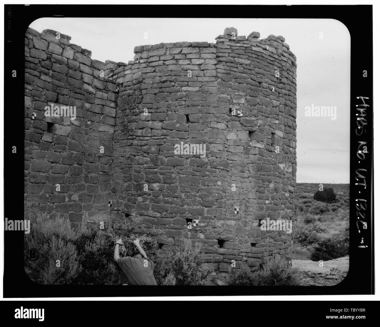 Norden Elevation, Hovenweep Castle Square Tower Group, Hovenweep Schloss, in der Nähe der park Hauptquartier, Aneth, San Juan County, UT Stockfotohttps://www.alamy.de/image-license-details/?v=1https://www.alamy.de/norden-elevation-hovenweep-castle-square-tower-group-hovenweep-schloss-in-der-nahe-der-park-hauptquartier-aneth-san-juan-county-ut-image248320571.html
RMTBYYBR–Norden Elevation, Hovenweep Castle Square Tower Group, Hovenweep Schloss, in der Nähe der park Hauptquartier, Aneth, San Juan County, UT
 Perspektivische Ansicht von der Nordseite Fort Point, Aussichtsturm, 25 Wentworth Road, New Castle, Rockingham County, NH Stockfotohttps://www.alamy.de/image-license-details/?v=1https://www.alamy.de/perspektivische-ansicht-von-der-nordseite-fort-point-aussichtsturm-25-wentworth-road-new-castle-rockingham-county-nh-image249413275.html
RMTDNN4Y–Perspektivische Ansicht von der Nordseite Fort Point, Aussichtsturm, 25 Wentworth Road, New Castle, Rockingham County, NH
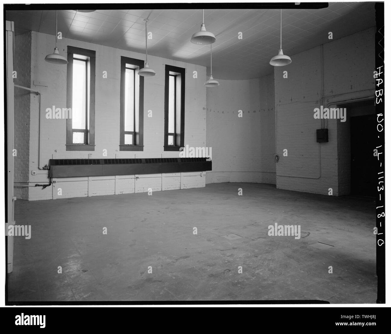 Zweite Etage, Norden und Westen Mauern - Fort Sheridan, Wasserturm, Leonard Wood Avenue, Lake Forest, Lake County, IL Stockfotohttps://www.alamy.de/image-license-details/?v=1https://www.alamy.de/zweite-etage-norden-und-westen-mauern-fort-sheridan-wasserturm-leonard-wood-avenue-lake-forest-lake-county-il-image256699090.html
RMTWHJ8J–Zweite Etage, Norden und Westen Mauern - Fort Sheridan, Wasserturm, Leonard Wood Avenue, Lake Forest, Lake County, IL
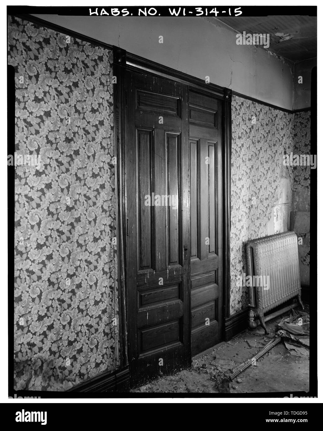 Nordwand von typischen 3RD FLOOR Zimmer - Massachusetts Block, 1525 Turm Avenue, Superior, Douglas County, WI; Corona, Julie, Sender Stockfotohttps://www.alamy.de/image-license-details/?v=1https://www.alamy.de/nordwand-von-typischen-3rd-floor-zimmer-massachusetts-block-1525-turm-avenue-superior-douglas-county-wi-corona-julie-sender-image249297361.html
RMTDGD95–Nordwand von typischen 3RD FLOOR Zimmer - Massachusetts Block, 1525 Turm Avenue, Superior, Douglas County, WI; Corona, Julie, Sender
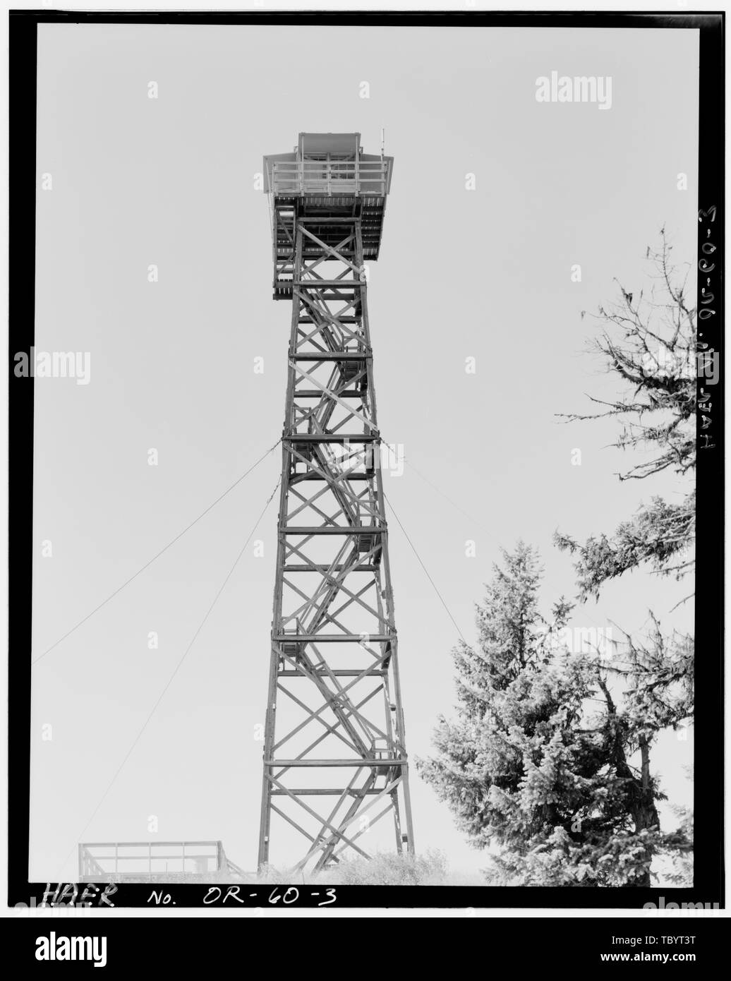 Norden ELEVATION. Hut Point Fire Lookout Tower, Forest Service Road 4340, 24 Meilen von Imnaha, Imnaha, Wallowa County, ODER Stockfotohttps://www.alamy.de/image-license-details/?v=1https://www.alamy.de/norden-elevation-hut-point-fire-lookout-tower-forest-service-road-4340-24-meilen-von-imnaha-imnaha-wallowa-county-oder-image248317996.html
RMTBYT3T–Norden ELEVATION. Hut Point Fire Lookout Tower, Forest Service Road 4340, 24 Meilen von Imnaha, Imnaha, Wallowa County, ODER
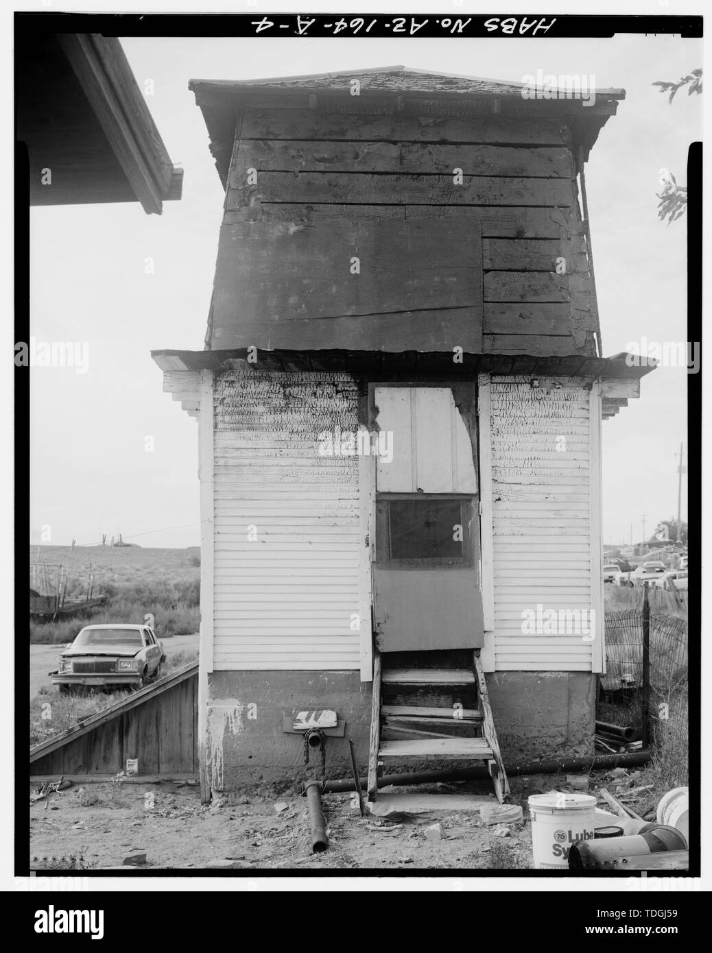 Nordseite, Anzeigen Eintrag Erdgeschoss Lagerraum. - Armijo Haus, Wasserturm, 301 Montano Street, Holbrook, Navajo County, AZ Stockfotohttps://www.alamy.de/image-license-details/?v=1https://www.alamy.de/nordseite-anzeigen-eintrag-erdgeschoss-lagerraum-armijo-haus-wasserturm-301-montano-street-holbrook-navajo-county-az-image249301173.html
RMTDGJ59–Nordseite, Anzeigen Eintrag Erdgeschoss Lagerraum. - Armijo Haus, Wasserturm, 301 Montano Street, Holbrook, Navajo County, AZ
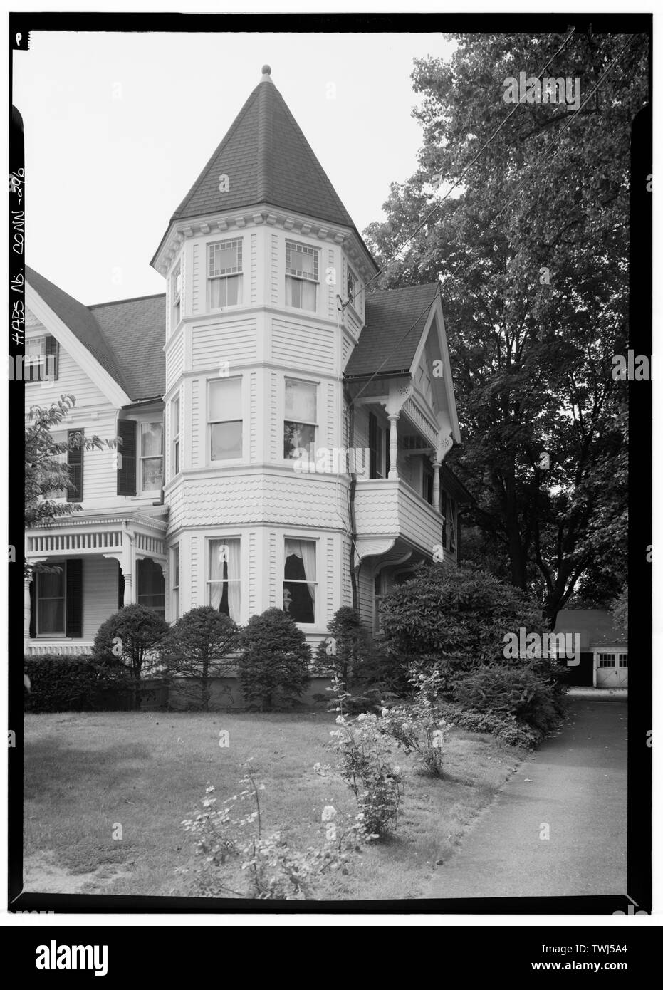 September 1966 DETAIL ECKTURM UND NORD (SEITE) Höhenlage - Simon C. Sherwood House, 67 Westway Straße, Southport, Fairfield County, CT Stockfotohttps://www.alamy.de/image-license-details/?v=1https://www.alamy.de/september-1966-detail-eckturm-und-nord-seite-hohenlage-simon-c-sherwood-house-67-westway-strasse-southport-fairfield-county-ct-image256710892.html
RMTWJ5A4–September 1966 DETAIL ECKTURM UND NORD (SEITE) Höhenlage - Simon C. Sherwood House, 67 Westway Straße, Southport, Fairfield County, CT
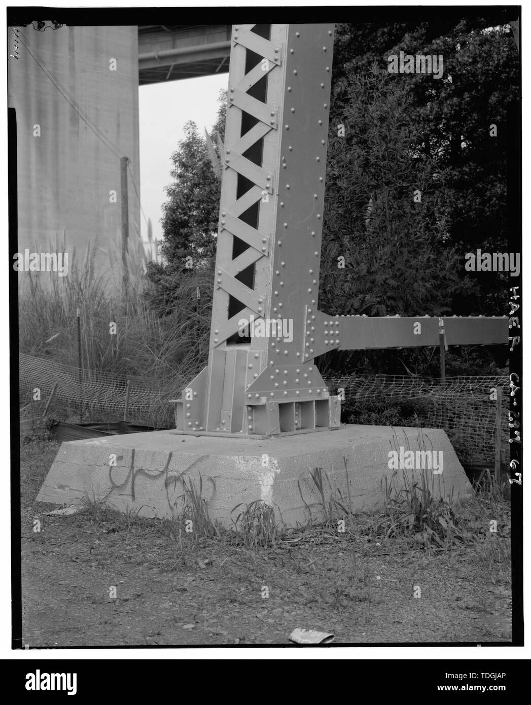 Nord-west Bein der Turm 7 des ursprünglichen Crockett Ansatz. - Carquinez Bridge, Spanning Carquinez Straße an der Interstate 80, Vallejo, Solano County, CA Stockfotohttps://www.alamy.de/image-license-details/?v=1https://www.alamy.de/nord-west-bein-der-turm-7-des-ursprunglichen-crockett-ansatz-carquinez-bridge-spanning-carquinez-strasse-an-der-interstate-80-vallejo-solano-county-ca-image249301326.html
RMTDGJAP–Nord-west Bein der Turm 7 des ursprünglichen Crockett Ansatz. - Carquinez Bridge, Spanning Carquinez Straße an der Interstate 80, Vallejo, Solano County, CA
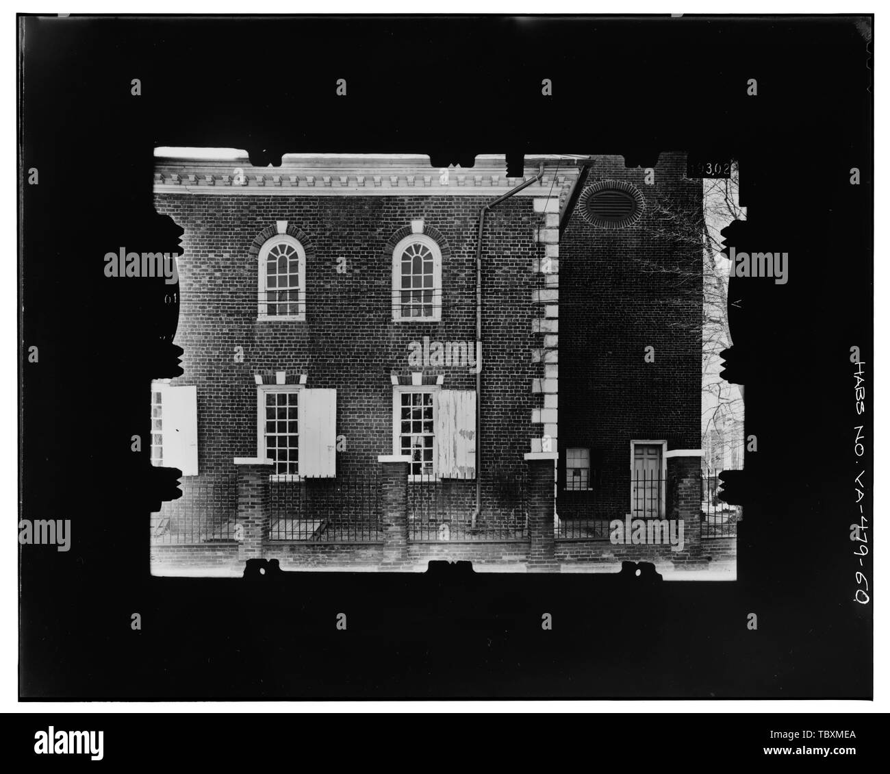 Norden ELEVATION, WEST END, EINSCHLIESSLICH BASE VON TURM Kopie Foto von photogrammetrischen Platte LCHABSGS 05U 195917 L. Christ Church (Bischöfliche), Columbus und Cameron Straßen, Alexandria, unabhängige Stadt, VA Wren, James Carlyle, John Stockfotohttps://www.alamy.de/image-license-details/?v=1https://www.alamy.de/norden-elevation-west-end-einschliesslich-base-von-turm-kopie-foto-von-photogrammetrischen-platte-lchabsgs-05u-195917-l-christ-church-bischofliche-columbus-und-cameron-strassen-alexandria-unabhangige-stadt-va-wren-james-carlyle-john-image248293202.html
RMTBXMEA–Norden ELEVATION, WEST END, EINSCHLIESSLICH BASE VON TURM Kopie Foto von photogrammetrischen Platte LCHABSGS 05U 195917 L. Christ Church (Bischöfliche), Columbus und Cameron Straßen, Alexandria, unabhängige Stadt, VA Wren, James Carlyle, John
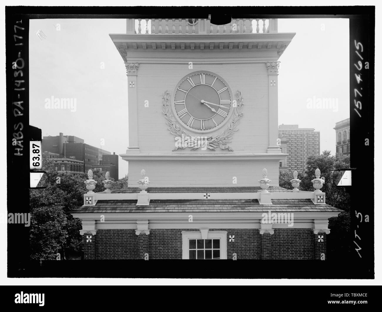 Norden ELEVATION, Turm, dritte Stufe. Glasplatte stereopair Anzahl PA 1430139 LCHABSGS 05 NT 5 157.4615. Links (gedruckte) Independence Hall Complex, Independence Hall, 500 Chestnut Street, Philadelphia, Philadelphia County, PA Stockfotohttps://www.alamy.de/image-license-details/?v=1https://www.alamy.de/norden-elevation-turm-dritte-stufe-glasplatte-stereopair-anzahl-pa-1430139-lchabsgs-05-nt-5-1574615-links-gedruckte-independence-hall-complex-independence-hall-500-chestnut-street-philadelphia-philadelphia-county-pa-image248293150.html
RMTBXMCE–Norden ELEVATION, Turm, dritte Stufe. Glasplatte stereopair Anzahl PA 1430139 LCHABSGS 05 NT 5 157.4615. Links (gedruckte) Independence Hall Complex, Independence Hall, 500 Chestnut Street, Philadelphia, Philadelphia County, PA
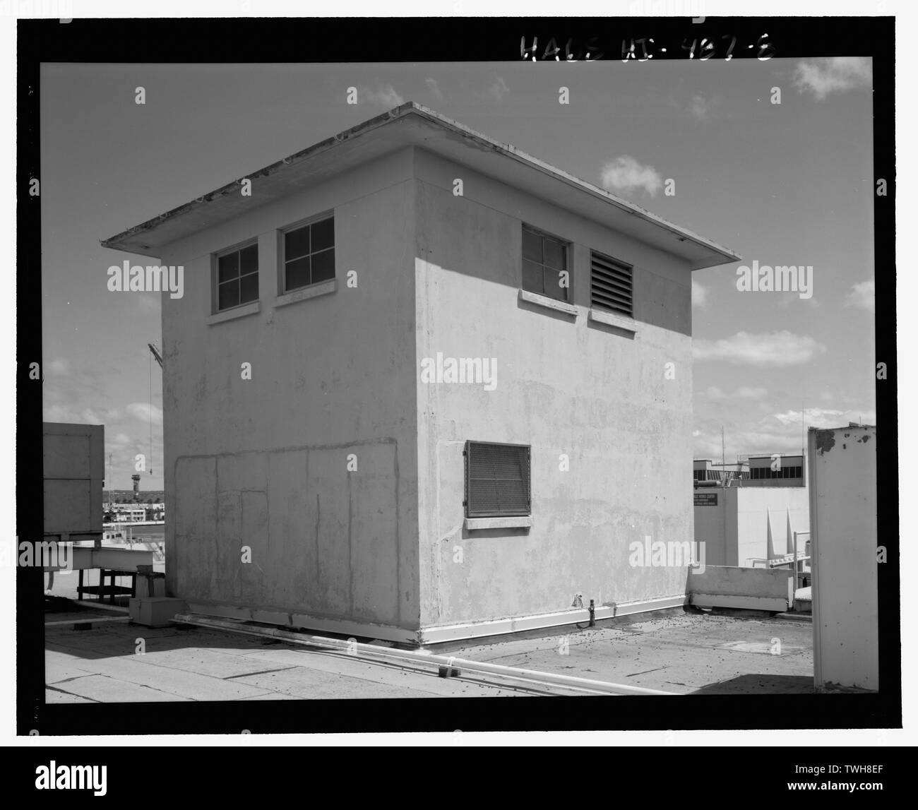 Roof Top Aufzug Turm am östlichen Ende der Nordseite - US Naval Base, Pearl Harbor, allgemeine Storehouse, Kreuzung von Avenue D und Seventh Street, Pearl City, Honolulu County, HI Stockfotohttps://www.alamy.de/image-license-details/?v=1https://www.alamy.de/roof-top-aufzug-turm-am-ostlichen-ende-der-nordseite-us-naval-base-pearl-harbor-allgemeine-storehouse-kreuzung-von-avenue-d-und-seventh-street-pearl-city-honolulu-county-hi-image256691415.html
RMTWH8EF–Roof Top Aufzug Turm am östlichen Ende der Nordseite - US Naval Base, Pearl Harbor, allgemeine Storehouse, Kreuzung von Avenue D und Seventh Street, Pearl City, Honolulu County, HI
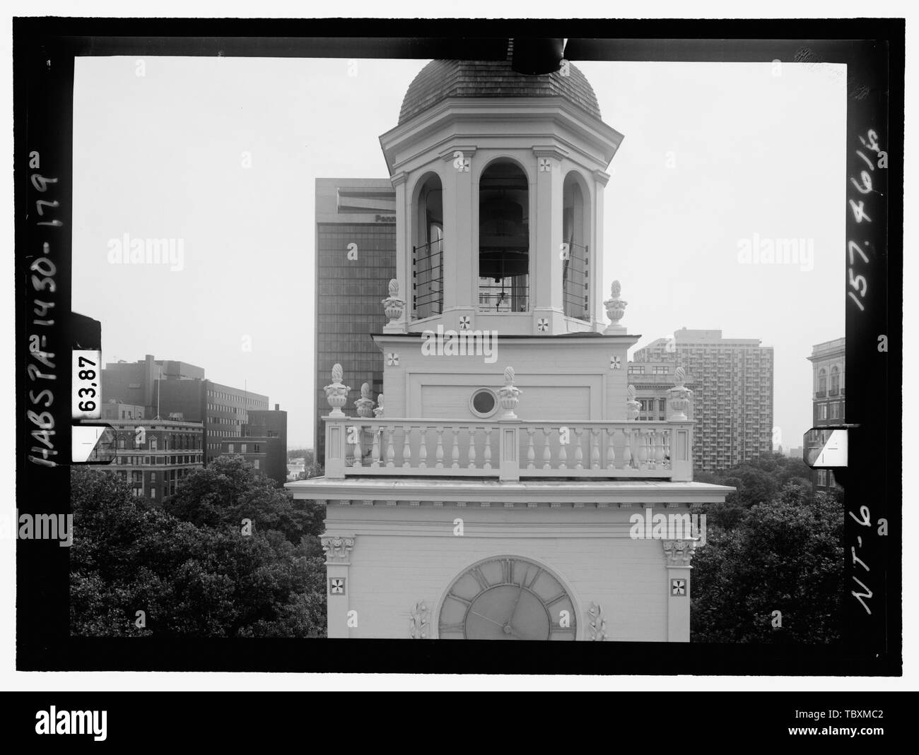 Norden ELEVATION, Turm, VIERTE STUFE. Glasplatte stereopair Anzahl PA 1430139 LCHABSGS 05 NT 6 157.4616. Links (gedruckte) Independence Hall Complex, Independence Hall, 500 Chestnut Street, Philadelphia, Philadelphia County, PA Stockfotohttps://www.alamy.de/image-license-details/?v=1https://www.alamy.de/norden-elevation-turm-vierte-stufe-glasplatte-stereopair-anzahl-pa-1430139-lchabsgs-05-nt-6-1574616-links-gedruckte-independence-hall-complex-independence-hall-500-chestnut-street-philadelphia-philadelphia-county-pa-image248293138.html
RMTBXMC2–Norden ELEVATION, Turm, VIERTE STUFE. Glasplatte stereopair Anzahl PA 1430139 LCHABSGS 05 NT 6 157.4616. Links (gedruckte) Independence Hall Complex, Independence Hall, 500 Chestnut Street, Philadelphia, Philadelphia County, PA
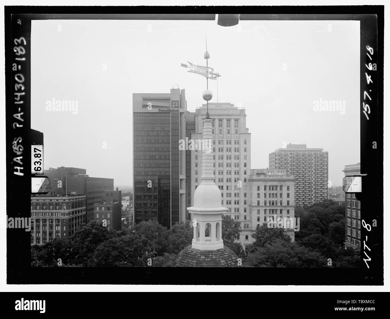 Norden ELEVATION, Tower, der sechsten Etappe. Glasplatte stereopair Anzahl PA 1430139 LCHABSGS 05 NT 8 157.4618. Links (gedruckte) Independence Hall Complex, Independence Hall, 500 Chestnut Street, Philadelphia, Philadelphia County, PA Stockfotohttps://www.alamy.de/image-license-details/?v=1https://www.alamy.de/norden-elevation-tower-der-sechsten-etappe-glasplatte-stereopair-anzahl-pa-1430139-lchabsgs-05-nt-8-1574618-links-gedruckte-independence-hall-complex-independence-hall-500-chestnut-street-philadelphia-philadelphia-county-pa-image248293148.html
RMTBXMCC–Norden ELEVATION, Tower, der sechsten Etappe. Glasplatte stereopair Anzahl PA 1430139 LCHABSGS 05 NT 8 157.4618. Links (gedruckte) Independence Hall Complex, Independence Hall, 500 Chestnut Street, Philadelphia, Philadelphia County, PA
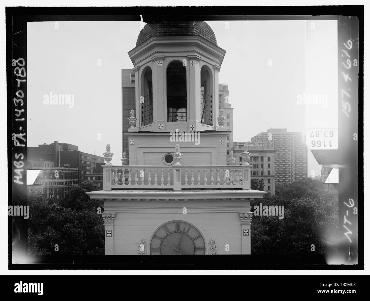 Norden ELEVATION, Turm, VIERTE STUFE. Glasplatte stereopair Anzahl PA 1430139 LCHABSGS 05 NT 6 157.4616. Rechts (nicht gedruckt) Independence Hall Complex, Independence Hall, 500 Chestnut Street, Philadelphia, Philadelphia County, PA Stockfotohttps://www.alamy.de/image-license-details/?v=1https://www.alamy.de/norden-elevation-turm-vierte-stufe-glasplatte-stereopair-anzahl-pa-1430139-lchabsgs-05-nt-6-1574616-rechts-nicht-gedruckt-independence-hall-complex-independence-hall-500-chestnut-street-philadelphia-philadelphia-county-pa-image248293139.html
RMTBXMC3–Norden ELEVATION, Turm, VIERTE STUFE. Glasplatte stereopair Anzahl PA 1430139 LCHABSGS 05 NT 6 157.4616. Rechts (nicht gedruckt) Independence Hall Complex, Independence Hall, 500 Chestnut Street, Philadelphia, Philadelphia County, PA
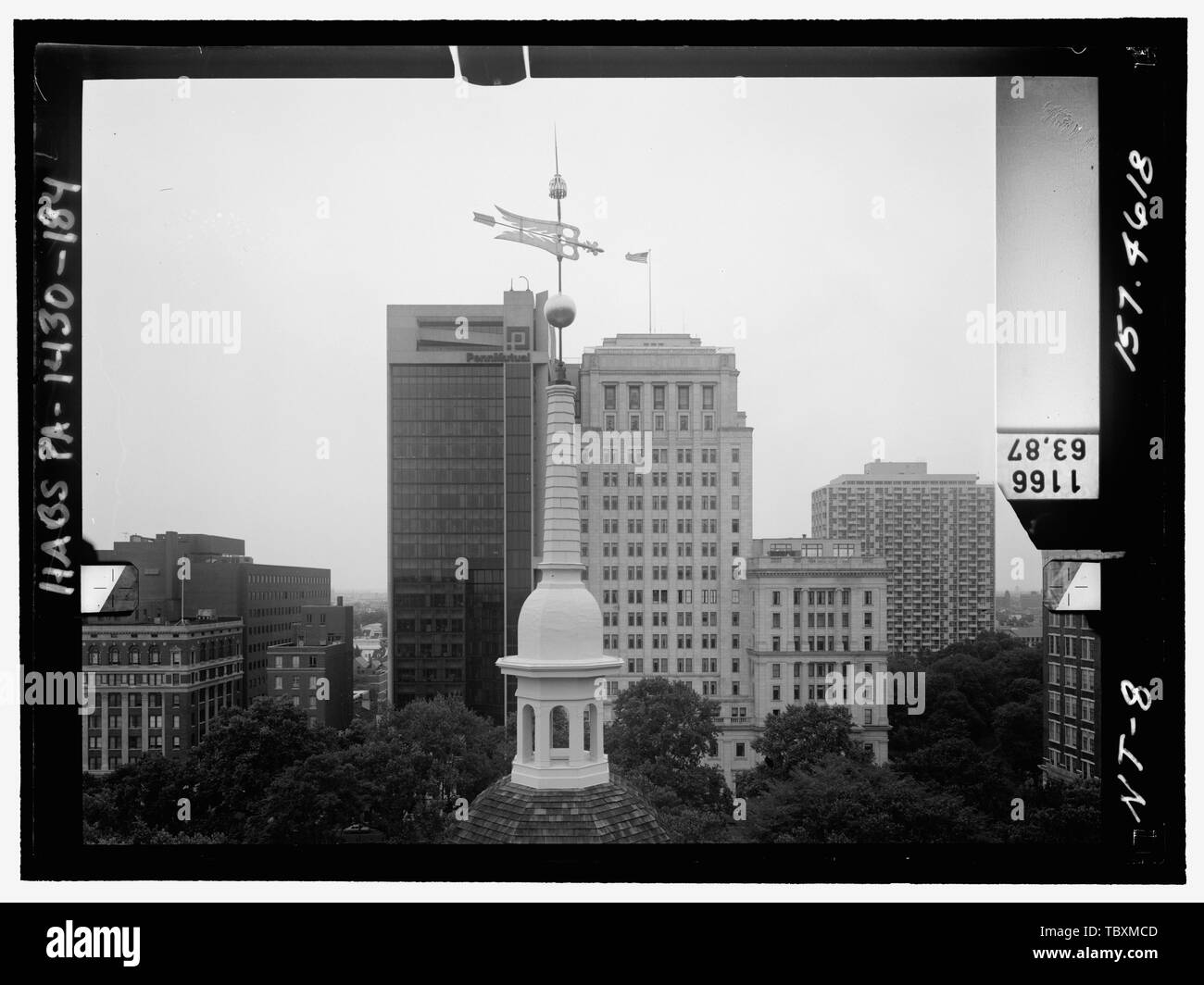 Norden ELEVATION, Tower, der sechsten Etappe. Glasplatte stereopair Anzahl PA 1430139 LCHABSGS 05 NT 8 157.4618. Rechts (nicht gedruckt) Independence Hall Complex, Independence Hall, 500 Chestnut Street, Philadelphia, Philadelphia County, PA Stockfotohttps://www.alamy.de/image-license-details/?v=1https://www.alamy.de/norden-elevation-tower-der-sechsten-etappe-glasplatte-stereopair-anzahl-pa-1430139-lchabsgs-05-nt-8-1574618-rechts-nicht-gedruckt-independence-hall-complex-independence-hall-500-chestnut-street-philadelphia-philadelphia-county-pa-image248293149.html
RMTBXMCD–Norden ELEVATION, Tower, der sechsten Etappe. Glasplatte stereopair Anzahl PA 1430139 LCHABSGS 05 NT 8 157.4618. Rechts (nicht gedruckt) Independence Hall Complex, Independence Hall, 500 Chestnut Street, Philadelphia, Philadelphia County, PA
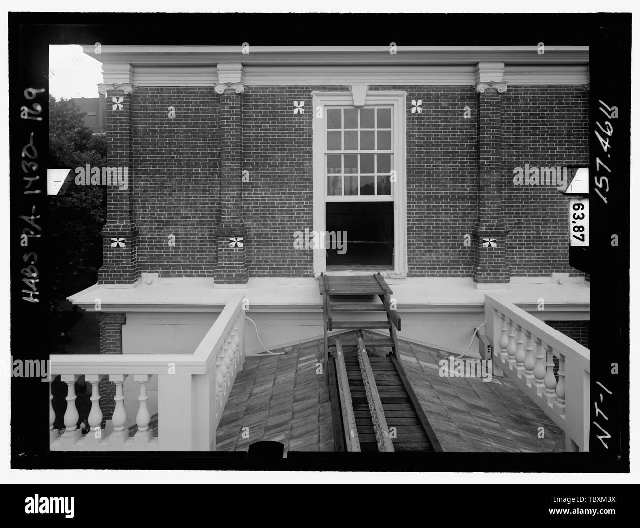 Norden ELEVATION, Turm, ERSTE STUFE, Links. Glasplatte stereopair Anzahl PA 1430139 LCHABSGS 05 NT 1 157.4611. Links (gedruckte) Independence Hall Complex, Independence Hall, 500 Chestnut Street, Philadelphia, Philadelphia County, PA Stockfotohttps://www.alamy.de/image-license-details/?v=1https://www.alamy.de/norden-elevation-turm-erste-stufe-links-glasplatte-stereopair-anzahl-pa-1430139-lchabsgs-05-nt-1-1574611-links-gedruckte-independence-hall-complex-independence-hall-500-chestnut-street-philadelphia-philadelphia-county-pa-image248293134.html
RMTBXMBX–Norden ELEVATION, Turm, ERSTE STUFE, Links. Glasplatte stereopair Anzahl PA 1430139 LCHABSGS 05 NT 1 157.4611. Links (gedruckte) Independence Hall Complex, Independence Hall, 500 Chestnut Street, Philadelphia, Philadelphia County, PA
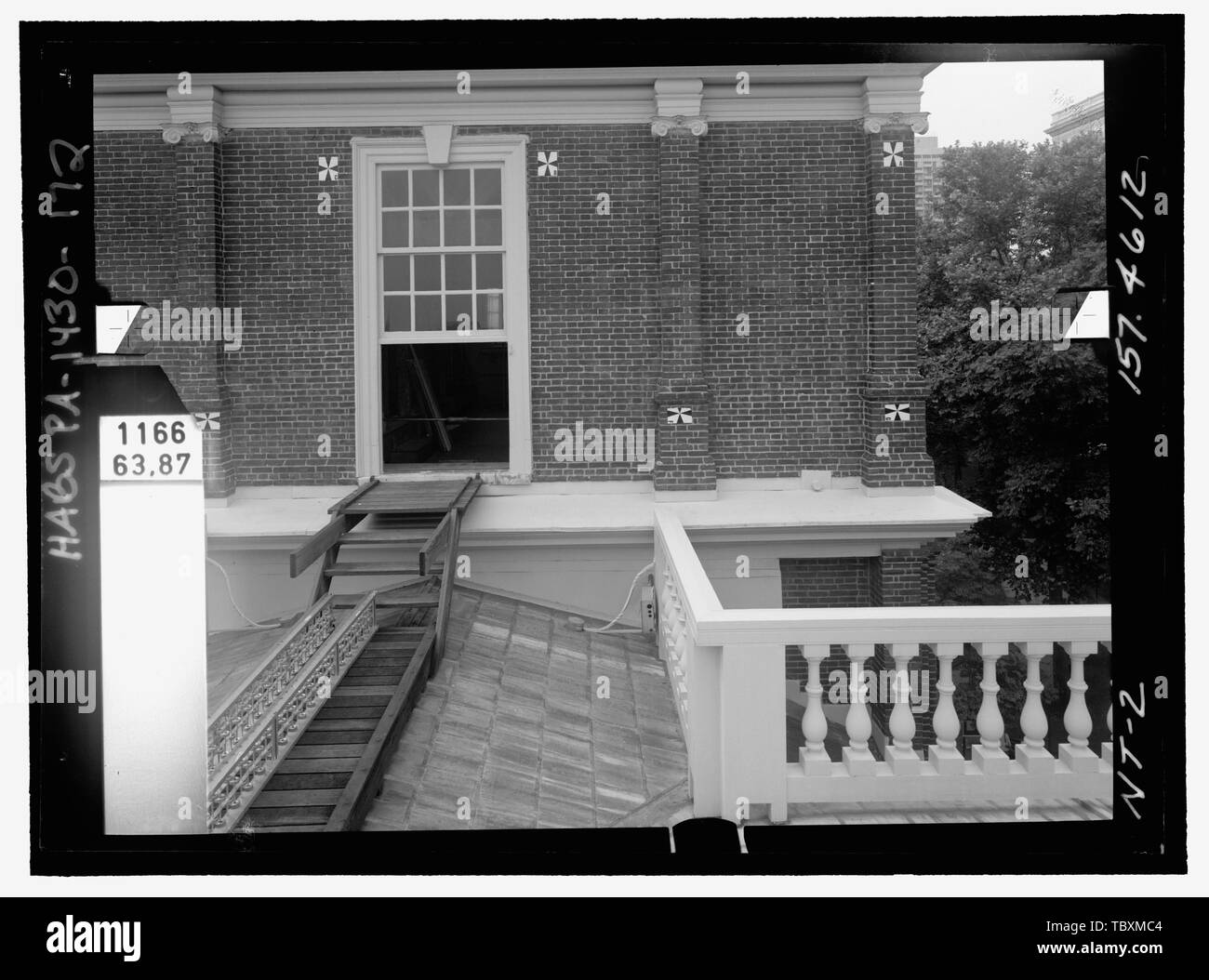
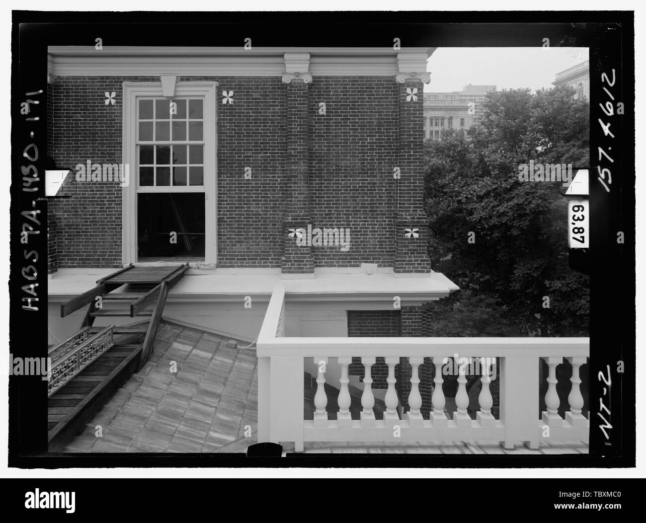 Norden ELEVATION, Turm, ERSTE STUFE, rechts. Glasplatte stereopair Anzahl PA 1430139 LCHABSGS 05 NT2 157.4612. Links (gedruckte) Independence Hall Complex, Independence Hall, 500 Chestnut Street, Philadelphia, Philadelphia County, PA Stockfotohttps://www.alamy.de/image-license-details/?v=1https://www.alamy.de/norden-elevation-turm-erste-stufe-rechts-glasplatte-stereopair-anzahl-pa-1430139-lchabsgs-05-nt2-1574612-links-gedruckte-independence-hall-complex-independence-hall-500-chestnut-street-philadelphia-philadelphia-county-pa-image248293136.html
RMTBXMC0–Norden ELEVATION, Turm, ERSTE STUFE, rechts. Glasplatte stereopair Anzahl PA 1430139 LCHABSGS 05 NT2 157.4612. Links (gedruckte) Independence Hall Complex, Independence Hall, 500 Chestnut Street, Philadelphia, Philadelphia County, PA
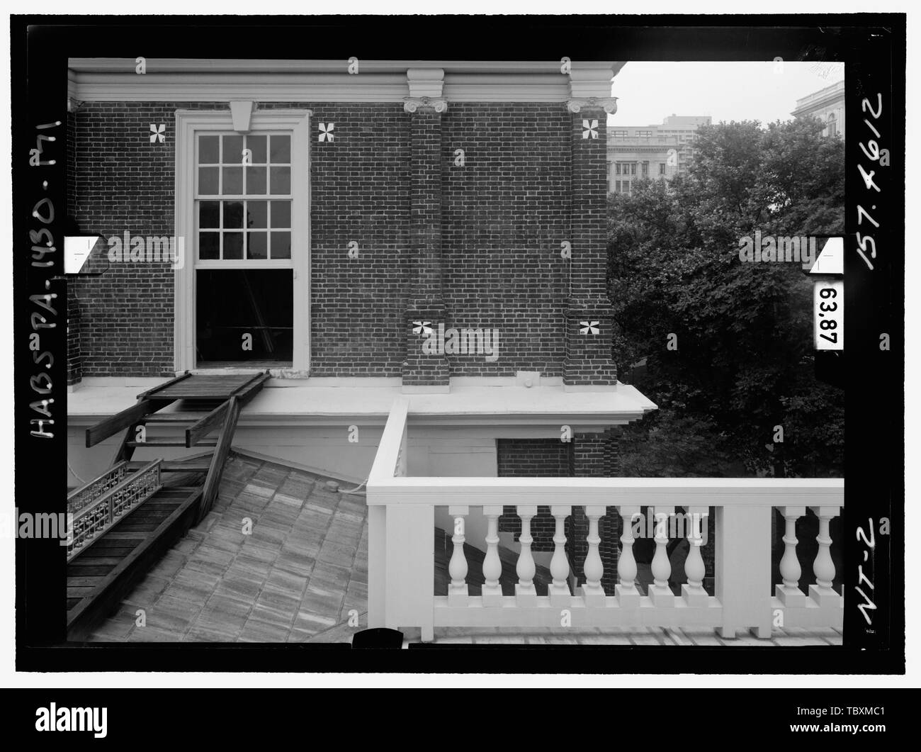
 Norden ELEVATION, Turm, ZWEITE STUFE, Links. Glasplatte stereopair Anzahl PA 1430139 LCHABSGS 05 NT3 157.4613. Links (gedruckte) Independence Hall Complex, Independence Hall, 500 Chestnut Street, Philadelphia, Philadelphia County, PA Stockfotohttps://www.alamy.de/image-license-details/?v=1https://www.alamy.de/norden-elevation-turm-zweite-stufe-links-glasplatte-stereopair-anzahl-pa-1430139-lchabsgs-05-nt3-1574613-links-gedruckte-independence-hall-complex-independence-hall-500-chestnut-street-philadelphia-philadelphia-county-pa-image248293140.html
RMTBXMC4–Norden ELEVATION, Turm, ZWEITE STUFE, Links. Glasplatte stereopair Anzahl PA 1430139 LCHABSGS 05 NT3 157.4613. Links (gedruckte) Independence Hall Complex, Independence Hall, 500 Chestnut Street, Philadelphia, Philadelphia County, PA
 Norden ELEVATION, Turm, ERSTE STUFE, rechts. Glasplatte stereopair Anzahl PA 1430139 LCHABSGS 05 NT2 157.4612. Rechts (nicht gedruckt) Independence Hall Complex, Independence Hall, 500 Chestnut Street, Philadelphia, Philadelphia County, PA Stockfotohttps://www.alamy.de/image-license-details/?v=1https://www.alamy.de/norden-elevation-turm-erste-stufe-rechts-glasplatte-stereopair-anzahl-pa-1430139-lchabsgs-05-nt2-1574612-rechts-nicht-gedruckt-independence-hall-complex-independence-hall-500-chestnut-street-philadelphia-philadelphia-county-pa-image248293137.html
RMTBXMC1–Norden ELEVATION, Turm, ERSTE STUFE, rechts. Glasplatte stereopair Anzahl PA 1430139 LCHABSGS 05 NT2 157.4612. Rechts (nicht gedruckt) Independence Hall Complex, Independence Hall, 500 Chestnut Street, Philadelphia, Philadelphia County, PA
 Norden ELEVATION, Turm, ZWEITE STUFE, rechts. Glasplatte stereopair Anzahl PA 1430139 LCHABSGS 05 NT 4 157.4614. Rechts (nicht gedruckt) Independence Hall Complex, Independence Hall, 500 Chestnut Street, Philadelphia, Philadelphia County, PA Stockfotohttps://www.alamy.de/image-license-details/?v=1https://www.alamy.de/norden-elevation-turm-zweite-stufe-rechts-glasplatte-stereopair-anzahl-pa-1430139-lchabsgs-05-nt-4-1574614-rechts-nicht-gedruckt-independence-hall-complex-independence-hall-500-chestnut-street-philadelphia-philadelphia-county-pa-image248293147.html
RMTBXMCB–Norden ELEVATION, Turm, ZWEITE STUFE, rechts. Glasplatte stereopair Anzahl PA 1430139 LCHABSGS 05 NT 4 157.4614. Rechts (nicht gedruckt) Independence Hall Complex, Independence Hall, 500 Chestnut Street, Philadelphia, Philadelphia County, PA
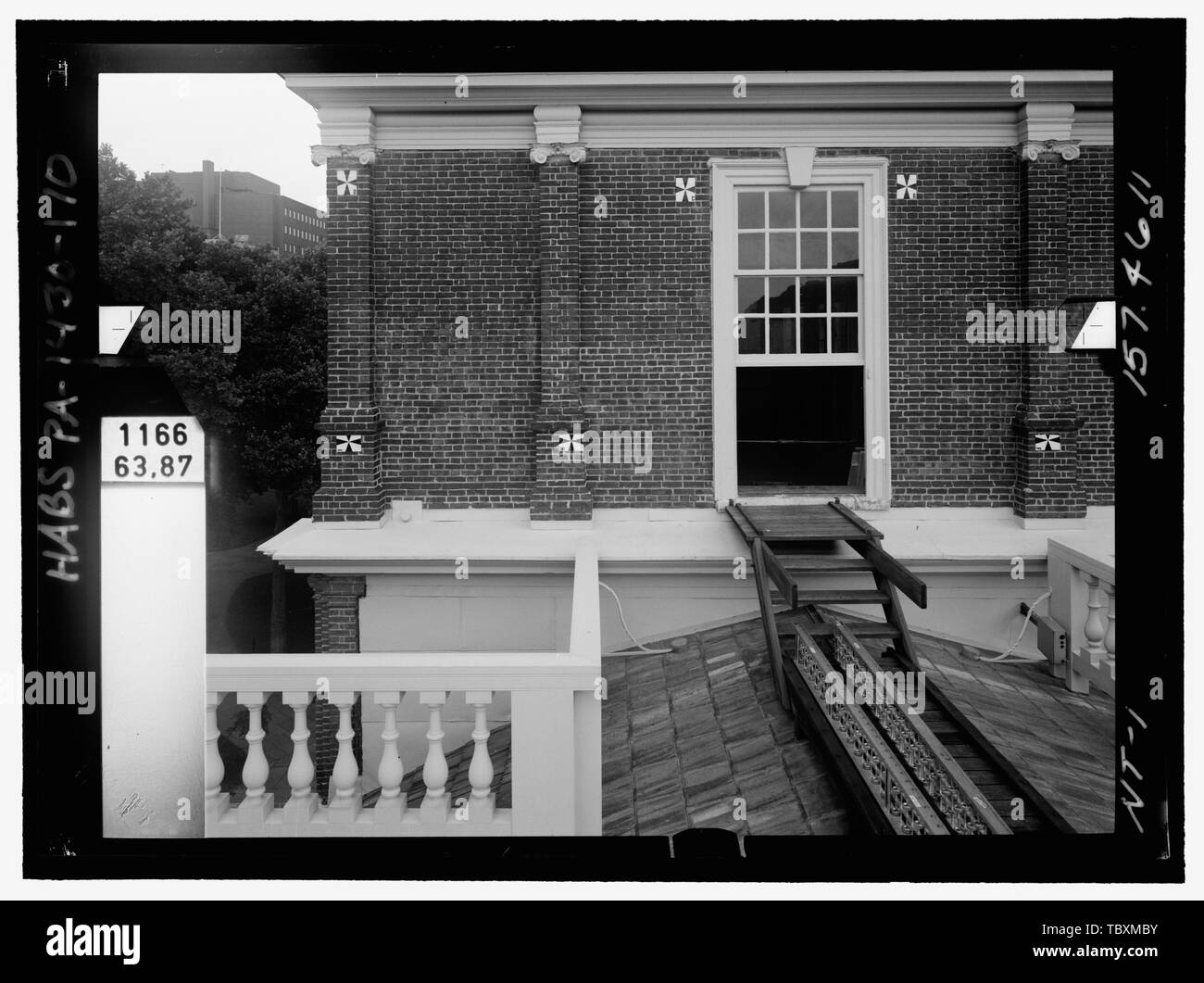 Norden ELEVATION, Turm, ERSTE STUFE, Links. Glasplatte stereopair Anzahl PA 1430139 LCHABSGS 05 NT 1 157.4611. Rechts (nicht gedruckt) Independence Hall Complex, Independence Hall, 500 Chestnut Street, Philadelphia, Philadelphia County, PA Stockfotohttps://www.alamy.de/image-license-details/?v=1https://www.alamy.de/norden-elevation-turm-erste-stufe-links-glasplatte-stereopair-anzahl-pa-1430139-lchabsgs-05-nt-1-1574611-rechts-nicht-gedruckt-independence-hall-complex-independence-hall-500-chestnut-street-philadelphia-philadelphia-county-pa-image248293135.html
RMTBXMBY–Norden ELEVATION, Turm, ERSTE STUFE, Links. Glasplatte stereopair Anzahl PA 1430139 LCHABSGS 05 NT 1 157.4611. Rechts (nicht gedruckt) Independence Hall Complex, Independence Hall, 500 Chestnut Street, Philadelphia, Philadelphia County, PA
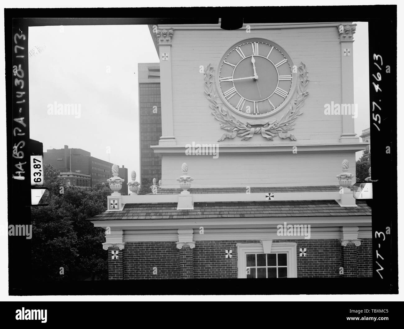 Norden ELEVATION, Turm, ZWEITE STUFE, Links. Glasplatte stereopair Anzahl PA 1430139 LCHABSGS 05 NT3 157.4613. Rechts (nicht gedruckt) Independence Hall Complex, Independence Hall, 500 Chestnut Street, Philadelphia, Philadelphia County, PA Stockfotohttps://www.alamy.de/image-license-details/?v=1https://www.alamy.de/norden-elevation-turm-zweite-stufe-links-glasplatte-stereopair-anzahl-pa-1430139-lchabsgs-05-nt3-1574613-rechts-nicht-gedruckt-independence-hall-complex-independence-hall-500-chestnut-street-philadelphia-philadelphia-county-pa-image248293141.html
RMTBXMC5–Norden ELEVATION, Turm, ZWEITE STUFE, Links. Glasplatte stereopair Anzahl PA 1430139 LCHABSGS 05 NT3 157.4613. Rechts (nicht gedruckt) Independence Hall Complex, Independence Hall, 500 Chestnut Street, Philadelphia, Philadelphia County, PA
 Perspektivische Ansicht Haupteingang,faand-231; Ade mit zweistöckigen quadratischen Turm, beachten Sie medizinische Kreuz aus Holz auf Turm, ursprünglich waren es vier. - Richmond Feldlazarett, 1330 Schneiden Boulevard, Richmond, Contra Costa County, CA Stockfotohttps://www.alamy.de/image-license-details/?v=1https://www.alamy.de/perspektivische-ansicht-haupteingangfaand-231-ade-mit-zweistockigen-quadratischen-turm-beachten-sie-medizinische-kreuz-aus-holz-auf-turm-ursprunglich-waren-es-vier-richmond-feldlazarett-1330-schneiden-boulevard-richmond-contra-costa-county-ca-image249401331.html
RMTDN5XB–Perspektivische Ansicht Haupteingang,faand-231; Ade mit zweistöckigen quadratischen Turm, beachten Sie medizinische Kreuz aus Holz auf Turm, ursprünglich waren es vier. - Richmond Feldlazarett, 1330 Schneiden Boulevard, Richmond, Contra Costa County, CA
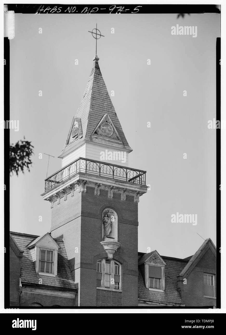 Blick auf den oberen Teil des zentralen Turm nach Norden - Ammendale normalen Institut, 6101 Ammendale Straße, Beltsville, Prince George's County, MD; christliche Brüder, Ammen, Daniel; McCusker; Klugh, T, Sender; Boucher, Jack E, Fotograf; Lavoie, Catherine C, Historiker Stockfotohttps://www.alamy.de/image-license-details/?v=1https://www.alamy.de/blick-auf-den-oberen-teil-des-zentralen-turm-nach-norden-ammendale-normalen-institut-6101-ammendale-strasse-beltsville-prince-georges-county-md-christliche-bruder-ammen-daniel-mccusker-klugh-t-sender-boucher-jack-e-fotograf-lavoie-catherine-c-historiker-image249392480.html
RMTDMPJ8–Blick auf den oberen Teil des zentralen Turm nach Norden - Ammendale normalen Institut, 6101 Ammendale Straße, Beltsville, Prince George's County, MD; christliche Brüder, Ammen, Daniel; McCusker; Klugh, T, Sender; Boucher, Jack E, Fotograf; Lavoie, Catherine C, Historiker
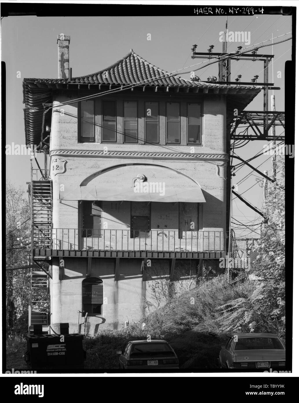 Nördlich der Erhöhung von Shell Verriegelung Turm, Struktur in die Steigung der Eisenbahn rightofway gebaut. New York, New Haven, Hartford Railroad, Shell Verriegelung Tower, New Haven Milepost 16, ca. 100 fühlen sich östlich von New Rochelle, New Rochelle, Westchester County, NY Stockfotohttps://www.alamy.de/image-license-details/?v=1https://www.alamy.de/nordlich-der-erhohung-von-shell-verriegelung-turm-struktur-in-die-steigung-der-eisenbahn-rightofway-gebaut-new-york-new-haven-hartford-railroad-shell-verriegelung-tower-new-haven-milepost-16-ca-100-fuhlen-sich-ostlich-von-new-rochelle-new-rochelle-westchester-county-ny-image248320511.html
RMTBYY9K–Nördlich der Erhöhung von Shell Verriegelung Turm, Struktur in die Steigung der Eisenbahn rightofway gebaut. New York, New Haven, Hartford Railroad, Shell Verriegelung Tower, New Haven Milepost 16, ca. 100 fühlen sich östlich von New Rochelle, New Rochelle, Westchester County, NY
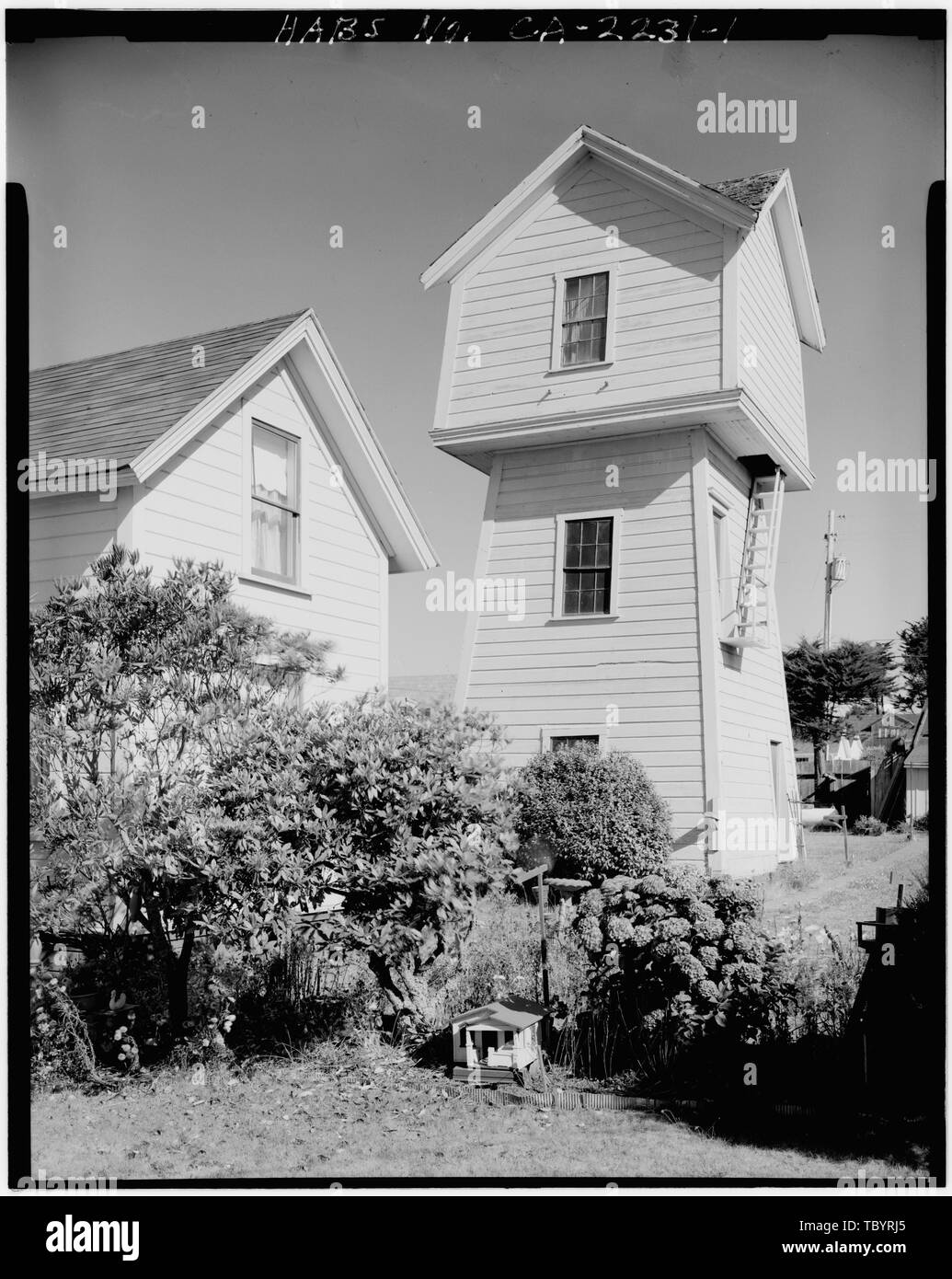 Im Norden und Westen seiten Fraga Haus, Wasserturm, 45040 Calpella Straße, Mendocino, Mendocino County, CA Stockfotohttps://www.alamy.de/image-license-details/?v=1https://www.alamy.de/im-norden-und-westen-seiten-fraga-haus-wasserturm-45040-calpella-strasse-mendocino-mendocino-county-ca-image248317613.html
RMTBYRJ5–Im Norden und Westen seiten Fraga Haus, Wasserturm, 45040 Calpella Straße, Mendocino, Mendocino County, CA
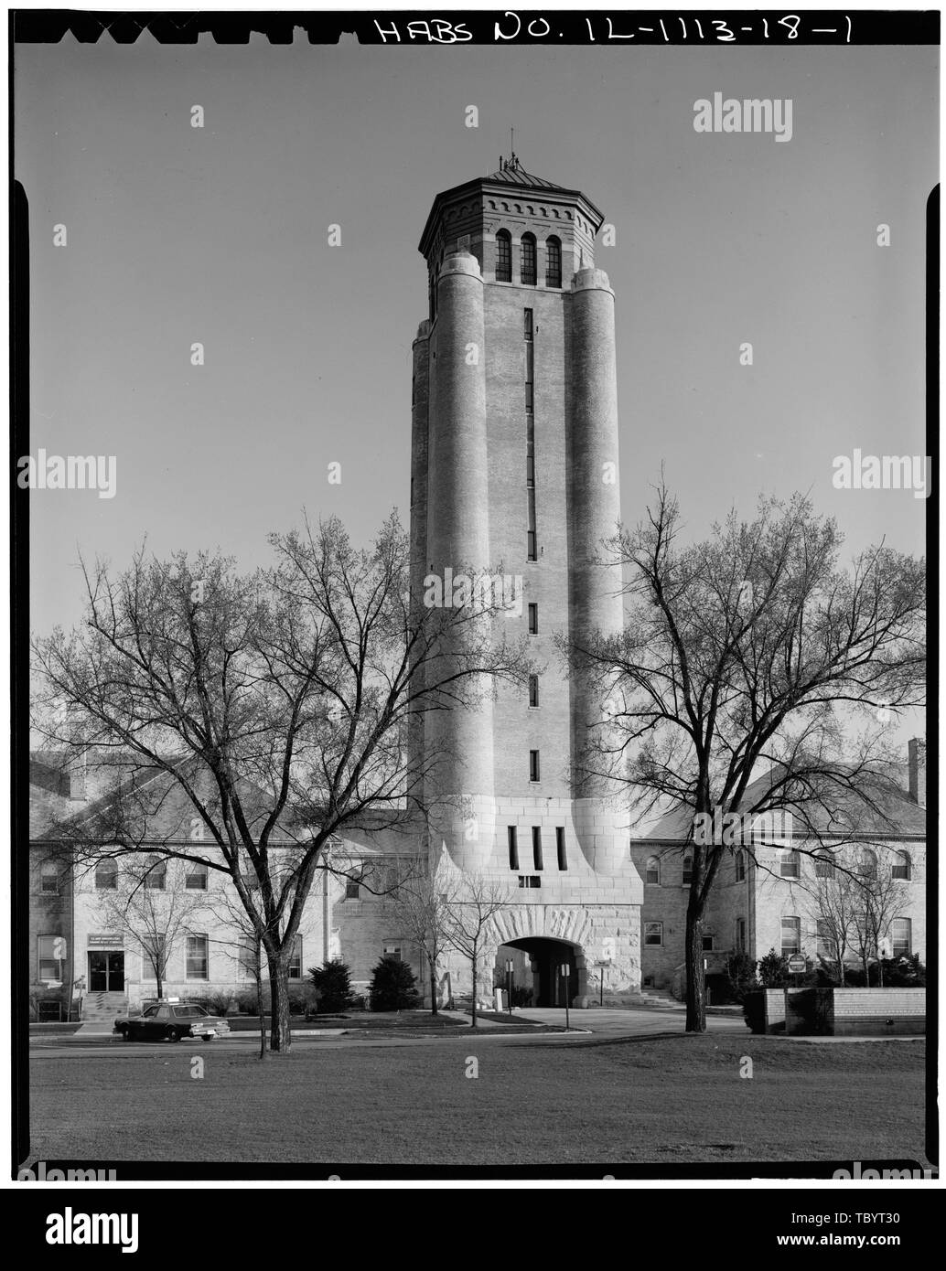 Nord HÖHE Fort Sheridan, Wasserturm, Leonard Wood Avenue, Lake Forest, Lake County, IL Stockfotohttps://www.alamy.de/image-license-details/?v=1https://www.alamy.de/nord-hohe-fort-sheridan-wasserturm-leonard-wood-avenue-lake-forest-lake-county-il-image248317972.html
RMTBYT30–Nord HÖHE Fort Sheridan, Wasserturm, Leonard Wood Avenue, Lake Forest, Lake County, IL
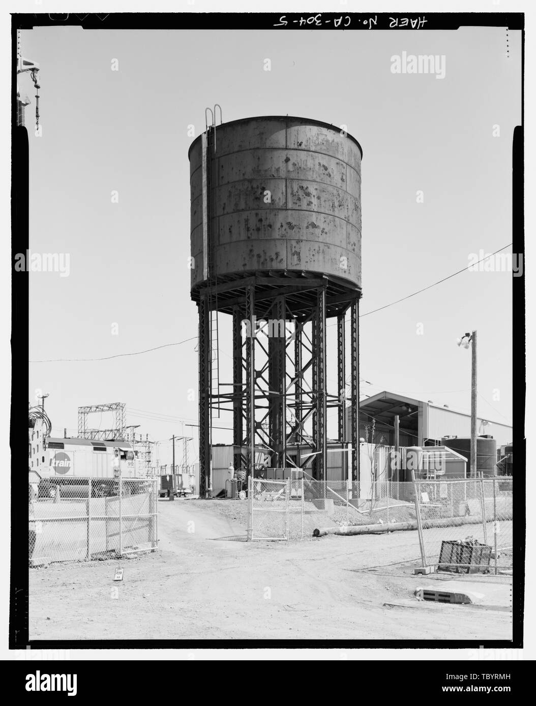 Nord- und Westseite, auf der Suche nach Südost. Southern Pacific Depot, Wasserturm, 65 Cahill Street, San Jose, Santa Clara County, CA Stockfotohttps://www.alamy.de/image-license-details/?v=1https://www.alamy.de/nord-und-westseite-auf-der-suche-nach-sudost-southern-pacific-depot-wasserturm-65-cahill-street-san-jose-santa-clara-county-ca-image248317681.html
RMTBYRMH–Nord- und Westseite, auf der Suche nach Südost. Southern Pacific Depot, Wasserturm, 65 Cahill Street, San Jose, Santa Clara County, CA
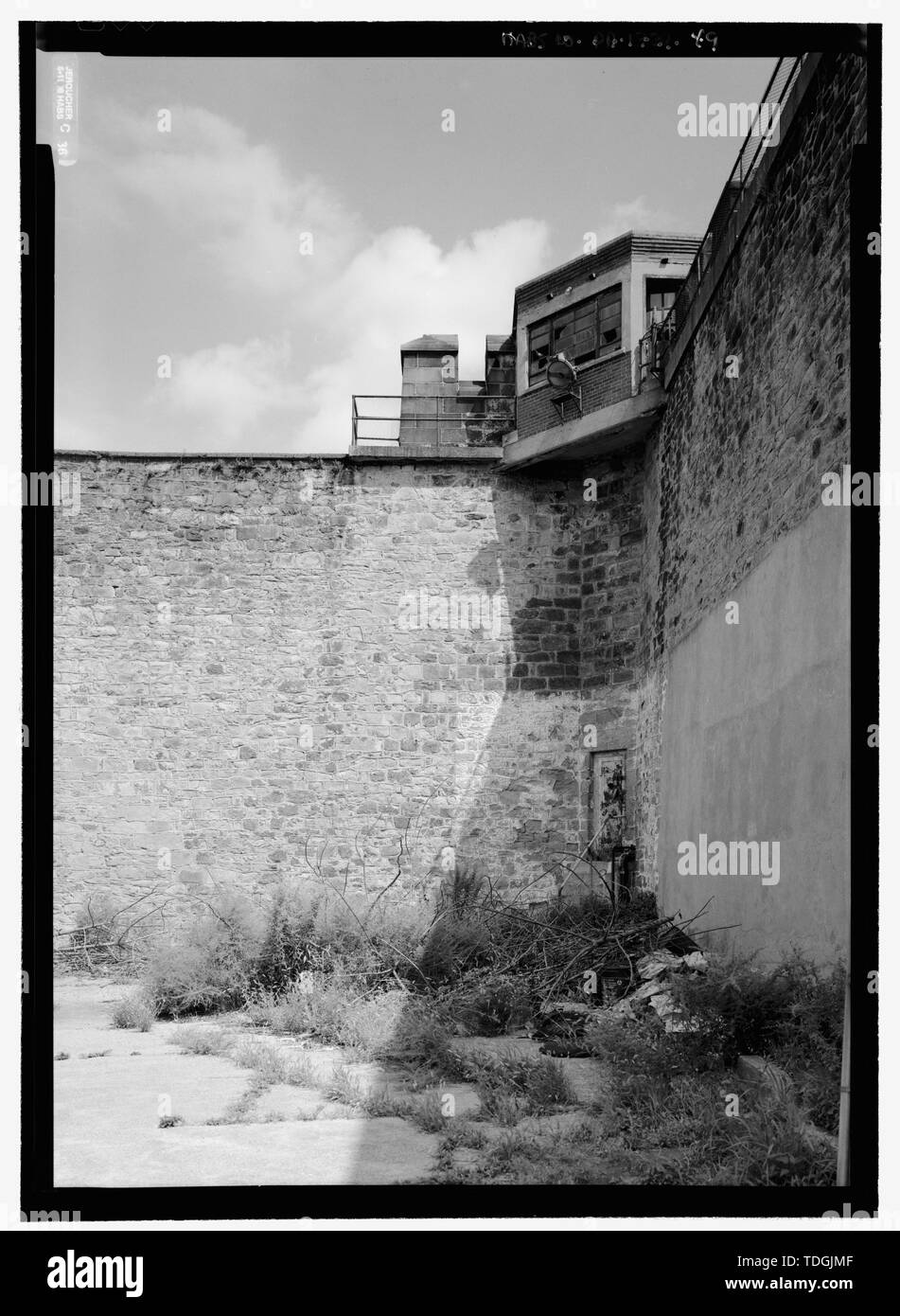 Nordosten guard Tower, Suchen aus dem Osten Hof, auf der nord-östlichen Zustandpenitentiary, 2125 Fairmount Avenue, Philadelphia, Philadelphia County, PA Stockfotohttps://www.alamy.de/image-license-details/?v=1https://www.alamy.de/nordosten-guard-tower-suchen-aus-dem-osten-hof-auf-der-nord-ostlichen-zustandpenitentiary-2125-fairmount-avenue-philadelphia-philadelphia-county-pa-image249301599.html
RMTDGJMF–Nordosten guard Tower, Suchen aus dem Osten Hof, auf der nord-östlichen Zustandpenitentiary, 2125 Fairmount Avenue, Philadelphia, Philadelphia County, PA
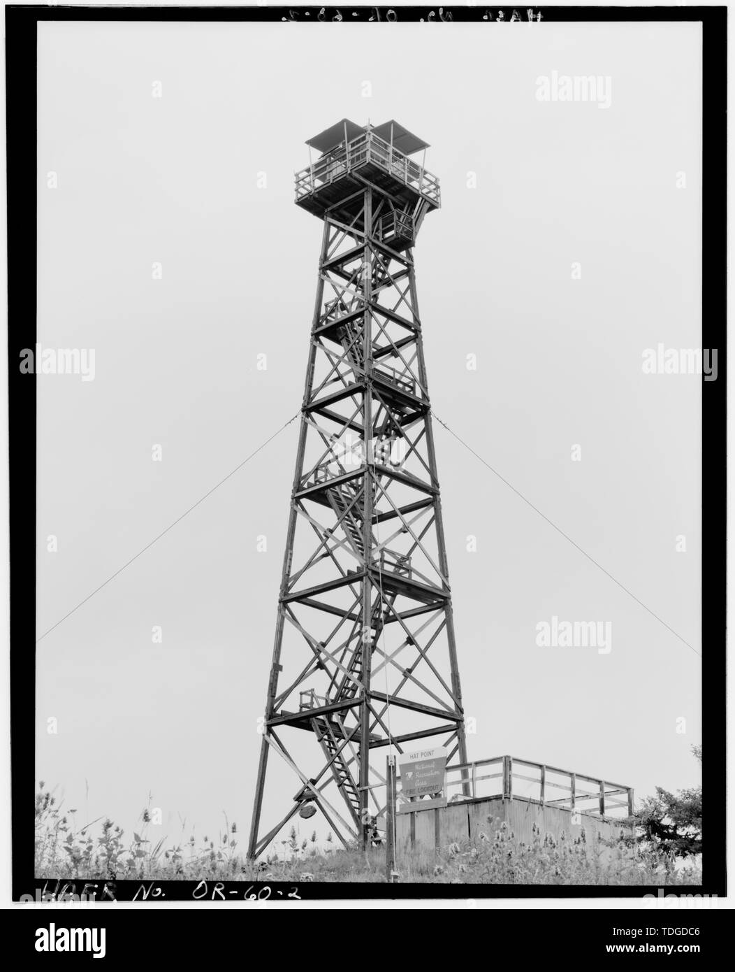 Nord - Ost Höhe. - Hut Point Fire Lookout Tower, Forest Service Road-4340, 24 Meilen von Imnaha, Imnaha, Wallowa County, ODER Stockfotohttps://www.alamy.de/image-license-details/?v=1https://www.alamy.de/nord-ost-hohe-hut-point-fire-lookout-tower-forest-service-road-4340-24-meilen-von-imnaha-imnaha-wallowa-county-oder-image249297446.html
RMTDGDC6–Nord - Ost Höhe. - Hut Point Fire Lookout Tower, Forest Service Road-4340, 24 Meilen von Imnaha, Imnaha, Wallowa County, ODER
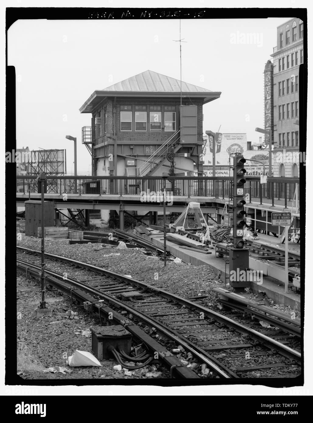 Schrägansicht in Höhe von Signal Tower. Suche South by Southwest. - Stillwell Avenue Station, Kreuzung von Stillwell und Surf Avenue, Brooklyn, Kings County, NY Stockfotohttps://www.alamy.de/image-license-details/?v=1https://www.alamy.de/schragansicht-in-hohe-von-signal-tower-suche-south-by-southwest-stillwell-avenue-station-kreuzung-von-stillwell-und-surf-avenue-brooklyn-kings-county-ny-image249374139.html
RMTDKY77–Schrägansicht in Höhe von Signal Tower. Suche South by Southwest. - Stillwell Avenue Station, Kreuzung von Stillwell und Surf Avenue, Brooklyn, Kings County, NY
 Zweiter Stock - Blick auf den Tower Zimmer bei der südwestlichen Ecke suchen Südwesten - Richardson Hall, East Dover 100, 29 North State Street, Dover, Kent County, DE Stockfotohttps://www.alamy.de/image-license-details/?v=1https://www.alamy.de/zweiter-stock-blick-auf-den-tower-zimmer-bei-der-sudwestlichen-ecke-suchen-sudwesten-richardson-hall-east-dover-100-29-north-state-street-dover-kent-county-de-image256710607.html
RMTWJ4YY–Zweiter Stock - Blick auf den Tower Zimmer bei der südwestlichen Ecke suchen Südwesten - Richardson Hall, East Dover 100, 29 North State Street, Dover, Kent County, DE
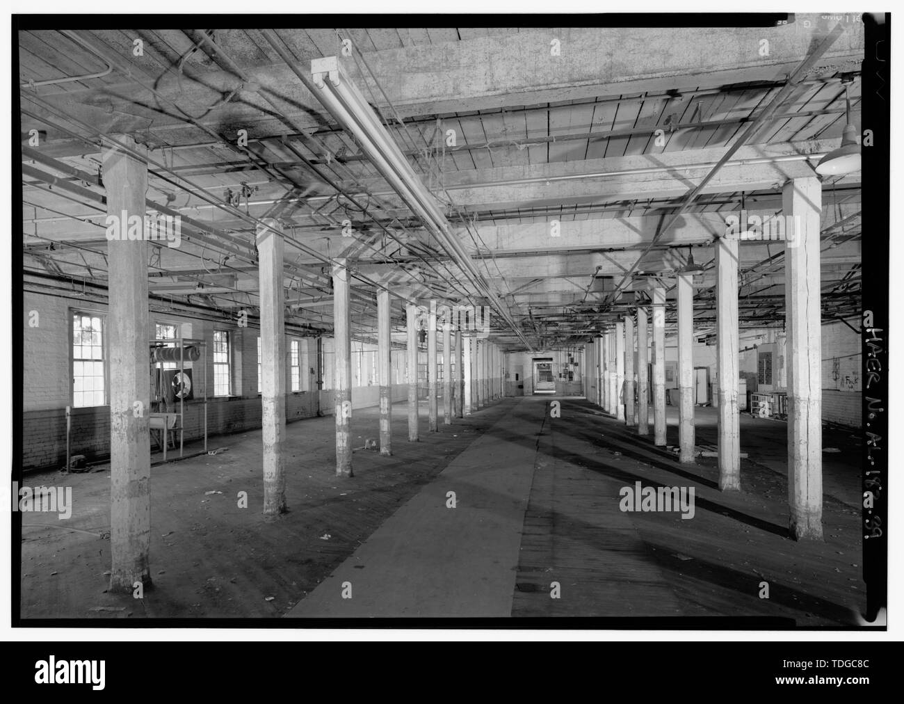 Mühle Nr. 2, 1.OG, übernommen von North End, mit Mühle Nr. 1 UND DER TURM. - Prattville Manufacturing Company, Nummer Eins, 242 South Court Street, Prattville, Autauga County, AL Stockfotohttps://www.alamy.de/image-license-details/?v=1https://www.alamy.de/muhle-nr-2-1og-ubernommen-von-north-end-mit-muhle-nr-1-und-der-turm-prattville-manufacturing-company-nummer-eins-242-south-court-street-prattville-autauga-county-al-image249296556.html
RMTDGC8C–Mühle Nr. 2, 1.OG, übernommen von North End, mit Mühle Nr. 1 UND DER TURM. - Prattville Manufacturing Company, Nummer Eins, 242 South Court Street, Prattville, Autauga County, AL
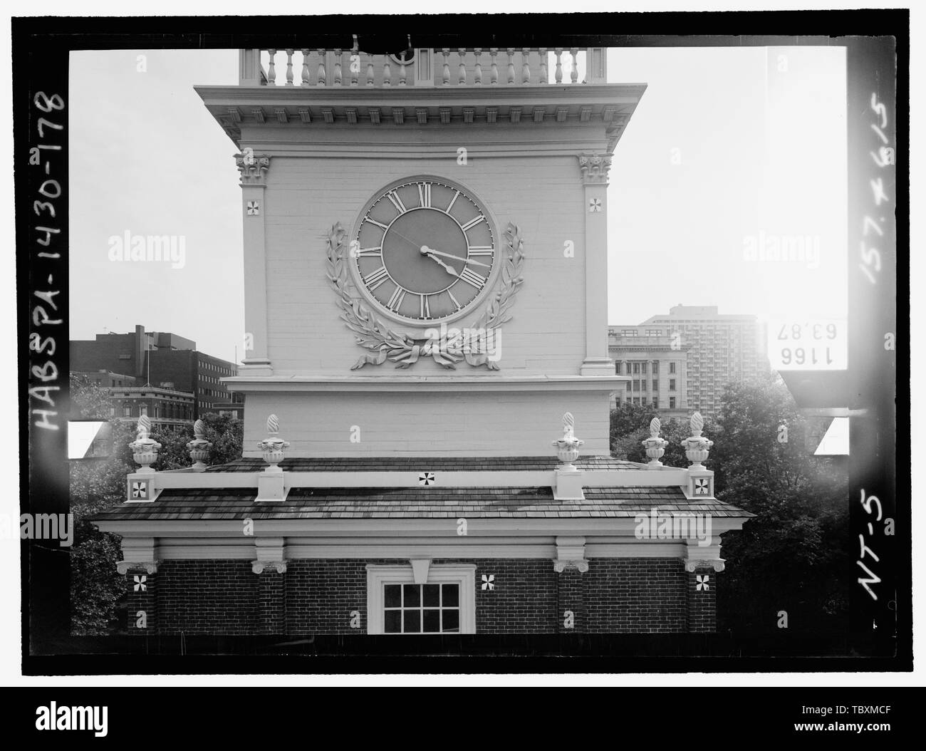 Norden ELEVATION, Turm, dritte Stufe. Glasplatte stereopair Anzahl PA 1430139 LCHABSGS 05 NT 5 157.4615. Rechts (nicht gedruckt) Independence Hall Complex, Independence Hall, 500 Chestnut Street, Philadelphia, Philadelphia County, PA Stockfotohttps://www.alamy.de/image-license-details/?v=1https://www.alamy.de/norden-elevation-turm-dritte-stufe-glasplatte-stereopair-anzahl-pa-1430139-lchabsgs-05-nt-5-1574615-rechts-nicht-gedruckt-independence-hall-complex-independence-hall-500-chestnut-street-philadelphia-philadelphia-county-pa-image248293151.html
RMTBXMCF–Norden ELEVATION, Turm, dritte Stufe. Glasplatte stereopair Anzahl PA 1430139 LCHABSGS 05 NT 5 157.4615. Rechts (nicht gedruckt) Independence Hall Complex, Independence Hall, 500 Chestnut Street, Philadelphia, Philadelphia County, PA
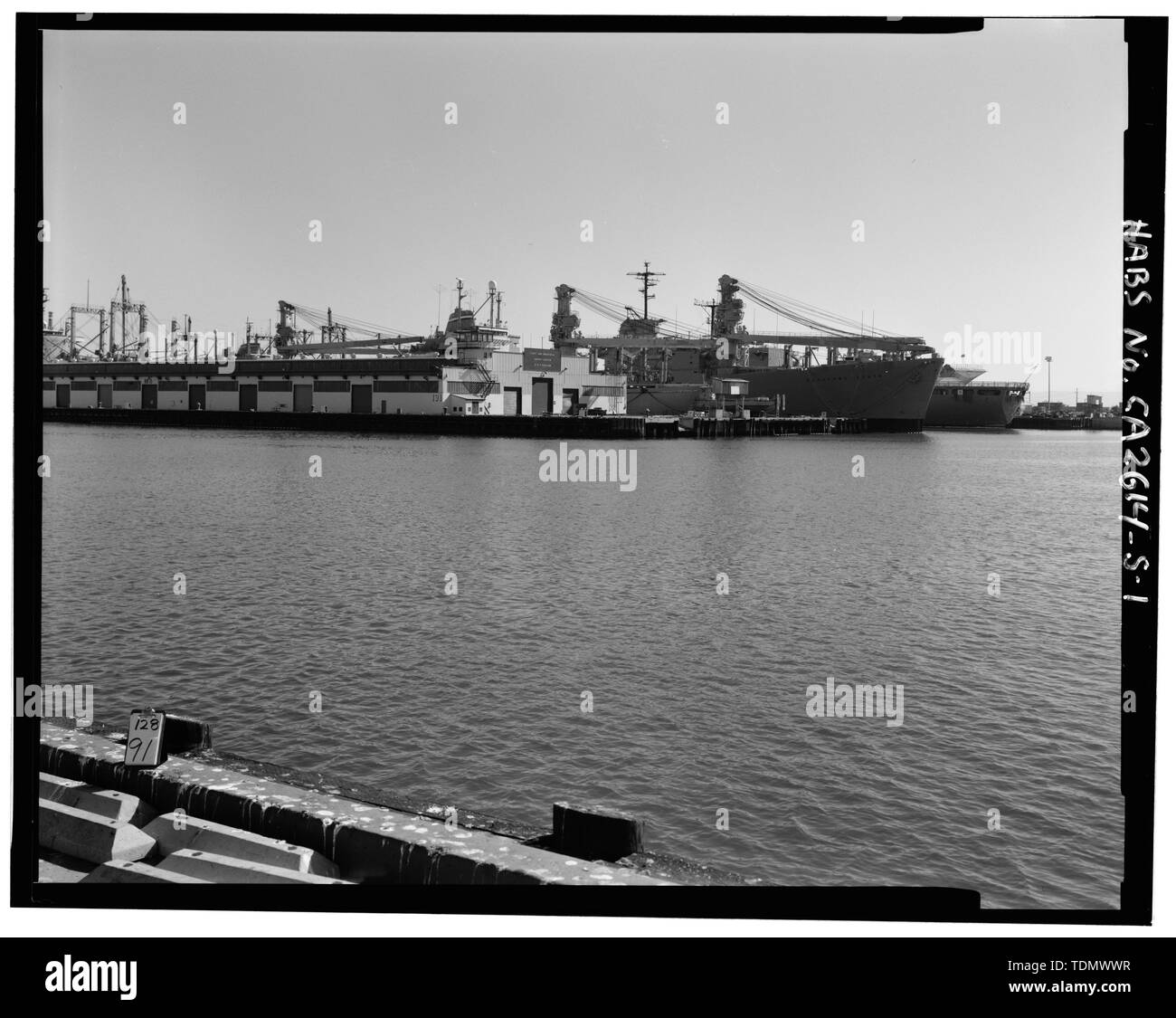 PIER 4, NORDOSTEN, VON WEST END VON NORDEN RN WHARF, nach Südosten über LIEGEPLATZ BEREICHE, MIT SIGNAL TOWER IM ZENTRUM. - Oakland Naval Supply Center, Piers Piers 4 und 5, 4 und 5, Oakland, Alameda County, CA Stockfotohttps://www.alamy.de/image-license-details/?v=1https://www.alamy.de/pier-4-nordosten-von-west-end-von-norden-rn-wharf-nach-sudosten-uber-liegeplatz-bereiche-mit-signal-tower-im-zentrum-oakland-naval-supply-center-piers-piers-4-und-5-4-und-5-oakland-alameda-county-ca-image249395043.html
RMTDMWWR–PIER 4, NORDOSTEN, VON WEST END VON NORDEN RN WHARF, nach Südosten über LIEGEPLATZ BEREICHE, MIT SIGNAL TOWER IM ZENTRUM. - Oakland Naval Supply Center, Piers Piers 4 und 5, 4 und 5, Oakland, Alameda County, CA
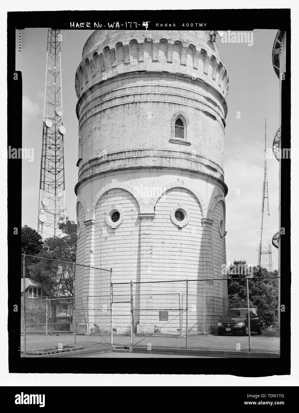 Teilweise Tower View, nordöstlich von Tennisplatz - Queen Anne Wassertank Nr. 1, 1410 First Avenue North, Seattle, King County, WA; Thompson, Reginald H, Stadt Ingenieur und Architekt; Louter, David, Sender Stockfotohttps://www.alamy.de/image-license-details/?v=1https://www.alamy.de/teilweise-tower-view-nordostlich-von-tennisplatz-queen-anne-wassertank-nr-1-1410-first-avenue-north-seattle-king-county-wa-thompson-reginald-h-stadt-ingenieur-und-architekt-louter-david-sender-image249398144.html
RMTDN1TG–Teilweise Tower View, nordöstlich von Tennisplatz - Queen Anne Wassertank Nr. 1, 1410 First Avenue North, Seattle, King County, WA; Thompson, Reginald H, Stadt Ingenieur und Architekt; Louter, David, Sender
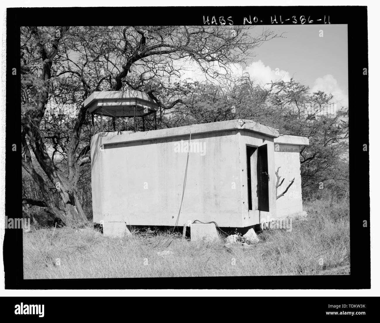 Oblique von mir Observation Tower Gebäude mit Eingangstür und Transformator Gebäude hinter der auf der rechten Seite. Blick Richtung Norden - Nordwesten - US Naval Base, Pearl Harbor, Waipio Halbinsel, Halbinsel Waipo, Pearl City, Honolulu County, HI Stockfotohttps://www.alamy.de/image-license-details/?v=1https://www.alamy.de/oblique-von-mir-observation-tower-gebaude-mit-eingangstur-und-transformator-gebaude-hinter-der-auf-der-rechten-seite-blick-richtung-norden-nordwesten-us-naval-base-pearl-harbor-waipio-halbinsel-halbinsel-waipo-pearl-city-honolulu-county-hi-image249372471.html
RMTDKW3K–Oblique von mir Observation Tower Gebäude mit Eingangstür und Transformator Gebäude hinter der auf der rechten Seite. Blick Richtung Norden - Nordwesten - US Naval Base, Pearl Harbor, Waipio Halbinsel, Halbinsel Waipo, Pearl City, Honolulu County, HI
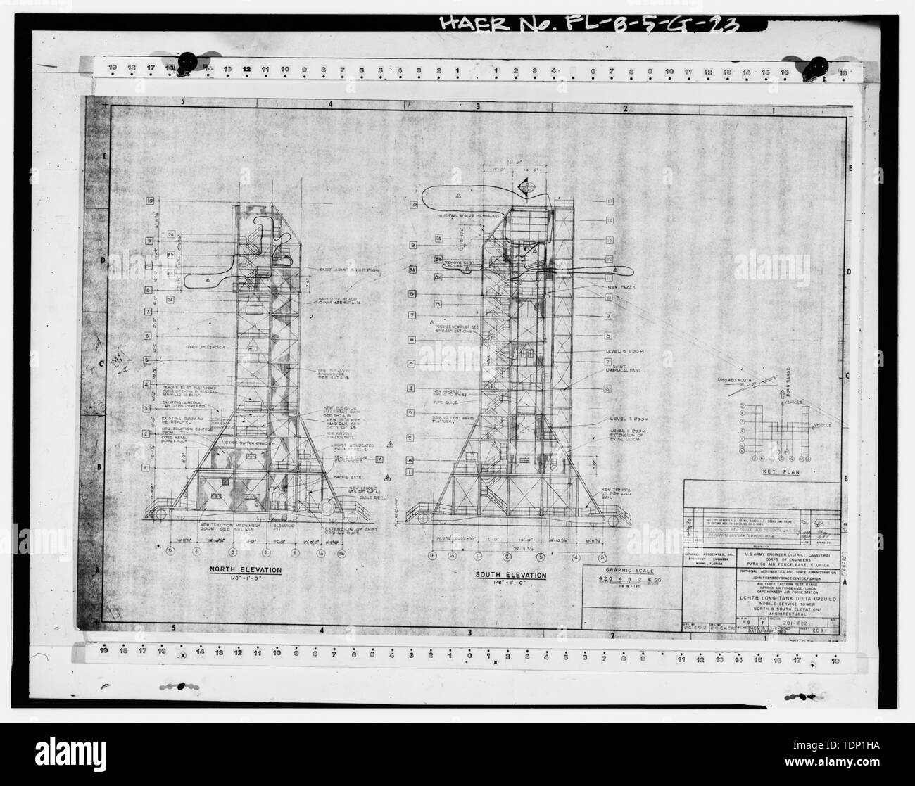 Fotokopie der technischen Zeichnung. LC-17 B LONG TANK DELTA UPBUILD-MOBILE SERVICE TOWER, Nord und Süd ERHÖHUNGEN - Architektur-, April 1969. - Cape Canaveral Air Station, Launch Complex 17, 28417, East End von Lighthouse Road, Cape Canaveral, Brevard County, FL Stockfotohttps://www.alamy.de/image-license-details/?v=1https://www.alamy.de/fotokopie-der-technischen-zeichnung-lc-17-b-long-tank-delta-upbuild-mobile-service-tower-nord-und-sud-erhohungen-architektur-april-1969-cape-canaveral-air-station-launch-complex-17-28417-east-end-von-lighthouse-road-cape-canaveral-brevard-county-fl-image249419894.html
RMTDP1HA–Fotokopie der technischen Zeichnung. LC-17 B LONG TANK DELTA UPBUILD-MOBILE SERVICE TOWER, Nord und Süd ERHÖHUNGEN - Architektur-, April 1969. - Cape Canaveral Air Station, Launch Complex 17, 28417, East End von Lighthouse Road, Cape Canaveral, Brevard County, FL
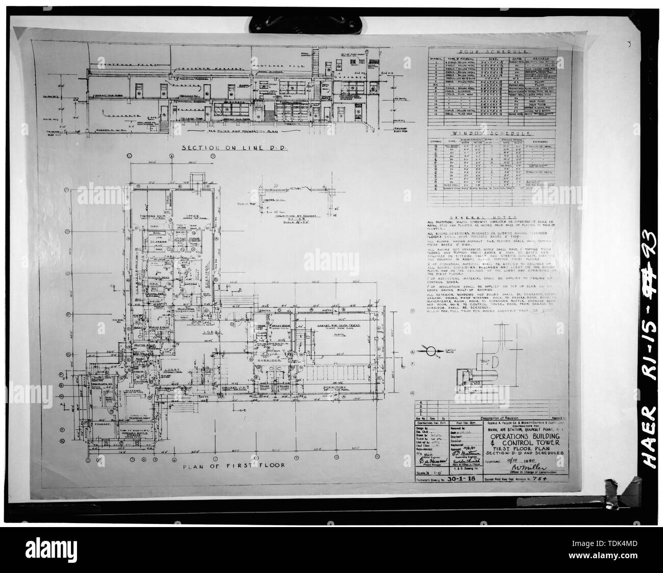 Operationen und CONTROL TOWER, (Gebäude 61) ersten Grundriss, FULLER - Scott, 10. Oktober 1940. QP ACC 754. - Quonset Point Naval Air Station, Roger Williams, North Kingstown, Washington County, RI; Albert Kahn, Incorporated; George einen volleren Firma; Merritt-Chapman und Scott Corporation Stockfotohttps://www.alamy.de/image-license-details/?v=1https://www.alamy.de/operationen-und-control-tower-gebaude-61-ersten-grundriss-fuller-scott-10-oktober-1940-qp-acc-754-quonset-point-naval-air-station-roger-williams-north-kingstown-washington-county-ri-albert-kahn-incorporated-george-einen-volleren-firma-merritt-chapman-und-scott-corporation-image249356477.html
RMTDK4MD–Operationen und CONTROL TOWER, (Gebäude 61) ersten Grundriss, FULLER - Scott, 10. Oktober 1940. QP ACC 754. - Quonset Point Naval Air Station, Roger Williams, North Kingstown, Washington County, RI; Albert Kahn, Incorporated; George einen volleren Firma; Merritt-Chapman und Scott Corporation
 Operationen und CONTROL TOWER, (Gebäude 61) zweite, dritte und vierte GRUNDRISSE, FULLER - Scott, 10. Oktober 1940. QP ACC 755. - Quonset Point Naval Air Station, Roger Williams, North Kingstown, Washington County, RI; Albert Kahn, Incorporated; George einen volleren Firma; Merritt-Chapman und Scott Corporation Stockfotohttps://www.alamy.de/image-license-details/?v=1https://www.alamy.de/operationen-und-control-tower-gebaude-61-zweite-dritte-und-vierte-grundrisse-fuller-scott-10-oktober-1940-qp-acc-755-quonset-point-naval-air-station-roger-williams-north-kingstown-washington-county-ri-albert-kahn-incorporated-george-einen-volleren-firma-merritt-chapman-und-scott-corporation-image249356479.html
RMTDK4MF–Operationen und CONTROL TOWER, (Gebäude 61) zweite, dritte und vierte GRUNDRISSE, FULLER - Scott, 10. Oktober 1940. QP ACC 755. - Quonset Point Naval Air Station, Roger Williams, North Kingstown, Washington County, RI; Albert Kahn, Incorporated; George einen volleren Firma; Merritt-Chapman und Scott Corporation
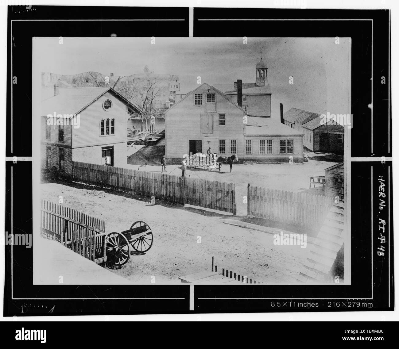 Norden ELEVATION, ANZEIGEN SINGLESTORY HINAUS ERWEITERT ÜBER GRABEN TREPPENTURM. Beachten SIE AUCH DIE LINIE DER SHAFTING AUS DER MÜHLE ZUM BACKSTEIN UND HOLZ STRUKTUR AUF DER LINKEN SEITE. c. 1870. Kredit SHRL. Slater Mühle, Pawtucket, Providence County, Rhode Pratt und Spencer alte Slater Mühle Verband N.P. Hicks und Unternehmen Slater, Samuel Wilkinson, Oziel Braun, Mose Anthony, Daniel Csillag, William Washburn, Abisha Jenckes Andrews, David Kingsley, Benjamin Mason, James Martin, David Taylor, Andrew Blackinton, Oliver Schäfer, Benjamin Evelith, William Evelith, Inigo Sterry, Cyprian Jenkins, William Jenkin Stockfotohttps://www.alamy.de/image-license-details/?v=1https://www.alamy.de/norden-elevation-anzeigen-singlestory-hinaus-erweitert-uber-graben-treppenturm-beachten-sie-auch-die-linie-der-shafting-aus-der-muhle-zum-backstein-und-holz-struktur-auf-der-linken-seite-c-1870-kredit-shrl-slater-muhle-pawtucket-providence-county-rhode-pratt-und-spencer-alte-slater-muhle-verband-np-hicks-und-unternehmen-slater-samuel-wilkinson-oziel-braun-mose-anthony-daniel-csillag-william-washburn-abisha-jenckes-andrews-david-kingsley-benjamin-mason-james-martin-david-taylor-andrew-blackinton-oliver-schafer-benjamin-evelith-william-evelith-inigo-sterry-cyprian-jenkins-william-jenkin-image248293120.html
RMTBXMBC–Norden ELEVATION, ANZEIGEN SINGLESTORY HINAUS ERWEITERT ÜBER GRABEN TREPPENTURM. Beachten SIE AUCH DIE LINIE DER SHAFTING AUS DER MÜHLE ZUM BACKSTEIN UND HOLZ STRUKTUR AUF DER LINKEN SEITE. c. 1870. Kredit SHRL. Slater Mühle, Pawtucket, Providence County, Rhode Pratt und Spencer alte Slater Mühle Verband N.P. Hicks und Unternehmen Slater, Samuel Wilkinson, Oziel Braun, Mose Anthony, Daniel Csillag, William Washburn, Abisha Jenckes Andrews, David Kingsley, Benjamin Mason, James Martin, David Taylor, Andrew Blackinton, Oliver Schäfer, Benjamin Evelith, William Evelith, Inigo Sterry, Cyprian Jenkins, William Jenkin
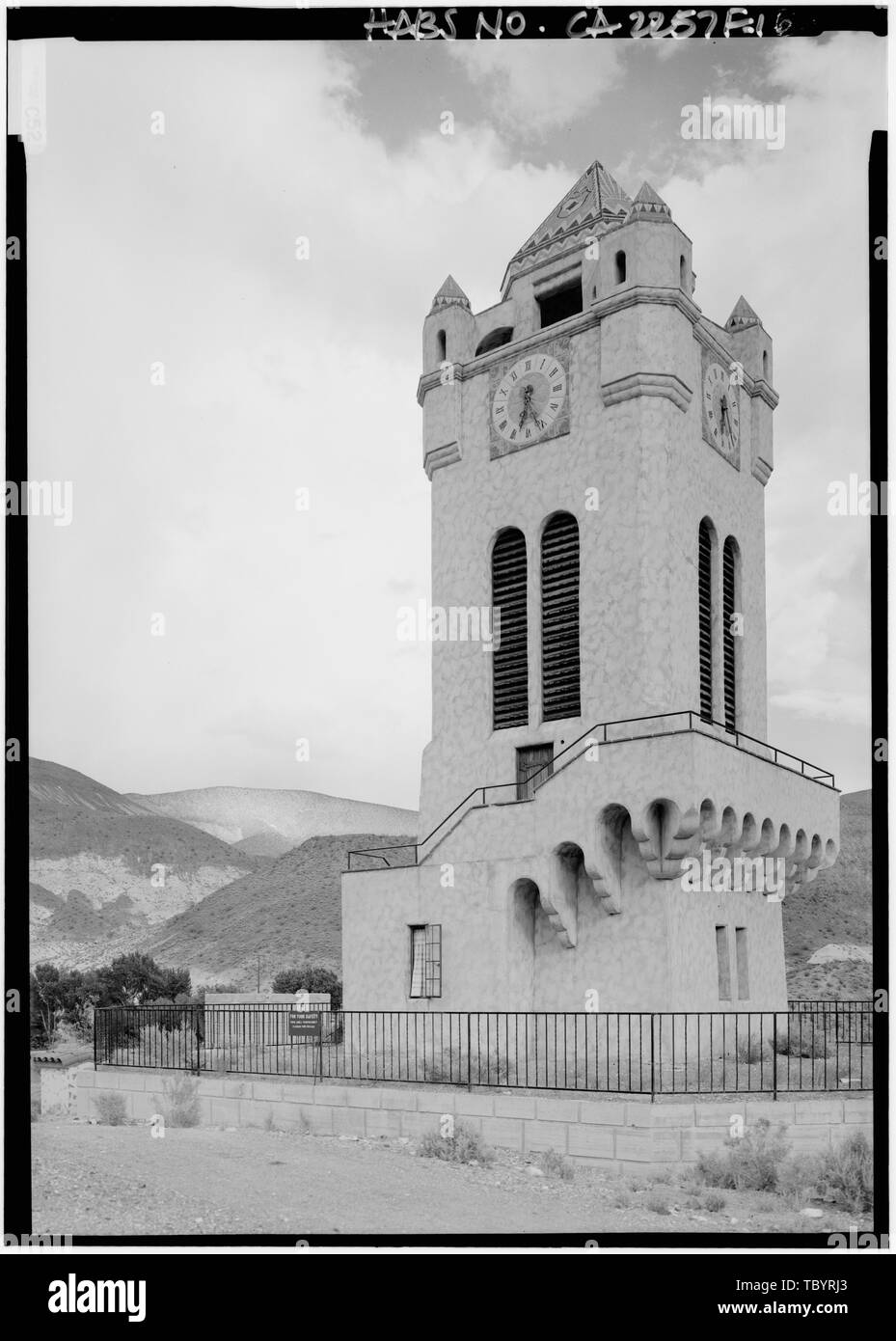 Im Norden und Westen seiten Death Valley Ranch, Chimes Tower, Death Valley Junction, Inyo County, CA Stockfotohttps://www.alamy.de/image-license-details/?v=1https://www.alamy.de/im-norden-und-westen-seiten-death-valley-ranch-chimes-tower-death-valley-junction-inyo-county-ca-image248317611.html
RMTBYRJ3–Im Norden und Westen seiten Death Valley Ranch, Chimes Tower, Death Valley Junction, Inyo County, CA
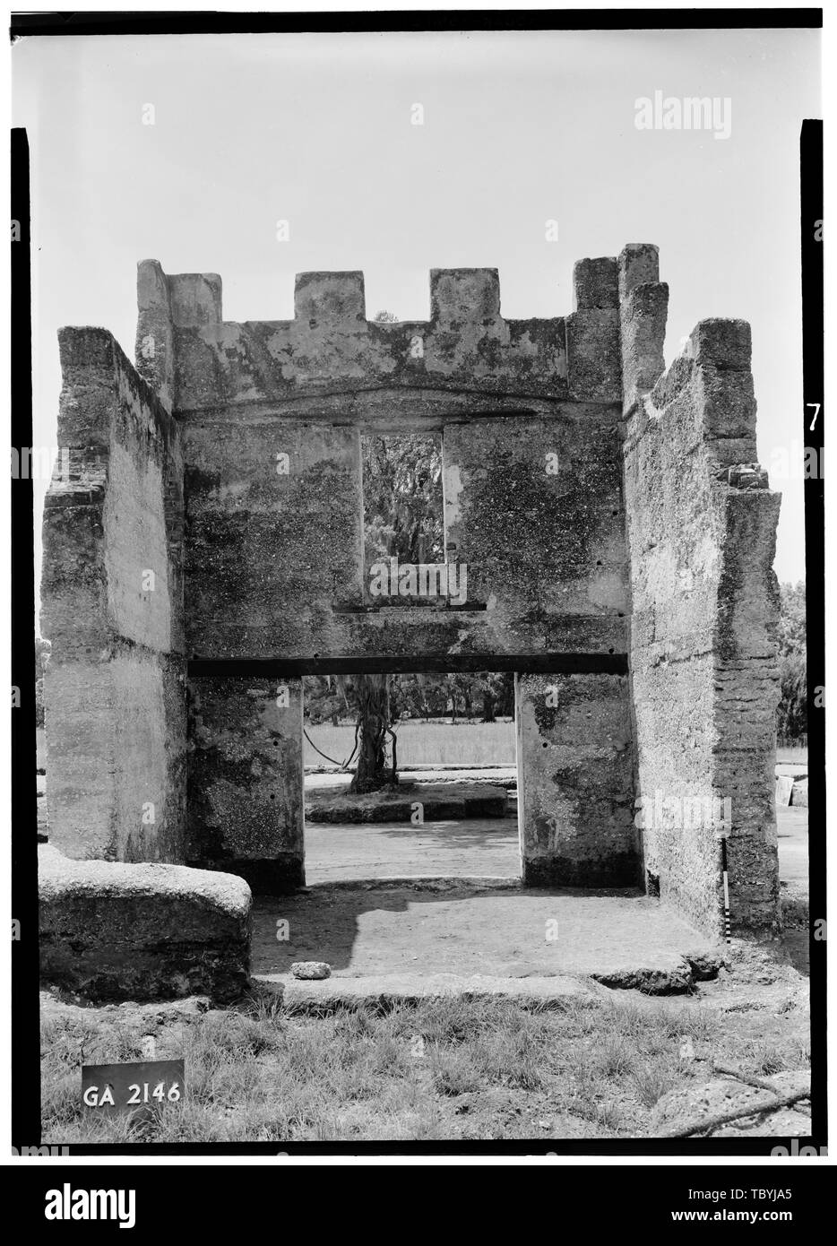 Mai 1958 TURM VON NORDEN Fort Frederica, Kasernen (Ruinen), Saint Simons Island, Glynn County, GA Stockfotohttps://www.alamy.de/image-license-details/?v=1https://www.alamy.de/mai-1958-turm-von-norden-fort-frederica-kasernen-ruinen-saint-simons-island-glynn-county-ga-image248313469.html
RMTBYJA5–Mai 1958 TURM VON NORDEN Fort Frederica, Kasernen (Ruinen), Saint Simons Island, Glynn County, GA
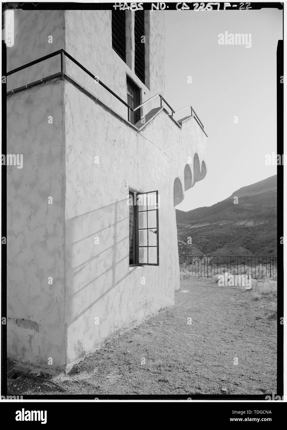 Nordseite, SCHRÄGANSICHT - Death Valley Ranch, Chimes Tower, Death Valley Junction, Inyo County, CA Stockfotohttps://www.alamy.de/image-license-details/?v=1https://www.alamy.de/nordseite-schragansicht-death-valley-ranch-chimes-tower-death-valley-junction-inyo-county-ca-image249296918.html
RMTDGCNA–Nordseite, SCHRÄGANSICHT - Death Valley Ranch, Chimes Tower, Death Valley Junction, Inyo County, CA
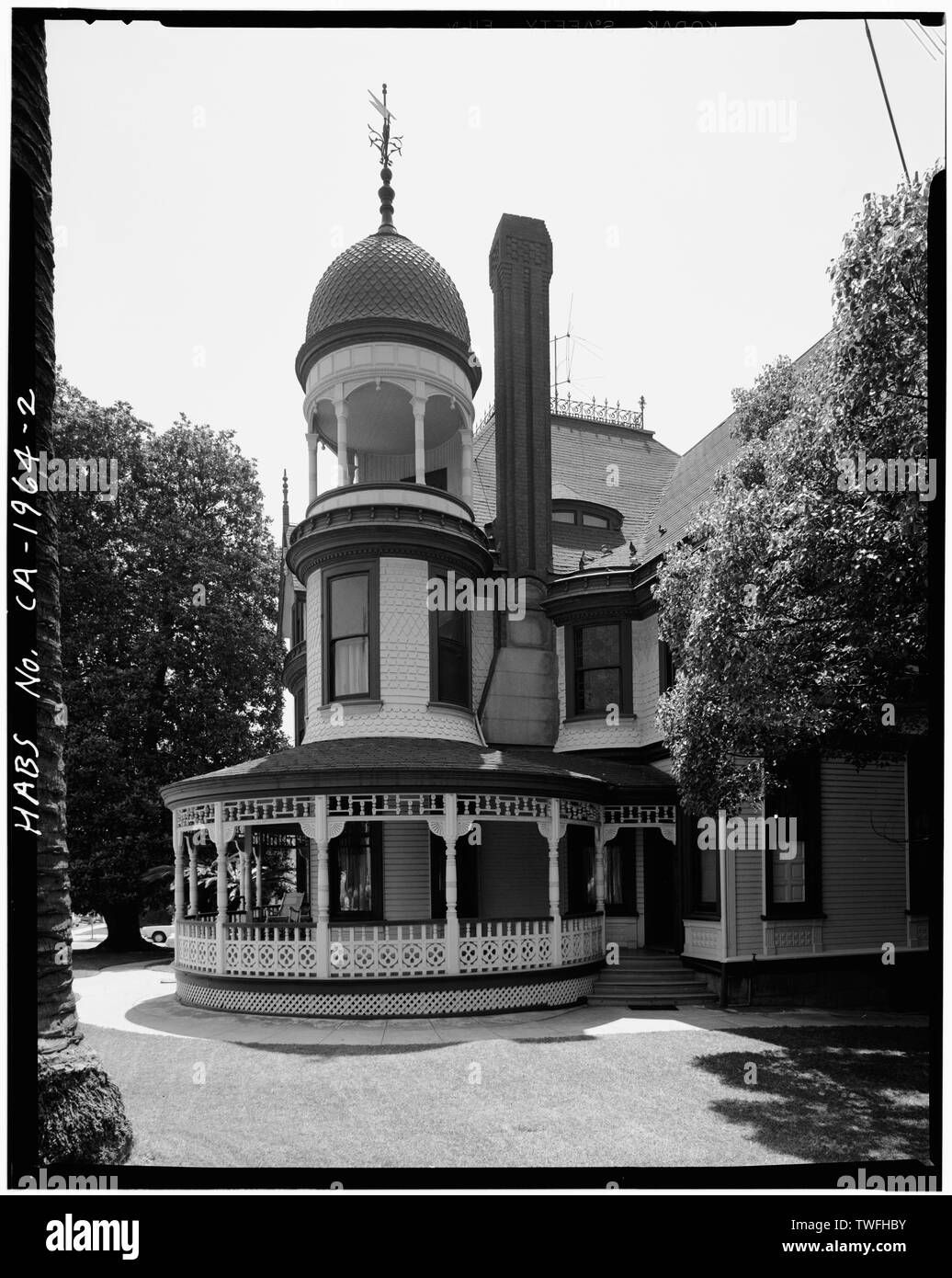 Vorhalle und Turm, AUS NORD-Long-Waterman House, 2408 First Avenue, San Diego, San Diego County, CA Stockfotohttps://www.alamy.de/image-license-details/?v=1https://www.alamy.de/vorhalle-und-turm-aus-nord-long-waterman-house-2408-first-avenue-san-diego-san-diego-county-ca-image256654495.html
RMTWFHBY–Vorhalle und Turm, AUS NORD-Long-Waterman House, 2408 First Avenue, San Diego, San Diego County, CA
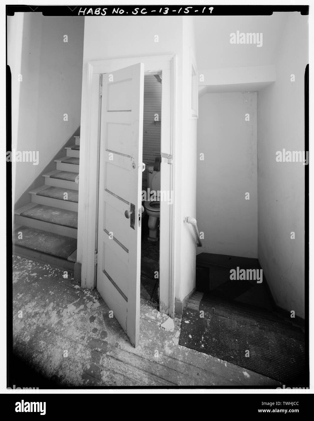 Zweite Etage, nordöstliche Ecke TREPPENTURM, Blick nach Norden - Alte Jüdische Waisenhaus, 88 Broad Street, Charleston, Charleston County, SC Stockfotohttps://www.alamy.de/image-license-details/?v=1https://www.alamy.de/zweite-etage-nordostliche-ecke-treppenturm-blick-nach-norden-alte-judische-waisenhaus-88-broad-street-charleston-charleston-county-sc-image256699196.html
RMTWHJCC–Zweite Etage, nordöstliche Ecke TREPPENTURM, Blick nach Norden - Alte Jüdische Waisenhaus, 88 Broad Street, Charleston, Charleston County, SC
 Seite und Treppen im Süden - Shawnee Tower, 500 Meter nördlich der Kreuzung des Township Straßen 222 und 393, Murray Stadt, Hocking County, OH Stockfotohttps://www.alamy.de/image-license-details/?v=1https://www.alamy.de/seite-und-treppen-im-suden-shawnee-tower-500-meter-nordlich-der-kreuzung-des-township-strassen-222-und-393-murray-stadt-hocking-county-oh-image256705050.html
RMTWHWWE–Seite und Treppen im Süden - Shawnee Tower, 500 Meter nördlich der Kreuzung des Township Straßen 222 und 393, Murray Stadt, Hocking County, OH
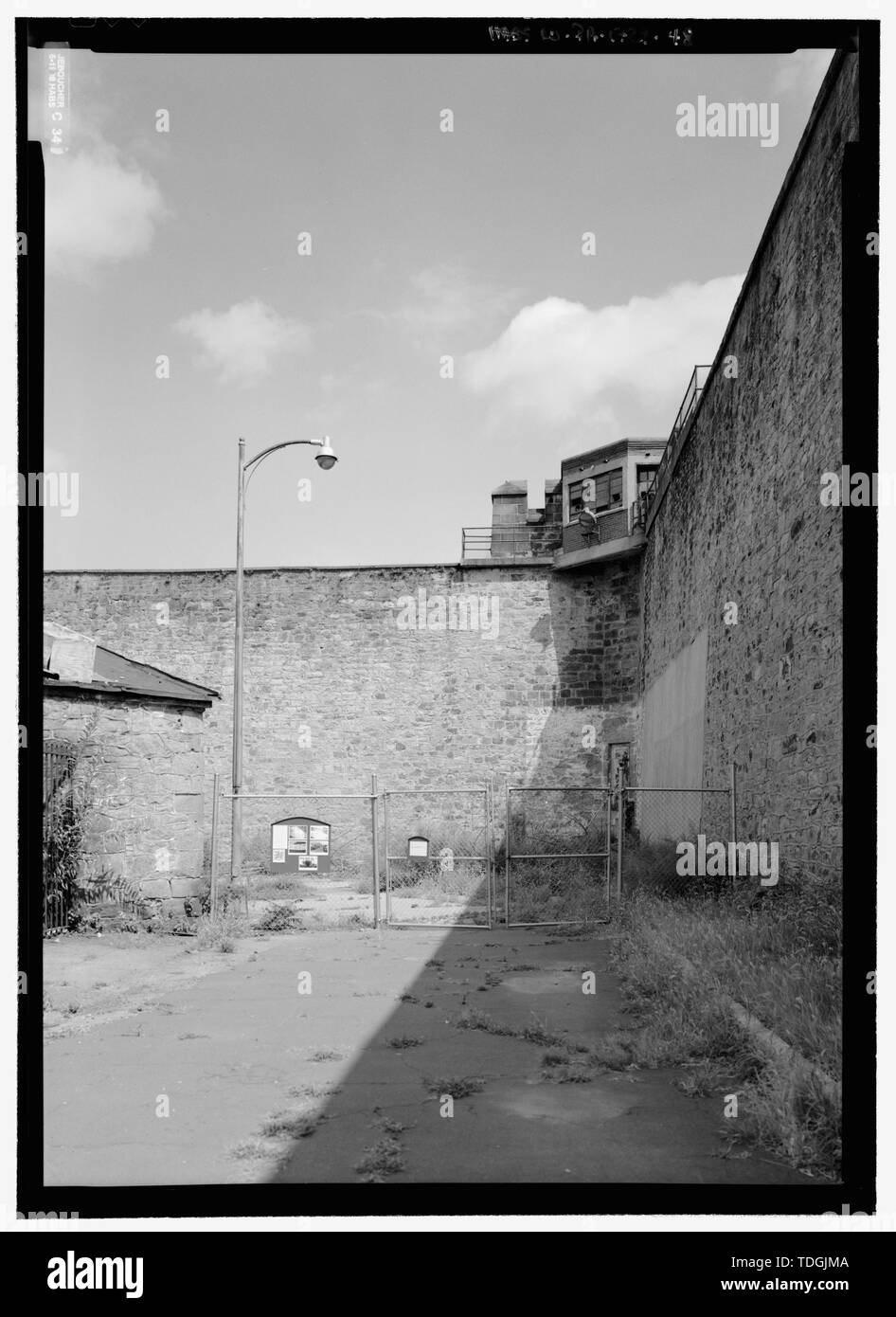 Nordosten guard Tower, Suchen aus dem Osten Hof, auf der nord-östlichen Zustandpenitentiary, 2125 Fairmount Avenue, Philadelphia, Philadelphia County, PA Stockfotohttps://www.alamy.de/image-license-details/?v=1https://www.alamy.de/nordosten-guard-tower-suchen-aus-dem-osten-hof-auf-der-nord-ostlichen-zustandpenitentiary-2125-fairmount-avenue-philadelphia-philadelphia-county-pa-image249301594.html
RMTDGJMA–Nordosten guard Tower, Suchen aus dem Osten Hof, auf der nord-östlichen Zustandpenitentiary, 2125 Fairmount Avenue, Philadelphia, Philadelphia County, PA
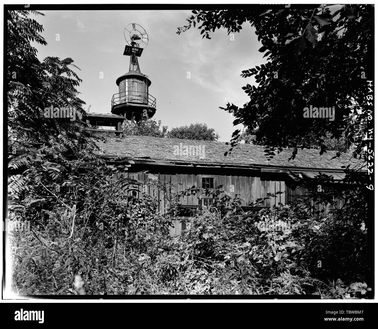 HAUPTSCHEUNE, KOMBINIERTE WINDMÜHLE UND HÖLZERNER WASSERTURM IM NORDEN, SCHWERES ÜBERWUCHSGEBIET IM VORDERGRUND The Meadows, River Road, Rhinebeck, Dutchess County, NY Stockfotohttps://www.alamy.de/image-license-details/?v=1https://www.alamy.de/hauptscheune-kombinierte-windmuhle-und-holzerner-wasserturm-im-norden-schweres-uberwuchsgebiet-im-vordergrund-the-meadows-river-road-rhinebeck-dutchess-county-ny-image248264359.html
RMTBWBM7–HAUPTSCHEUNE, KOMBINIERTE WINDMÜHLE UND HÖLZERNER WASSERTURM IM NORDEN, SCHWERES ÜBERWUCHSGEBIET IM VORDERGRUND The Meadows, River Road, Rhinebeck, Dutchess County, NY
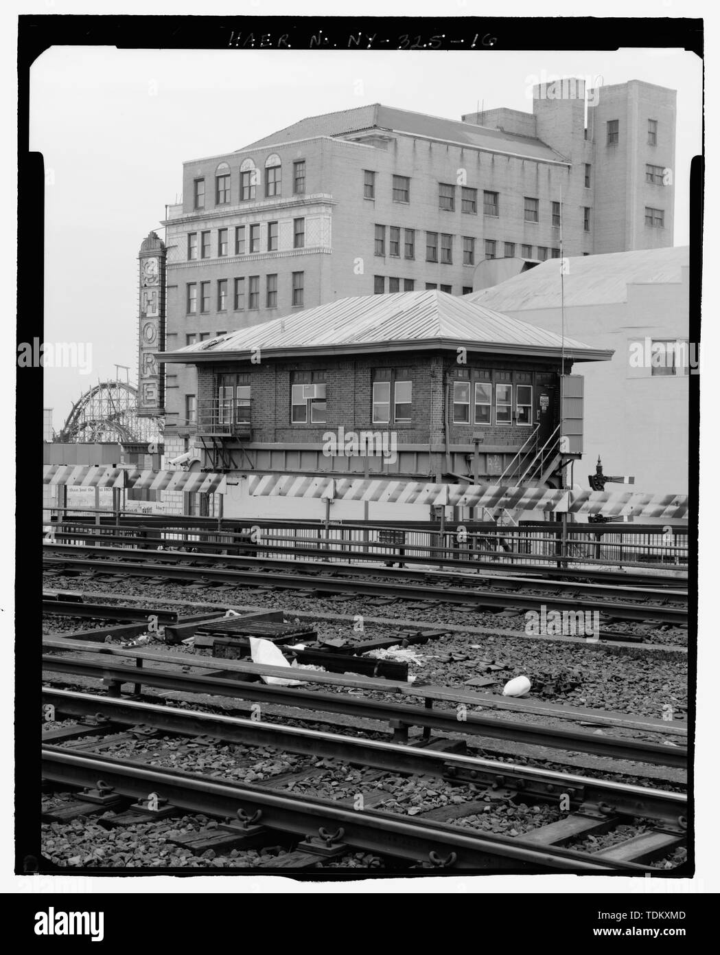 Schrägansicht im Norden und Osten Erhöhungen der Signal Tower. Suche nach Südwesten. - Stillwell Avenue Station, Kreuzung von Stillwell und Surf Avenue, Brooklyn, Kings County, NY Stockfotohttps://www.alamy.de/image-license-details/?v=1https://www.alamy.de/schragansicht-im-norden-und-osten-erhohungen-der-signal-tower-suche-nach-sudwesten-stillwell-avenue-station-kreuzung-von-stillwell-und-surf-avenue-brooklyn-kings-county-ny-image249373725.html
RMTDKXMD–Schrägansicht im Norden und Osten Erhöhungen der Signal Tower. Suche nach Südwesten. - Stillwell Avenue Station, Kreuzung von Stillwell und Surf Avenue, Brooklyn, Kings County, NY
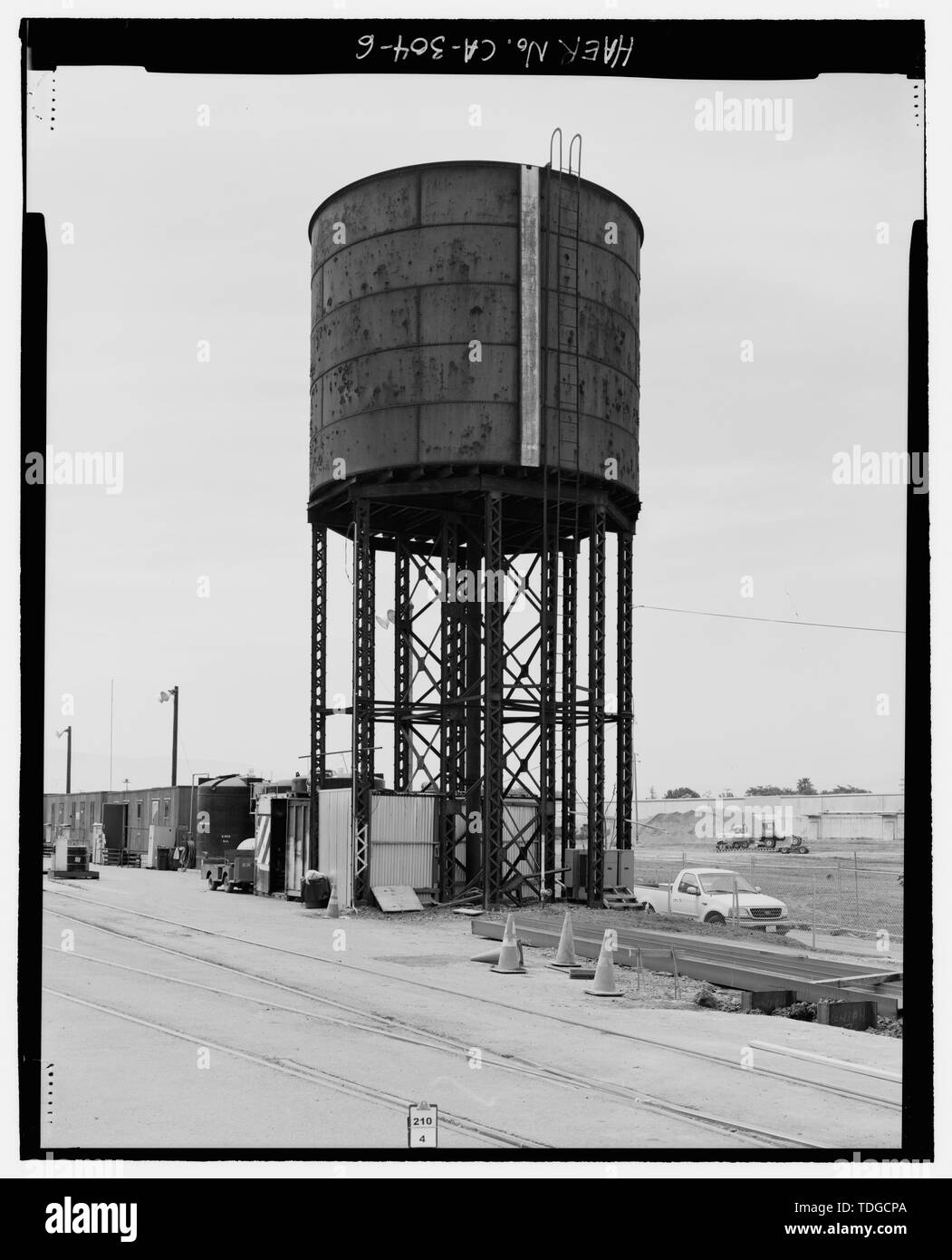 Nordseite, WASSERSTAND MANOMETER. - Southern Pacific Depot, Wasserturm, 65 Cahill Street, San Jose, Santa Clara County, CA Stockfotohttps://www.alamy.de/image-license-details/?v=1https://www.alamy.de/nordseite-wasserstand-manometer-southern-pacific-depot-wasserturm-65-cahill-street-san-jose-santa-clara-county-ca-image249296946.html
RMTDGCPA–Nordseite, WASSERSTAND MANOMETER. - Southern Pacific Depot, Wasserturm, 65 Cahill Street, San Jose, Santa Clara County, CA
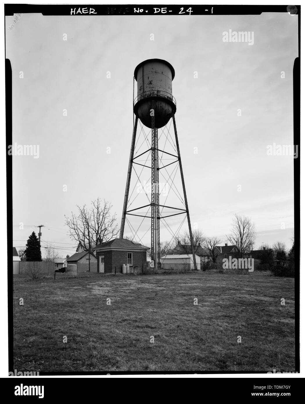 Blick von Norden und Westen SEITEN DER WASSERTURM UND PUMPENHAUS, Südosten - Townsend Wasserturm, Lattomus Avenue, Townsend, New Castle County, DE Stockfotohttps://www.alamy.de/image-license-details/?v=1https://www.alamy.de/blick-von-norden-und-westen-seiten-der-wasserturm-und-pumpenhaus-sudosten-townsend-wasserturm-lattomus-avenue-townsend-new-castle-county-de-image249380683.html
RMTDM7GY–Blick von Norden und Westen SEITEN DER WASSERTURM UND PUMPENHAUS, Südosten - Townsend Wasserturm, Lattomus Avenue, Townsend, New Castle County, DE
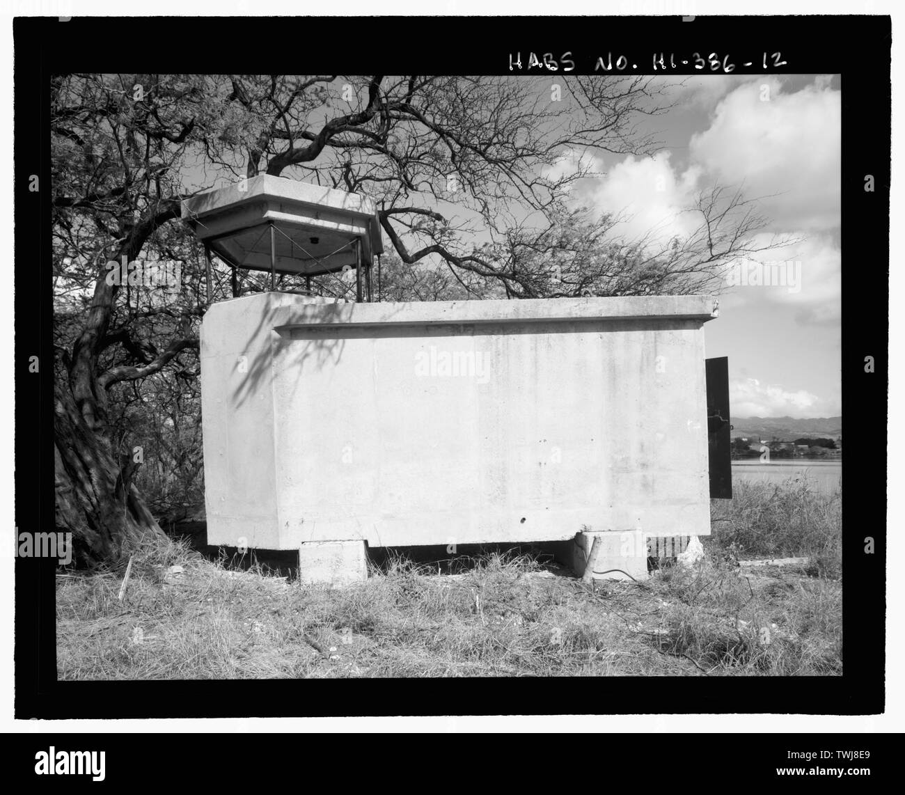 Seite von mir Observation Tower Gebäude. Blick Richtung Norden - US-Marinestützpunkt Pearl Harbor, Waipio Halbinsel, Halbinsel Waipo, Pearl City, Honolulu County, HI Stockfotohttps://www.alamy.de/image-license-details/?v=1https://www.alamy.de/seite-von-mir-observation-tower-gebaude-blick-richtung-norden-us-marinestutzpunkt-pearl-harbor-waipio-halbinsel-halbinsel-waipo-pearl-city-honolulu-county-hi-image256713361.html
RMTWJ8E9–Seite von mir Observation Tower Gebäude. Blick Richtung Norden - US-Marinestützpunkt Pearl Harbor, Waipio Halbinsel, Halbinsel Waipo, Pearl City, Honolulu County, HI
 Überblick über Standort, Blick nach Norden - Atchison, Topeka & Santa Fe Control Tower 19, Santa Fe Railway Milepost 51, Dallas, Dallas County, TX; Wegman-French, Lysa, Sender Stockfotohttps://www.alamy.de/image-license-details/?v=1https://www.alamy.de/uberblick-uber-standort-blick-nach-norden-atchison-topeka-santa-fe-control-tower-19-santa-fe-railway-milepost-51-dallas-dallas-county-tx-wegman-french-lysa-sender-image249376878.html
RMTDM2N2–Überblick über Standort, Blick nach Norden - Atchison, Topeka & Santa Fe Control Tower 19, Santa Fe Railway Milepost 51, Dallas, Dallas County, TX; Wegman-French, Lysa, Sender
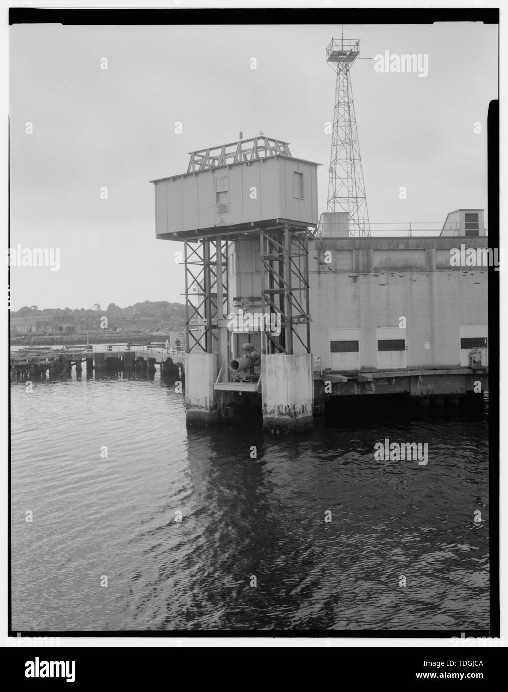 Nordosten (Steuerbord) Aufzug Turm mit Tauchpumpe feuern Rohr, mit Blick nach Süden. - Naval Torpedo Station, Feuern Pier, nördlichen Ende von Gould Insel in der Narragansett Bay, Newport, Newport County, RI Stockfotohttps://www.alamy.de/image-license-details/?v=1https://www.alamy.de/nordosten-steuerbord-aufzug-turm-mit-tauchpumpe-feuern-rohr-mit-blick-nach-suden-naval-torpedo-station-feuern-pier-nordlichen-ende-von-gould-insel-in-der-narragansett-bay-newport-newport-county-ri-image249301370.html
RMTDGJCA–Nordosten (Steuerbord) Aufzug Turm mit Tauchpumpe feuern Rohr, mit Blick nach Süden. - Naval Torpedo Station, Feuern Pier, nördlichen Ende von Gould Insel in der Narragansett Bay, Newport, Newport County, RI
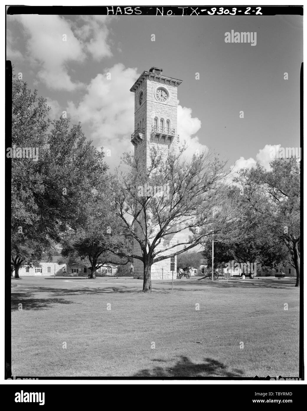 Im Norden und Westen SEITEN DER WATCH TOWER Fort Sam Houston, San Antonio Depot, WaterWatch Tower, Grayson Street und New Braunfels Avenue, San Antonio, Bexar County, TX Cary, Brian, Sender Stockfotohttps://www.alamy.de/image-license-details/?v=1https://www.alamy.de/im-norden-und-westen-seiten-der-watch-tower-fort-sam-houston-san-antonio-depot-waterwatch-tower-grayson-street-und-new-braunfels-avenue-san-antonio-bexar-county-tx-cary-brian-sender-image248317677.html
RMTBYRMD–Im Norden und Westen SEITEN DER WATCH TOWER Fort Sam Houston, San Antonio Depot, WaterWatch Tower, Grayson Street und New Braunfels Avenue, San Antonio, Bexar County, TX Cary, Brian, Sender
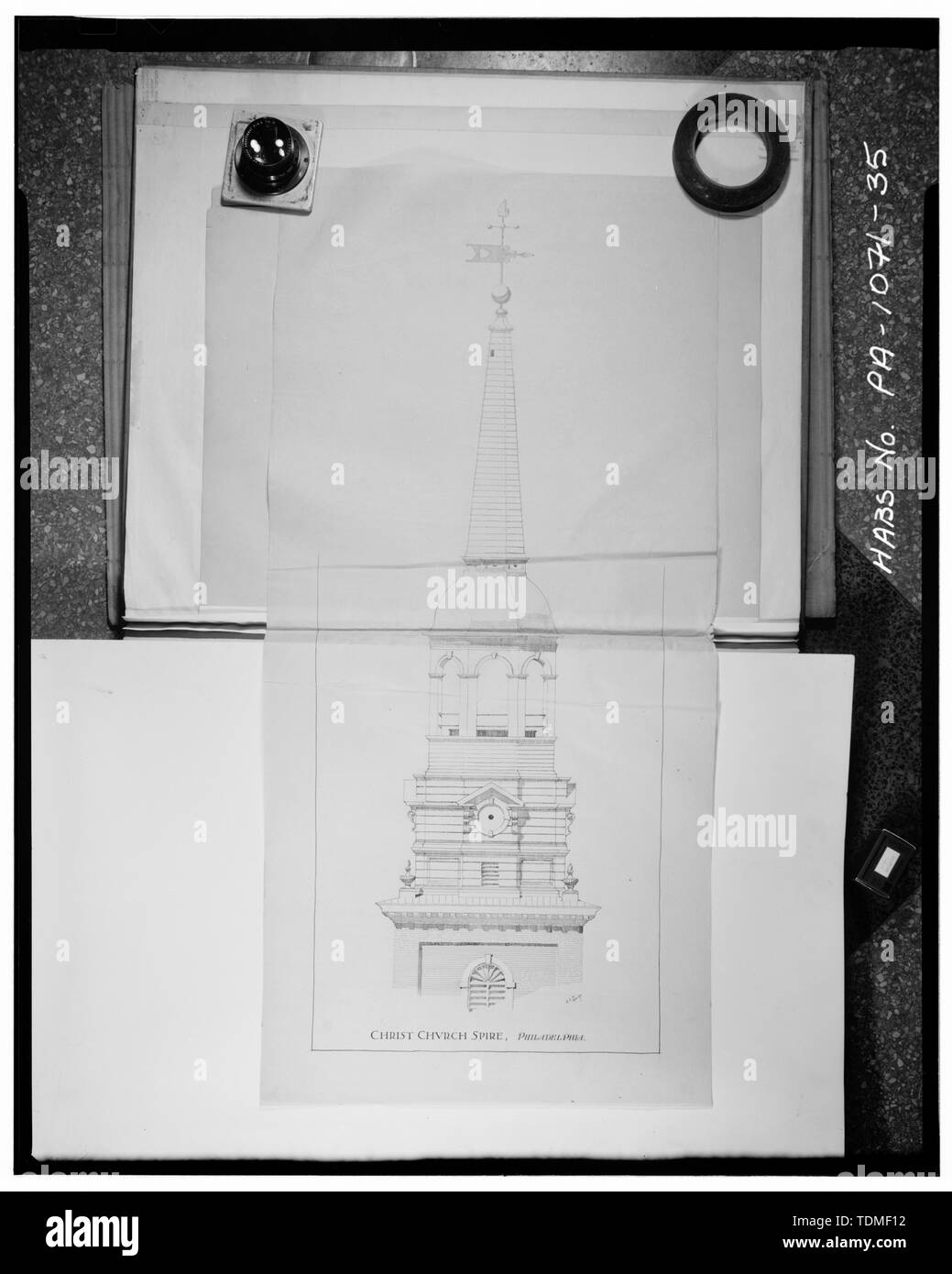 Fotokopie der 1897 gemessenen ZEICHNUNG DER GLOCKENTURM (Mit freundlicher Genehmigung der Freien Bibliothek von Philadelphia - Zeichnung von C.L. Hillman und John McClintock) - Christus Kirche, 22-26 North Second Street, Philadelphia, Philadelphia County, PA Stockfotohttps://www.alamy.de/image-license-details/?v=1https://www.alamy.de/fotokopie-der-1897-gemessenen-zeichnung-der-glockenturm-mit-freundlicher-genehmigung-der-freien-bibliothek-von-philadelphia-zeichnung-von-cl-hillman-und-john-mcclintock-christus-kirche-22-26-north-second-street-philadelphia-philadelphia-county-pa-image249386510.html
RMTDMF12–Fotokopie der 1897 gemessenen ZEICHNUNG DER GLOCKENTURM (Mit freundlicher Genehmigung der Freien Bibliothek von Philadelphia - Zeichnung von C.L. Hillman und John McClintock) - Christus Kirche, 22-26 North Second Street, Philadelphia, Philadelphia County, PA
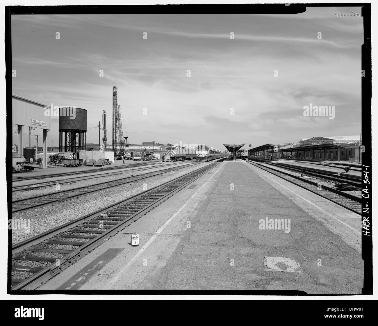 Blick nach Norden ZEIGT DAS WASSER TURM AN DER LINKEN SEITE AN DER BEIFAHRERSEITE PLATTFORMEN IM ZENTRUM UND BAHNHOF AUF DER RECHTEN SEITE. - Southern Pacific Depot, Wasserturm, 65 Cahill Street, San Jose, Santa Clara County, CA Stockfotohttps://www.alamy.de/image-license-details/?v=1https://www.alamy.de/blick-nach-norden-zeigt-das-wasser-turm-an-der-linken-seite-an-der-beifahrerseite-plattformen-im-zentrum-und-bahnhof-auf-der-rechten-seite-southern-pacific-depot-wasserturm-65-cahill-street-san-jose-santa-clara-county-ca-image249328712.html
RMTDHW8T–Blick nach Norden ZEIGT DAS WASSER TURM AN DER LINKEN SEITE AN DER BEIFAHRERSEITE PLATTFORMEN IM ZENTRUM UND BAHNHOF AUF DER RECHTEN SEITE. - Southern Pacific Depot, Wasserturm, 65 Cahill Street, San Jose, Santa Clara County, CA
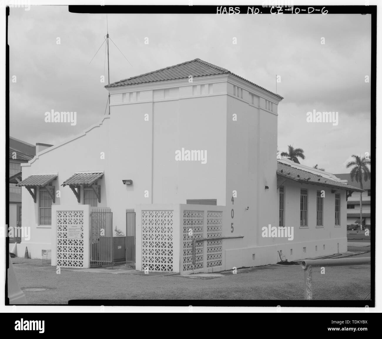 Schrägansicht der Süd- und Ostseite mit Fallschirm Turm, im Nordwesten. - Albrook Air Force Station, Fallschirm und Bewaffnung Gebäude, 200 Meter nördlich von Andrews Boulevard, Balboa, ehemaligen Panama Canal Zone, CZ Stockfotohttps://www.alamy.de/image-license-details/?v=1https://www.alamy.de/schragansicht-der-sud-und-ostseite-mit-fallschirm-turm-im-nordwesten-albrook-air-force-station-fallschirm-und-bewaffnung-gebaude-200-meter-nordlich-von-andrews-boulevard-balboa-ehemaligen-panama-canal-zone-cz-image249374270.html
RMTDKYBX–Schrägansicht der Süd- und Ostseite mit Fallschirm Turm, im Nordwesten. - Albrook Air Force Station, Fallschirm und Bewaffnung Gebäude, 200 Meter nördlich von Andrews Boulevard, Balboa, ehemaligen Panama Canal Zone, CZ
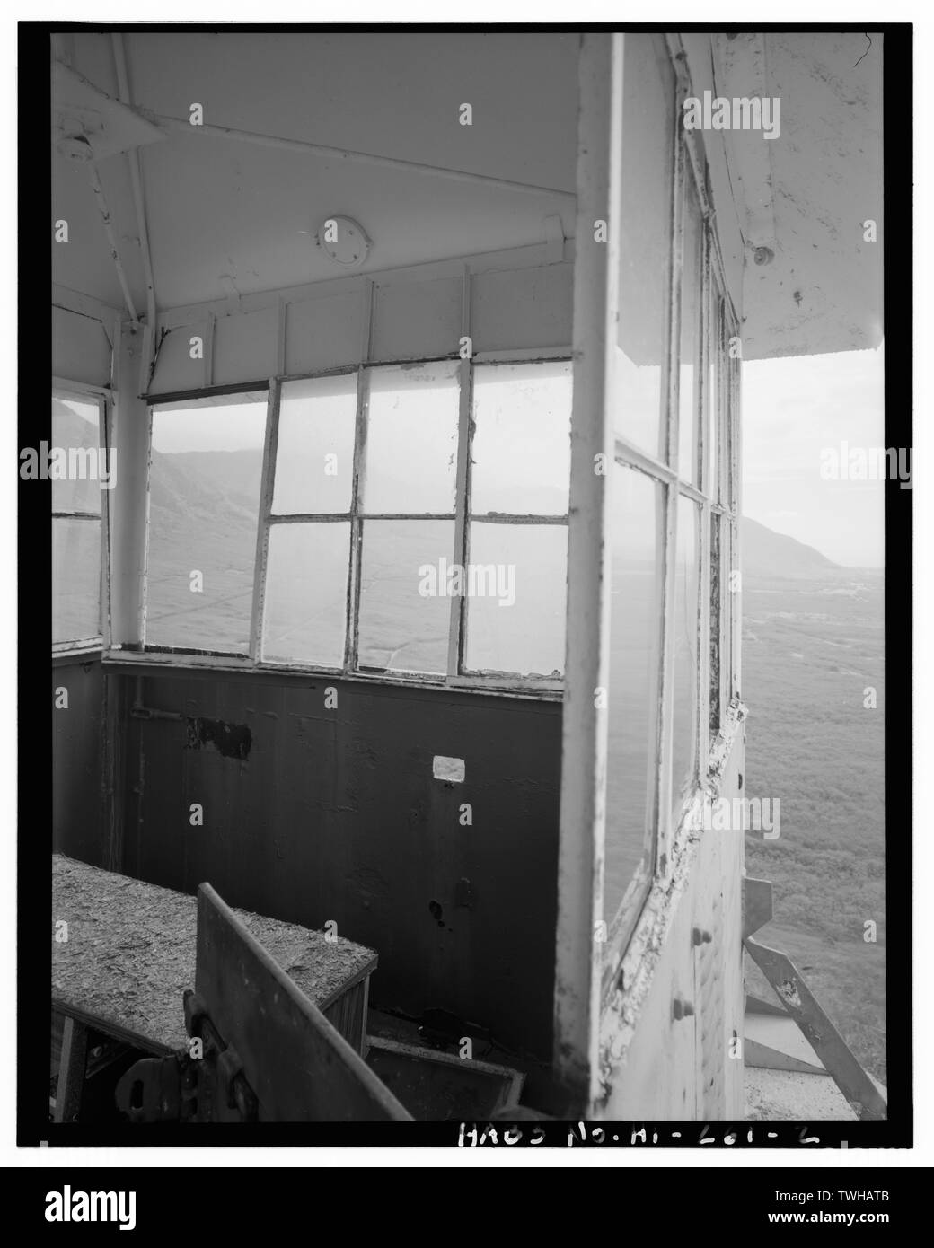 S 316, WACHTURM Interieur. - Naval Zeitschrift Lualualei, Hauptsitz Niederlassung, Guard-Watch Turm Typ, Aus Dent Straße und auf kolekole Road in der Nähe der nördlichen Grenze von Installation, Pearl City, Honolulu County, HI Stockfotohttps://www.alamy.de/image-license-details/?v=1https://www.alamy.de/s-316-wachturm-interieur-naval-zeitschrift-lualualei-hauptsitz-niederlassung-guard-watch-turm-typ-aus-dent-strasse-und-auf-kolekole-road-in-der-nahe-der-nordlichen-grenze-von-installation-pearl-city-honolulu-county-hi-image256693259.html
RMTWHATB–S 316, WACHTURM Interieur. - Naval Zeitschrift Lualualei, Hauptsitz Niederlassung, Guard-Watch Turm Typ, Aus Dent Straße und auf kolekole Road in der Nähe der nördlichen Grenze von Installation, Pearl City, Honolulu County, HI
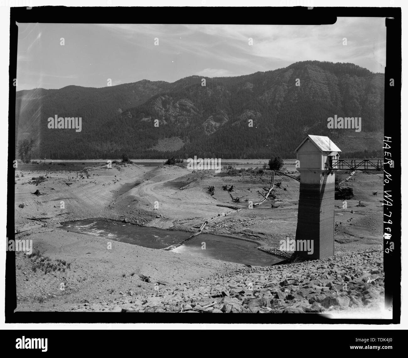 Offenen ABSCHNITT VON EINLASS- Kanal, VON CONDUIT AUF BASIS VON GATE TOWER, Blick nach Norden - kachess Damm, am Kanal, kachess Fluss, 1,5 Meilen nördlich der Interstate 90, Easton, Kittitas County, WA BEGRABEN Stockfotohttps://www.alamy.de/image-license-details/?v=1https://www.alamy.de/offenen-abschnitt-von-einlass-kanal-von-conduit-auf-basis-von-gate-tower-blick-nach-norden-kachess-damm-am-kanal-kachess-fluss-15-meilen-nordlich-der-interstate-90-easton-kittitas-county-wa-begraben-image249356408.html
RMTDK4J0–Offenen ABSCHNITT VON EINLASS- Kanal, VON CONDUIT AUF BASIS VON GATE TOWER, Blick nach Norden - kachess Damm, am Kanal, kachess Fluss, 1,5 Meilen nördlich der Interstate 90, Easton, Kittitas County, WA BEGRABEN
 Nord- und Westseite des Kühlturms, Utility (Gebäude 2606) ist im Hintergrund rechts März Air Force Base, Strategic Air Command, Kühlturm, 5220 Riverside Drive, Moreno Valley, Riverside County, CA Stockfotohttps://www.alamy.de/image-license-details/?v=1https://www.alamy.de/nord-und-westseite-des-kuhlturms-utility-gebaude-2606-ist-im-hintergrund-rechts-marz-air-force-base-strategic-air-command-kuhlturm-5220-riverside-drive-moreno-valley-riverside-county-ca-image248320354.html
RMTBYY42–Nord- und Westseite des Kühlturms, Utility (Gebäude 2606) ist im Hintergrund rechts März Air Force Base, Strategic Air Command, Kühlturm, 5220 Riverside Drive, Moreno Valley, Riverside County, CA
 Monica Griesbach, Fotograf August 1997. Blick auf LOS ANGELES RATHAUS Turm im 5. Stock DACH, nach Südosten. Los Angeles City Hall, 200 North Spring Street, Los Angeles, Los Angeles County, CA Stockfotohttps://www.alamy.de/image-license-details/?v=1https://www.alamy.de/monica-griesbach-fotograf-august-1997-blick-auf-los-angeles-rathaus-turm-im-5-stock-dach-nach-sudosten-los-angeles-city-hall-200-north-spring-street-los-angeles-los-angeles-county-ca-image248315072.html
RMTBYMBC–Monica Griesbach, Fotograf August 1997. Blick auf LOS ANGELES RATHAUS Turm im 5. Stock DACH, nach Südosten. Los Angeles City Hall, 200 North Spring Street, Los Angeles, Los Angeles County, CA