1591 x 1571 px | 26,9 x 26,6 cm | 10,6 x 10,5 inches | 150dpi
Weitere Informationen:
Dieses Bild ist ein gemeinfreies Bild. Dies bedeutet, dass entweder das Urheberrecht dafür abgelaufen ist oder der Inhaber des Bildes auf sein Urheberrecht verzichtet hat. Alamy berechnet Ihnen eine Gebühr für den Zugriff auf die hochauflösende Kopie des Bildes.
Dieses Bild kann kleinere Mängel aufweisen, da es sich um ein historisches Bild oder ein Reportagebild handel
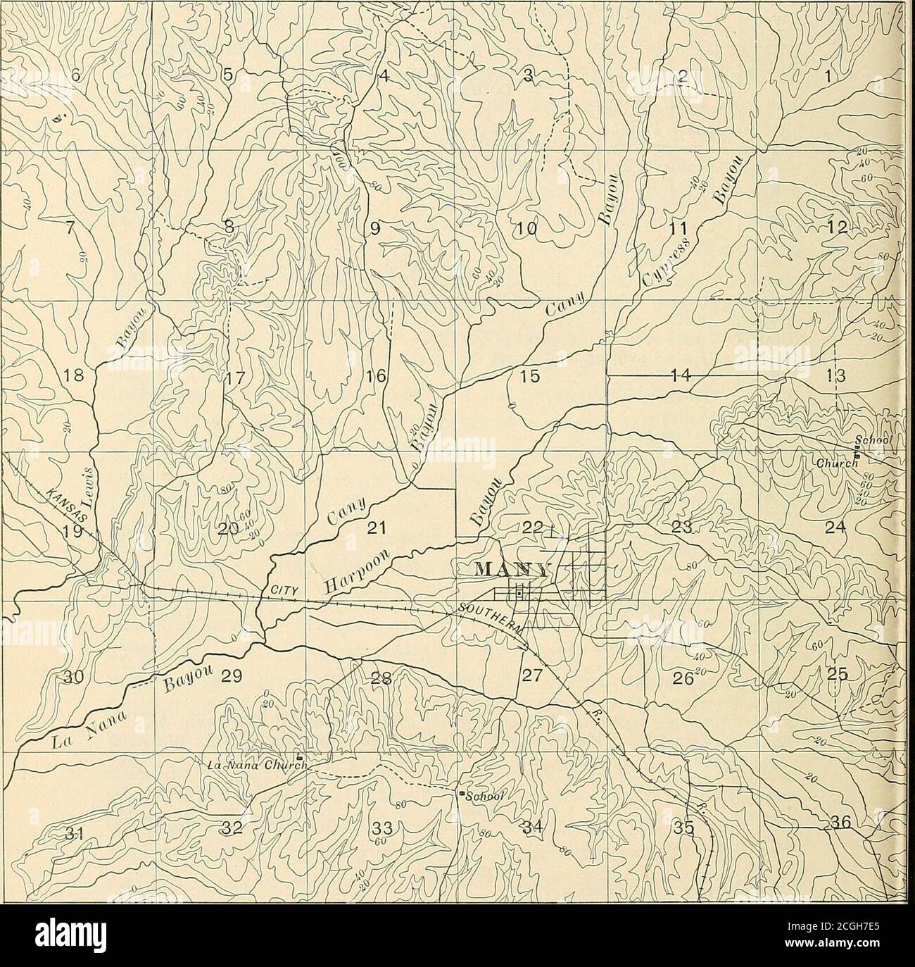
. Geology and underground water resources of northern Louisiana . - (2^ miles north of) Bossier City Bossier City Pool Caddo Parish: Missionary Belcher Belcher (3 miles northeast of) ... Dixie Dixie (2j^ miles east of) Dixie (3 miles southwest of) Uni Below Shreveport Robson Ba5ou Pierre Natchitoches Parish; Luella Montrose Grant Parish: Colfax Rapides Parish: Rapides (average of 5 wells) Alexandria Alexandria Alexandria .. Pineville Pineville Lamothe Thick-ness ofdeposits 69 Feet.120130 76 80 195?III? 13096 12560 85 121 70 -no10670 300?180 130 10890 155110+200?230? 105+ Table showing thickness of Port Hudson and redeposited Lafayette beds inthe Mississippi Willey, arid indicating the position of the old landsufface Well No 72 873872894922 923867 Location Lake Providence.Hays Landing. .. Mound Monroe Monroe.... Fish Pond LOUISIANA Thick-ness ofdeposits Feet.248?109135+ 95 80 145+ 7 Numbers correspond to those used in Chapter V.^Numbers correspond to those used in Chapter V. 295. Scale of miles Fig. 21.—Sketch topographic map near Many, Sabine Parish, La., showing the characteristic flat-bottomed, steep-sidecsmall stream valleys of northern Louisiana and southern Arkansas, by A. C. Veatch, 1899. veatch] Underground Water of Northern La. 49 lu the area between the main streams the tributaries formed intime an interlocking drainage very little different from that ofto-day, and at the close of this long period of erosion almost allof the old plain level had been destroyed (PI. xxv) and themajor topographic features of northern Louisiana and southernArkansas produced. Indeed, the only great difference betweenthe topography of that day and this was that the principalvalleys were loo to 150 feet deeper, and the Port Hudson terraces(PI. xxvii) were entirely absent. The valleys of the smallstreams did not then show their present anomalous, steep sided, flat-bottomed, filled character (fig. 21), but the hill slopes passedin curves of gradually lessening gradient to th