8192 x 5464 px | 69,4 x 46,3 cm | 27,3 x 18,2 inches | 300dpi
Aufnahmedatum:
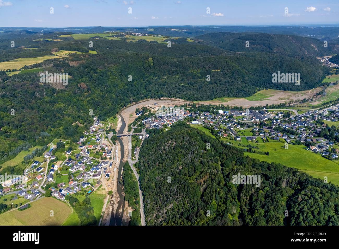
25. August 2021
Weitere Informationen:
Aerial view, flooded area at the river Ahr with bridge Kapellenstraße as well as catholic parish church St. Kunibert in Hönningen, Ahr flood, Ahr valley, Rhineland-Palatinate, Germany, Ahr flood, place of worship, bridge, DE, Europe, flood disaster, faith community, place of worship, holy site, flood disaster, Hönningen, flood of the century, church, church community, denomination, aerial photography, aerial photography, religion, religious site, overview, birds-eyes view, overview, flooding, inundation, flood area, Luftbild, Überschwemmungsgebiet am Fluss Ahr mit Brücke Kapellenstraße sowie kath. Pfarrkirche St. Kunibert in Hönningen, Ahr-Hochwasser, Ahrtal, Rheinland-Pfalz, Deutschland, Ahrhochwasser, Andachtstätte, Brücke, DE, Europa, Flutkatastrophe, Glaubensgemeinschaft, Gotteshaus, Heilige Stätte, Hochwasserkatastrophe, Hönningen, Jahrhunderthochwasser, Kirche, Kirchengemeinde, Konfession, Luftaufnahme, Luftbildfotografie, Luftfotografie, Religion, Religiöse Stätte, Uebersicht, Vogelperspektive, birds-eyes view, overview, Überflutung, Überschwemmung, Überschwemmungsgebiet
Dieses Bild kann nicht für Konsumgüter lizenziert werden.