Sonnenuntergang über dem Atlantischen Ozean Panoramablick Landschaft Caldera de Taburiente Nationalpark Vulkanberg Gipfel Roque de los Muchachos Kanarische Inseln Spanien
11464 x 2513 px | 97,1 x 21,3 cm | 38,2 x 8,4 inches | 300dpi
Aufnahmedatum:
25. Februar 2025
Ort:
La Palma, Canary Islands, Spain
Weitere Informationen:
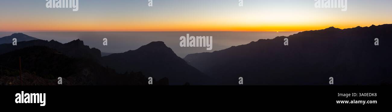
Pico de la Nieve, the Snow Peak among La Palma's mountains, is part of the Caldera de Taburiente, the world's largest erosion crater. Like its namesake on neighbouring Gran Canaria it is located on the rim of a large Caldera but here the likeness already stops. The Palmerian Pico de la Nieve is 400m higher than its counterpart and is actually covered with snow for several days and weeks each year. Moreover, it is part of a natural park, the Parque Nacional de la Caldera de Taburiente and is clear of any construction. The Gran Canarian summit on the other hand is marred by multiple radio, TV and radar installations. Pico de la Nieve is among the highest summits of La Palma. Like the other caldera rim summits it towers 1500m above the crater with near vertical walls to the inside and a smooth 30° slope on the outside. The main route to the summit is the Ruta de la Cresteria, a two day trekking trail, which follows two thirds of the caldera crest. On the other hand Pico de la Nieve is one of the few caldera summits which can be reached from the outside. There is a long 2000m ascent from the town of Las Nieves which can be cut short by driving up the Palmeran mountain road LP-22. This leads to a parking lot roughly 300m below the summit. Consequently Pico de la Nieve is one of the most popular summits of La Palma, only surpassed by Roque de los Muchachos and Pico de la Cruz, which both can be reached by car (the parking lots are very close to these summits).