5972 x 4657 px | 50,6 x 39,4 cm | 19,9 x 15,5 inches | 300dpi
Aufnahmedatum:
1810
Ort:
Warwickshire
Weitere Informationen:
Dieses Bild kann kleinere Mängel aufweisen, da es sich um ein historisches Bild oder ein Reportagebild handel
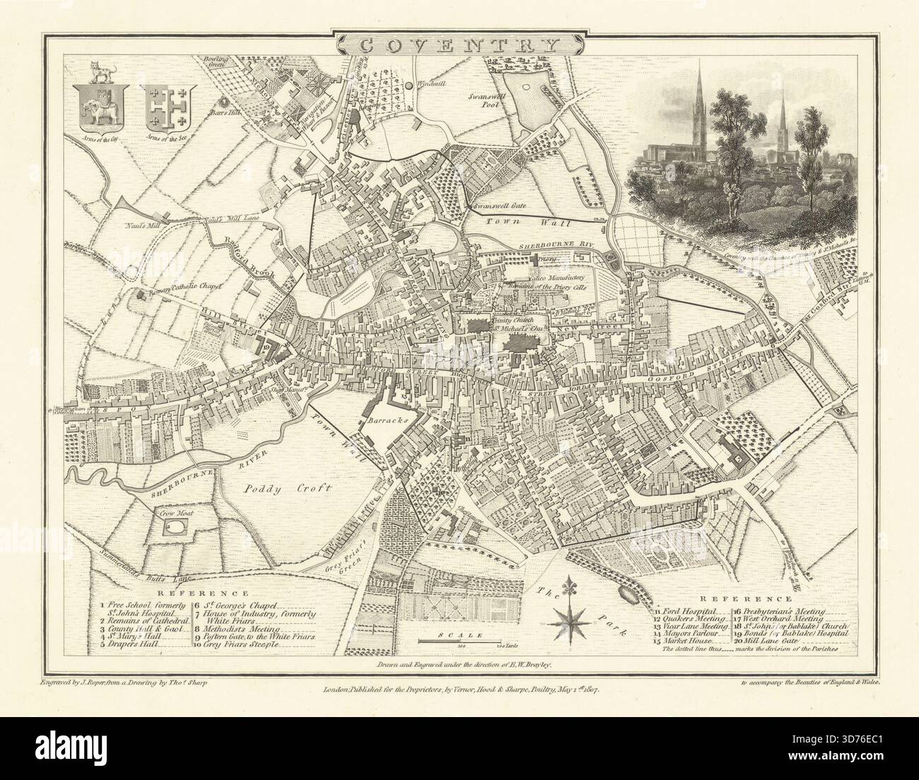
Coventry. Artist/engraver/cartographer: Drawn by Thomas Sharp. Engraved by John Roper. Provenance: "The British Atlas; comprising a complete set of County Maps, of England and Wales; with a general map of Navigable Rivers and Canals; and Plans of Cities and principal Towns", London: Printed for Vernor, Hood and Sharpe; Longman, Hurst, Rees, and Orme; J. Harris; J. Cuthell; J. Cundee; W. Faden; J. and A. Arch; Crosby and Co; J. Richardson; and J. M. Richardson. Type: Antique engraved town plan. Engraved plan showing Coventry’s medieval layout and spired churches, with a vignette of the skyline. Arms of the city and see inset; references include religious and civic institutions and meeting houses. The town wall is shown, with the shag (textile) factory and mill