6410 x 8000 px | 54,3 x 67,7 cm | 21,4 x 26,7 inches | 300dpi
Aufnahmedatum:
1896
Ort:
Lake Placid, New York, USA
Weitere Informationen:
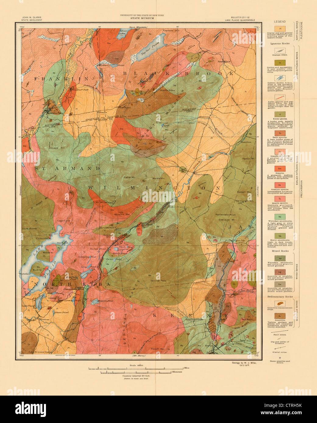
This attractive and historic geologic map is focused on Lake Placid, and the surrounding areas of Keene, Black Brook, Wilmington, Jay, Franklin Falls and the like in NY State. The colors alone make this a beautiful map, and the geologic detail and information makes it even more interesting. Based on the USGS base map, it was produced by the State University at Albany as part of an in depth geographic mapping of the state. A key at right identifies 18 different geologic units as well as fault zones, dip and strike of foliation, glacial striae, and stone quarries and mines. The geology was completed by W. J. Miller in 1915-16 and the base map was engraved by the U.S. Geological Survey in 1896.