4500 x 4094 px | 38,1 x 34,7 cm | 15 x 13,6 inches | 300dpi
Aufnahmedatum:
19. Mai 2023
Weitere Informationen:
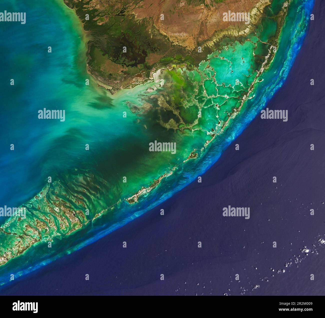
The chain of hundreds of low-lying islands, also called cays or keys, that extend from southern Florida are relics of a time when global sea levels were higher than today. About 125, 000 years ago, during a warm interglacial period, water covered the area. However, the sea was shallow enough that big communities of coral flourished just below the surface and built up reefs. As time passed and an ice age took hold, sea levels dropped and the tops of some reefs—as well as some sand bars—began to poke above the water surface. Over time, material from these exposed reefs and sand bars hardened and fossilized, forming the sedimentary rocks that make up the modern Florida Keys. On March 30, 2022, the Operational Land Imager (OLI) on Landsat 8 captured these natural-color views of the islands. North and west of the island chain, light passing through shallow waters and reflecting off the sea grass beds and sandy bottoms of Florida Bay gives this part of the scene a green-yellow hue. The light blue line south and east of the islands is a living coral reef system—among the largest in the world. Deeper water beyond the edge of the Florida platform appears dark blue.