4475 x 6233 px | 37,9 x 52,8 cm | 14,9 x 20,8 inches | 300dpi
Aufnahmedatum:
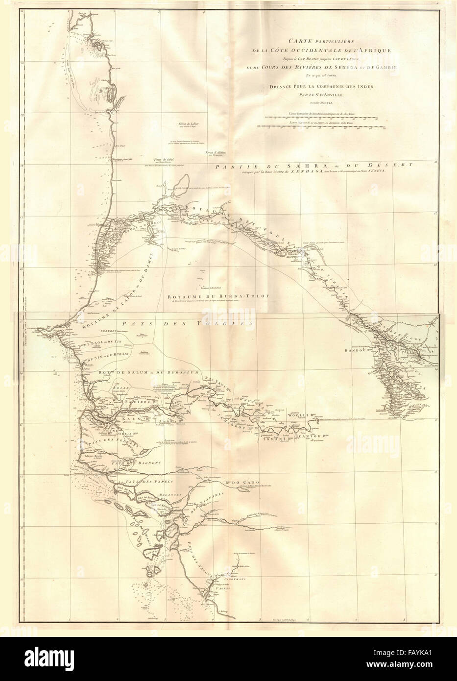
1751
Ort:
West Africa
Weitere Informationen:
Dieses Bild kann kleinere Mängel aufweisen, da es sich um ein historisches Bild oder ein Reportagebild handel
Artist/engraver/cartographer: Jean Baptiste Bourguignon d'Anville. Provenance: The map was extracted from a composite atlas of early 18th century maps, the latest of which was dated c1754. Type: Large antique 18th century atlas wall map, printed on thick, good quality paper. This large eighteenth century map shows the coast of West Africa between Ras Nouadhibou (marked with its French name of Cap Blanc) which is today on the border between Mauritania and Western Sahara, and Cape Verga, near Boffa in present day Guinea. It includes the coastline of the present day countries of Mauritania, Senegal, The Gambia, Guinea-Bissau and part of Guinea. The course of the Senegal and Gambia rivers are charted in detail. The Cap-Vert is shown, with "Dacar" (Dakar) and the Île de Gorée both marked, as is the Île St-Louis to the north. Banjul is marked as Pte. de Banion.