12122 x 8176 px | 102,6 x 69,2 cm | 40,4 x 27,3 inches | 300dpi
Aufnahmedatum:
1954
Ort:
Canary Islands
Weitere Informationen:
Dieses Bild kann kleinere Mängel aufweisen, da es sich um ein historisches Bild oder ein Reportagebild handel
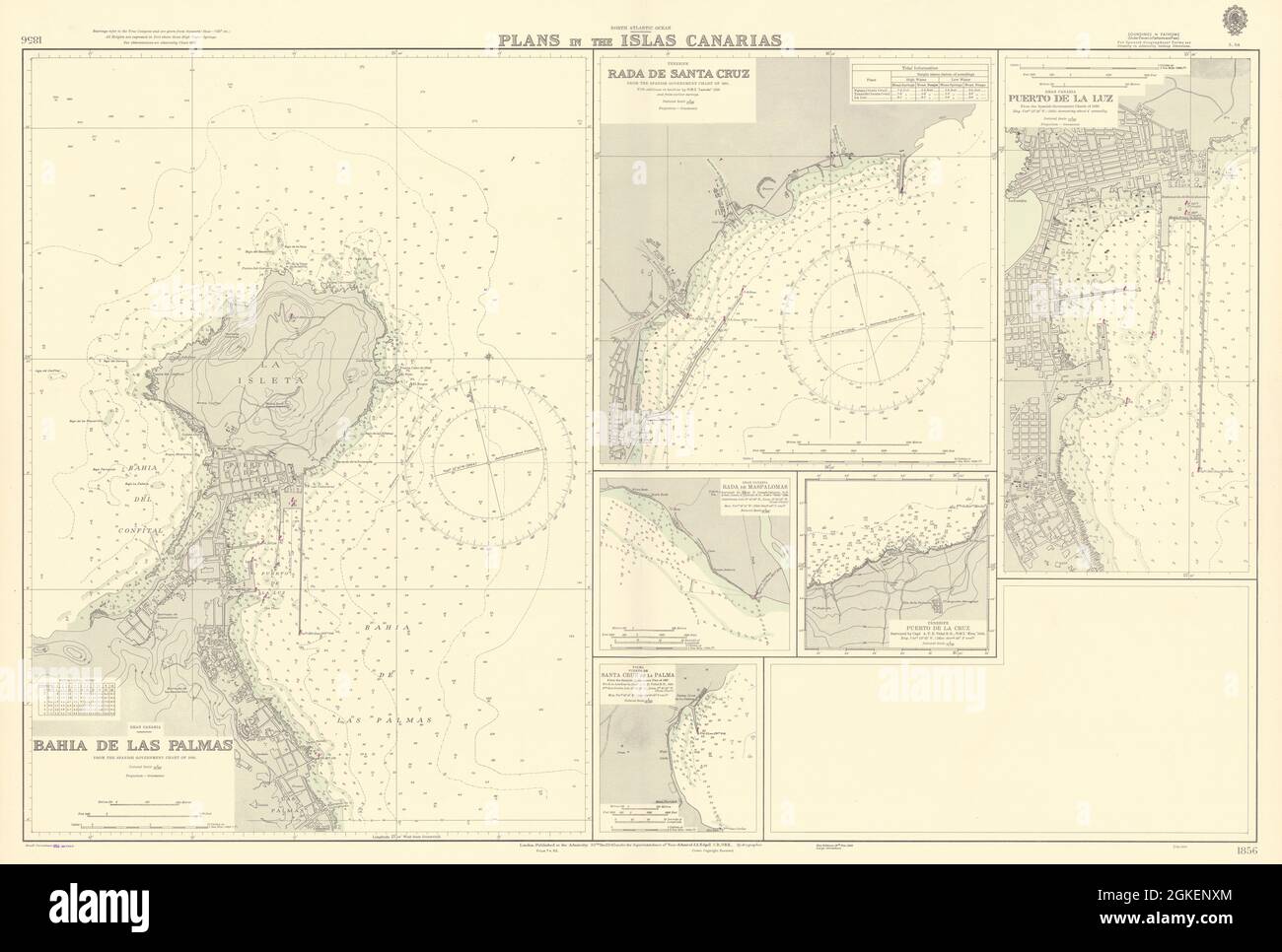
North Atlantic Ocean - Plans in the Islas Canarias // Gran Canaria - Bahia de las Palmas // Tenerife - Rada de Santa Cruz // Gran Canaria - Puerto de la Luz // Gran Canaria - Rada de Maspalomas // Tenerife - Puerto de la Cruz // Tenerife - Puerto de Santa Cruz de la Palma. Artist/engraver/cartographer: Bahia de las Palmas from the Spanish Government chart of 1950. Rada de Santa Cruz from the Spanish Government chart of 1951 with additions in hairline by H.M.S. "Leander" 1936 and from earlier surveys. Puerto de la Luz from the Spanish Government charts of 1950. Rada de Maspalomas surveyed by Lieut. F. Creagh-Osborne R.N. & Sub. Lieut. A.C. Gotto R.N., H.M.S "Dido" 1898. Puerto de la Cruz surveyed by Capt A.T.E. Vidal R.N., H.M.S. "Aetna, " 1838. Puerto de Santa Cruz de Palma from the Spanish Government Plan of 1927. Work in hairline by Capt. A.T.E. Vidal R.N., 1838. Provenance: London. Published at the Admiralty under the Superintendence of Vice Admiral J.A. Edgell, C.B., O.B.E., Hydrographer. Crown Copyright reserved. Type: Large British nautical sea chart. Sea charts such as this were working navigational aids which were commonly updated and corrected during their working lives by hand annotation and/or printed overlays. They may also feature manuscript navigational notes, comments or other markings.