12138 x 8161 px | 102,8 x 69,1 cm | 40,5 x 27,2 inches | 300dpi
Aufnahmedatum:
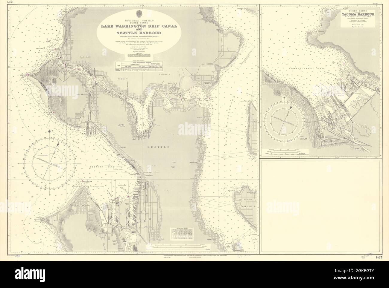
1955
Ort:
Washington
Weitere Informationen:
Dieses Bild kann kleinere Mängel aufweisen, da es sich um ein historisches Bild oder ein Reportagebild handel
North America - West Coast - Puget Sound - Lake Washington Ship Canal and Seattle Harbour // Puget Sound - Tacoma Harbour. Artist/engraver/cartographer: From the United States Government chart of 1935 with additions and corrections to 1954. Tacoma Harbour from the United States Government chart of 1935 with additions and corrections to 1954. Provenance: London. Published at the Admiralty under the Superintendence of Rear-Admiral J.A. Edgell, O.B.E., Hydrographer. Crown Copyright reserved. Type: Large British nautical sea chart. Sea charts such as this were working navigational aids which were commonly updated and corrected during their working lives by hand annotation and/or printed overlays. They may also feature manuscript navigational notes, comments or other markings.